Bendorf elevation
Bendorf (Rheinland-Pfalz), Germany elevation is 96 meters and Bendorf elevation in feet is 315 ft above sea level [src 1]. Bendorf is a populated place (feature code) with elevation that is 162 meters (531 ft) smaller than average city elevation in Germany.
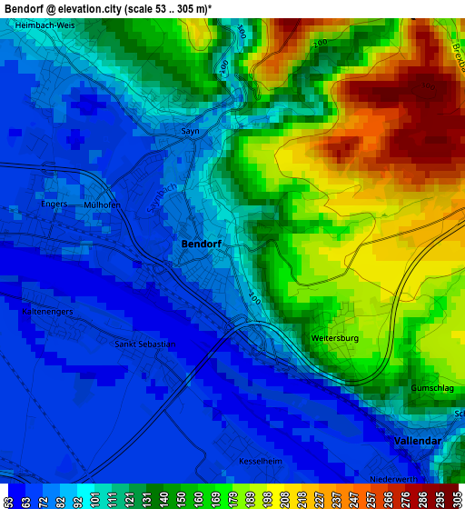
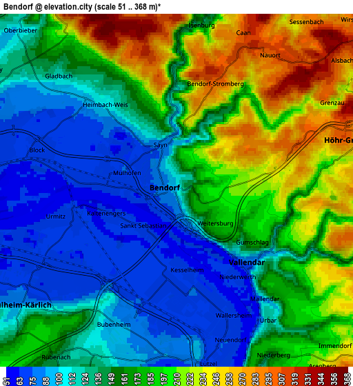
Below is the Elevation map of Bendorf, which displays elevation range with different colors. Scale of the first map is from 53 to 305 m (174 to 1001 ft) with average elevation of 122.1 meters (=401 ft) [note 1]
These maps also provides idea of topography and contour of this city, they are displayed at different zoom levels. More info about maps, scale and edge coordinates you can find below images.
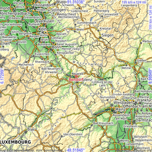
| \ | Map #1 | Map #2 | Topo.Map |
| Scale [m] | 53..305 m | 51..368 m | × |
| Scale [ft] | 174..1001 ft | 167..1207 ft | × |
| Average | 122.1 m = 401 ft | 158.8 m = 521 ft | × |
| Width | 6.23 km = 3.9 mi | 12.45 km = 7.7 mi | 199.2 km = 123.8 mi |
| Height | 6.23 km = 3.9 mi | 12.45 km = 7.7 mi | 199.2 km = 123.8 mi |
| ↑Max Latitude | 50.45088° | 50.478853° | 51.31038° |
| Latitude at center | 50.42289° | 50.42289° | 50.42289° |
| ↓Min Latitude | 50.394883° | 50.36686° | 49.51845° |
| ← Min Longitude | 7.535295° | 7.491349° | 6.17299° |
| Longitude center | 7.57924° | 7.57924° | 7.57924° |
| →Max Longitude | 7.623185° | 7.667131° | 8.98549° |
Nearby cities:
Cities around Bendorf sort by population:
• Mülheim-Kärlich elevation 92 m
7.1 km,  233°
233°
• Höhr-Grenzhausen 256 m
6.5 km,  78°
78°
• Vallendar 168 m
4.4 km,  133°
133°
• Urmitz 60 m
4.5 km,  261°
261°
• Stromberg 300 m
4.2 km,  21°
21°
• Urbar 162 m
5.8 km,  138°
138°
• Sankt Sebastian 71 m
1.8 km,  222°
222°
• Nauort 309 m
6.2 km,  38°
38°
• Weitersburg 186 m
1.6 km,  115°
115°
• Kaltenengers 67 m
2.2 km,  251°
251°
• Niederwerth 75 m
3.7 km, 133°
• Heimbach 88 m
4.4 km,  312°
312°
Multilingual:
 En español:
Bendorf elevación 96 m.
 En France:
Bendorf élévation 96 m.


Sources and notes:
- [note 1] Map square and city borders are not equal. Map elevation data is calculated only from area inside that square.
- [src 1] Elevation data from geonames database provided with same terms of usage.
- [src 2] The elevation map of Bendorf is generated using elevation data from NASA's 3 arcsec (90m) resolution SRTM data.
- [src 3] Base (background) map © OpenStreetMap contributors tiles are generated by Geofabrik and OpenTopoMap.
Copyright & License:
This Bendorf Elevation Map is licensed under CC BY-SA. You may reuse any part from this page, if you give a proper credit by linking to this URL:
 More info on terms of use page.