Vallendar elevation
Vallendar (Rheinland-Pfalz), Germany elevation is 168 meters and Vallendar elevation in feet is 551 ft above sea level [src 1]. Vallendar is a populated place (feature code) with elevation that is 90 meters (295 ft) smaller than average city elevation in Germany.
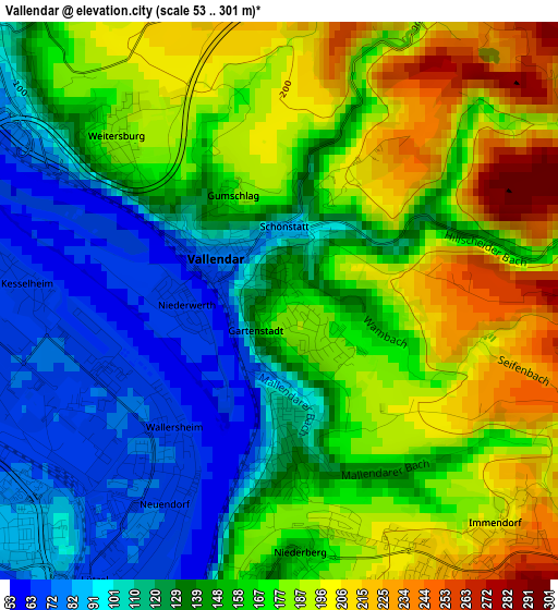
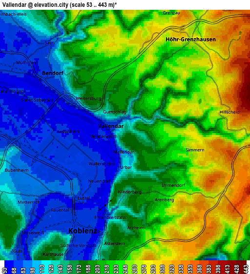
Below is the Elevation map of Vallendar, which displays elevation range with different colors. Scale of the first map is from 53 to 301 m (174 to 988 ft) with average elevation of 152.9 meters (=502 ft) [note 1]
These maps also provides idea of topography and contour of this city, they are displayed at different zoom levels. More info about maps, scale and edge coordinates you can find below images.
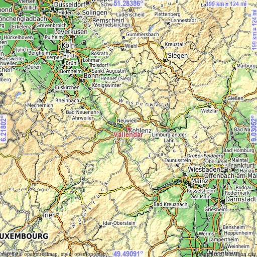
| \ | Map #1 | Map #2 | Topo.Map |
| Scale [m] | 53..301 m | 53..443 m | × |
| Scale [ft] | 174..988 ft | 174..1453 ft | × |
| Average | 152.9 m = 502 ft | 188.4 m = 618 ft | × |
| Width | 6.23 km = 3.9 mi | 12.46 km = 7.7 mi | 199.4 km = 123.9 mi |
| Height | 6.23 km = 3.9 mi | 12.46 km = 7.7 mi | 199.3 km = 123.8 mi |
| ↑Max Latitude | 50.423866° | 50.451855° | 51.28386° |
| Latitude at center | 50.39586° | 50.39586° | 50.39586° |
| ↓Min Latitude | 50.367837° | 50.339798° | 49.49091° |
| ← Min Longitude | 7.580325° | 7.536379° | 6.21802° |
| Longitude center | 7.62427° | 7.62427° | 7.62427° |
| →Max Longitude | 7.668215° | 7.712161° | 9.03052° |
Nearby cities:
Cities around Vallendar sort by population:
• Koblenz elevation 75 m
5.7 km,  214°
214°
• Bendorf 96 m
4.4 km,  313°
313°
• Höhr-Grenzhausen 256 m
5.4 km,  36°
36°
• Stromberg 300 m
7.1 km,  346°
346°
• Urbar 162 m
1.5 km,  155°
155°
• Hillscheid 320 m
5.4 km,  77°
77°
• Sankt Sebastian 71 m
4.7 km,  290°
290°
• Weitersburg 186 m
2.9 km,  323°
323°
• Neuhäusel 323 m
6.2 km,  102°
102°
• Kaltenengers 67 m
5.7 km, 293°
• Simmern 283 m
3.6 km, 101°
• Niederwerth 75 m
0.7 km, 310°
Multilingual:
 En español:
Vallendar elevación 168 m.
 En France:
Vallendar élévation 168 m.
 Auf Deutsch:
Vallendar höhe über dem Meeresspiegel ist 168 m.

Sources and notes:
- [note 1] Map square and city borders are not equal. Map elevation data is calculated only from area inside that square.
- [src 1] Elevation data from geonames database provided with same terms of usage.
- [src 2] The elevation map of Vallendar is generated using elevation data from NASA's 3 arcsec (90m) resolution SRTM data.
- [src 3] Base (background) map © OpenStreetMap contributors tiles are generated by Geofabrik and OpenTopoMap.
Copyright & License:
This Vallendar Elevation Map is licensed under CC BY-SA. You may reuse any part from this page, if you give a proper credit by linking to this URL:
 More info on terms of use page.