Kreischa elevation
Kreischa (Saxony), Germany elevation is 210 meters and Kreischa elevation in feet is 689 ft above sea level [src 1]. Kreischa is a seat of a fourth-order administrative division (feature code) with elevation that is 48 meters (157 ft) smaller than average city elevation in Germany.
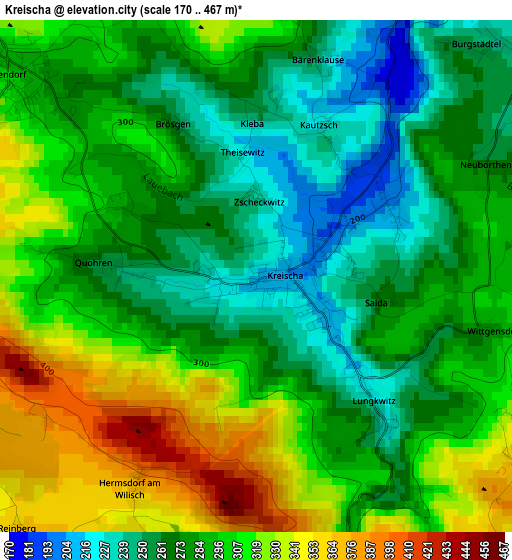
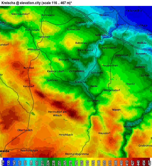
Below is the Elevation map of Kreischa, which displays elevation range with different colors. Scale of the first map is from 170 to 467 m (558 to 1532 ft) with average elevation of 289.9 meters (=951 ft) [note 1]
These maps also provides idea of topography and contour of this city, they are displayed at different zoom levels. More info about maps, scale and edge coordinates you can find below images.
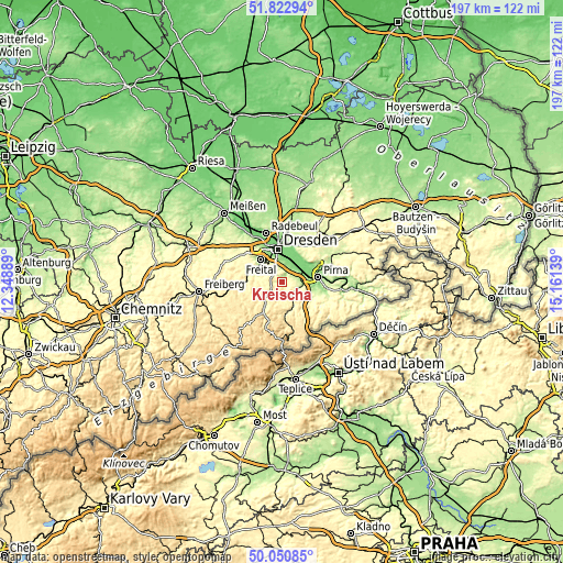
| \ | Map #1 | Map #2 | Topo.Map |
| Scale [m] | 170..467 m | 116..467 m | × |
| Scale [ft] | 558..1532 ft | 381..1532 ft | × |
| Average | 289.9 m = 951 ft | 298 m = 978 ft | × |
| Width | 6.16 km = 3.8 mi | 12.31 km = 7.6 mi | 197 km = 122.4 mi |
| Height | 6.16 km = 3.8 mi | 12.31 km = 7.6 mi | 197 km = 122.4 mi |
| ↑Max Latitude | 50.97302° | 51.000684° | 51.82294° |
| Latitude at center | 50.94534° | 50.94534° | 50.94534° |
| ↓Min Latitude | 50.917644° | 50.889931° | 50.05085° |
| ← Min Longitude | 13.711195° | 13.667249° | 12.34889° |
| Longitude center | 13.75514° | 13.75514° | 13.75514° |
| →Max Longitude | 13.799085° | 13.843031° | 15.16139° |
Nearby cities:
Cities around Kreischa sort by population:
• Dresden elevation 116 m
11.8 km,  354°
354°
• Pirna 119 m
12.8 km,  83°
83°
• Freital 171 m
9.7 km,  310°
310°
• Heidenau 120 m
8.4 km,  69°
69°
• Dippoldiswalde 365 m
8.1 km,  227°
227°
• Bannewitz 280 m
5.9 km,  333°
333°
• Dohna 164 m
7.3 km, 80°
• Rabenau 336 m
8.1 km,  285°
285°
• Glashütte 325 m
10.5 km,  170°
170°
• Reinhardtsgrimma 328 m
5.9 km,  179°
179°
• Liebstadt 337 m
11.5 km,  141°
141°
• Hermsdorf 379 m
2.8 km,  210°
210°
Multilingual:
 En español:
Kreischa elevación 210 m.
 En France:
Kreischa élévation 210 m.
 Auf Deutsch:
Kreischa höhe über dem Meeresspiegel ist 210 m.

Sources and notes:
- [note 1] Map square and city borders are not equal. Map elevation data is calculated only from area inside that square.
- [src 1] Elevation data from geonames database provided with same terms of usage.
- [src 2] The elevation map of Kreischa is generated using elevation data from NASA's 3 arcsec (90m) resolution SRTM data.
- [src 3] Base (background) map © OpenStreetMap contributors tiles are generated by Geofabrik and OpenTopoMap.
Copyright & License:
This Kreischa Elevation Map is licensed under CC BY-SA. You may reuse any part from this page, if you give a proper credit by linking to this URL:
 More info on terms of use page.