Heidenau elevation
Heidenau (Saxony), Germany elevation is 120 meters and Heidenau elevation in feet is 394 ft above sea level [src 1]. Heidenau is a populated place (feature code) with elevation that is 138 meters (453 ft) smaller than average city elevation in Germany.
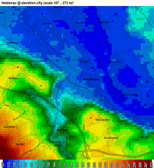
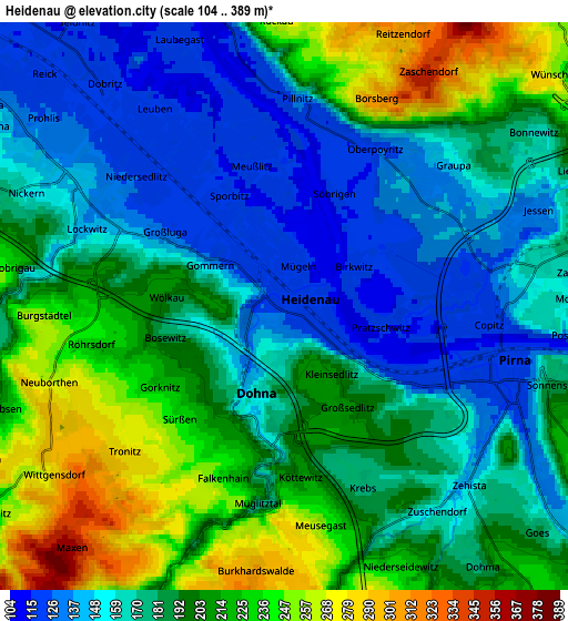
Below is the Elevation map of Heidenau, which displays elevation range with different colors. Scale of the first map is from 107 to 273 m (351 to 896 ft) with average elevation of 149.7 meters (=491 ft) [note 1]
These maps also provides idea of topography and contour of this city, they are displayed at different zoom levels. More info about maps, scale and edge coordinates you can find below images.
| \ | Map #1 | Map #2 | Topo.Map |
| Scale [m] | 107..273 m | 104..389 m | × |
| Scale [ft] | 351..896 ft | 341..1276 ft | × |
| Average | 149.7 m = 491 ft | 186.3 m = 611 ft | × |
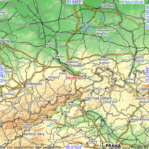
| Width | 6.15 km = 3.8 mi | 12.31 km = 7.6 mi | 196.9 km = 122.3 mi |
| Height | 6.15 km = 3.8 mi | 12.31 km = 7.6 mi | 196.9 km = 122.3 mi |
| ↑Max Latitude | 50.999874° | 51.027522° | 51.8493° |
| Latitude at center | 50.97221° | 50.97221° | 50.97221° |
| ↓Min Latitude | 50.94453° | 50.916833° | 50.07824° |
| ← Min Longitude | 13.823465° | 13.779519° | 12.46116° |
| Longitude center | 13.86741° | 13.86741° | 13.86741° |
| →Max Longitude | 13.911355° | 13.955301° | 15.27366° |
Nearby cities:
Cities around Heidenau sort by population:
• Pirna elevation 119 m
5.1 km,  107°
107°
• Bannewitz 280 m
10.8 km,  282°
282°
• Dohna 164 m
1.9 km,  199°
199°
• Dürrröhrsdorf 223 m
11.4 km,  52°
52°
• Kreischa 210 m
8.4 km,  249°
249°
• Lohmen 206 m
9.6 km,  79°
79°
• Reinhardtsgrimma 328 m
11.8 km,  221°
221°
• Struppen 231 m
11.3 km, 112°
• Dohma 215 m
7.7 km,  143°
143°
• Stadt Wehlen 163 m
11.6 km,  97°
97°
• Liebstadt 337 m
12 km,  183°
183°
• Hermsdorf 379 m
10.8 km,  239°
239°
Multilingual:
 En español:
Heidenau elevación 120 m.
 En France:
Heidenau élévation 120 m.
 Auf Deutsch:
Heidenau höhe über dem Meeresspiegel ist 120 m.

Sources and notes:
- [note 1] Map square and city borders are not equal. Map elevation data is calculated only from area inside that square.
- [src 1] Elevation data from geonames database provided with same terms of usage.
- [src 2] The elevation map of Heidenau is generated using elevation data from NASA's 3 arcsec (90m) resolution SRTM data.
- [src 3] Base (background) map © OpenStreetMap contributors tiles are generated by Geofabrik and OpenTopoMap.
Copyright & License:
This Heidenau Elevation Map is licensed under CC BY-SA. You may reuse any part from this page, if you give a proper credit by linking to this URL:
 More info on terms of use page.