Martinhagen elevation
Martinhagen (Hesse, Regierungsbezirk Kassel), Germany elevation is 385 meters and Martinhagen elevation in feet is 1263 ft above sea level [src 1]. Martinhagen is a populated place (feature code) with elevation that is 127 meters (417 ft) bigger than average city elevation in Germany.
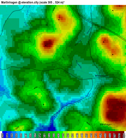
Below is the Elevation map of Martinhagen, which displays elevation range with different colors. Scale of the first map is from 305 to 524 m (1001 to 1719 ft) with average elevation of 388.5 meters (=1275 ft) [note 1]
These maps also provides idea of topography and contour of this city, they are displayed at different zoom levels. More info about maps, scale and edge coordinates you can find below images.
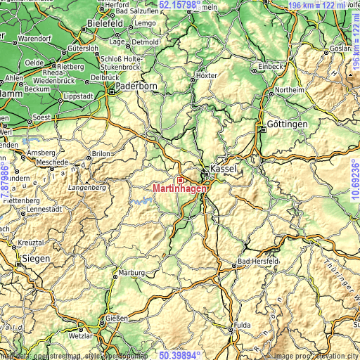
| \ | Map #1 | Topo.Map |
| Scale [m] | 305..524 m | × |
| Scale [ft] | 1001..1719 ft | × |
| Average | 388.5 m = 1275 ft | × |
| Width | 6.11 km = 3.8 mi | 195.6 km = 121.5 mi |
| Height | 6.11 km = 3.8 mi | 195.6 km = 121.5 mi |
| ↑Max Latitude | 51.314356° | 52.15798° |
| Latitude at center | 51.28688° | 51.28688° |
| ↓Min Latitude | 51.259387° | 50.39894° |
| ← Min Longitude | 9.242165° | 7.87986° |
| Longitude center | 9.28611° | 9.28611° |
| →Max Longitude | 9.330055° | 10.69236° |
Nearby cities:
Cities around Martinhagen sort by population:
• Kassel elevation 164 m
15.2 km,  77°
77°
• Baunatal 216 m
9.3 km,  114°
114°
• Vellmar 178 m
15.6 km,  59°
59°
• Lohfelden 196 m
17.3 km,  97°
97°
• Wolfhagen 283 m
9.2 km,  298°
298°
• Gudensberg 246 m
13.5 km,  155°
155°
• Calden 238 m
15.8 km,  30°
30°
• Zierenberg 276 m
9.2 km,  6°
6°
• Niedenstein 314 m
6.2 km, 164°
• Naumburg 286 m
9.4 km,  242°
242°
• Guxhagen 172 m
16.8 km,  125°
125°
• Breuna 290 m
16 km,  333°
333°
Multilingual:
 En español:
Martinhagen elevación 385 m.
 En France:
Martinhagen élévation 385 m.
 Auf Deutsch:
Martinhagen höhe über dem Meeresspiegel ist 385 m.

Sources and notes:
- [note 1] Map square and city borders are not equal. Map elevation data is calculated only from area inside that square.
- [src 1] Elevation data from geonames database provided with same terms of usage.
- [src 2] The elevation map of Martinhagen is generated using elevation data from NASA's 3 arcsec (90m) resolution SRTM data.
- [src 3] Base (background) map © OpenStreetMap contributors tiles are generated by Geofabrik and OpenTopoMap.
Copyright & License:
This Martinhagen Elevation Map is licensed under CC BY-SA. You may reuse any part from this page, if you give a proper credit by linking to this URL:
 More info on terms of use page.