Lohfelden elevation
Lohfelden (Hesse, Regierungsbezirk Kassel), Germany elevation is 196 meters and Lohfelden elevation in feet is 643 ft above sea level [src 1]. Lohfelden is a seat of a fourth-order administrative division (feature code) with elevation that is 62 meters (203 ft) smaller than average city elevation in Germany.
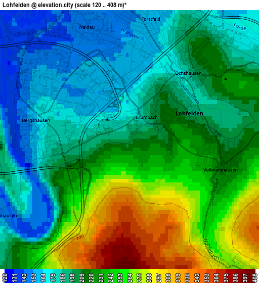
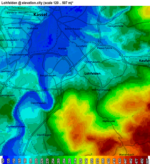
Below is the Elevation map of Lohfelden, which displays elevation range with different colors. Scale of the first map is from 120 to 408 m (394 to 1339 ft) with average elevation of 216.2 meters (=709 ft) [note 1]
These maps also provides idea of topography and contour of this city, they are displayed at different zoom levels. More info about maps, scale and edge coordinates you can find below images.
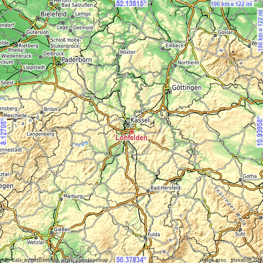
| \ | Map #1 | Map #2 | Topo.Map |
| Scale [m] | 120..408 m | 120..507 m | × |
| Scale [ft] | 394..1339 ft | 394..1663 ft | × |
| Average | 216.2 m = 709 ft | 238.3 m = 782 ft | × |
| Width | 6.11 km = 3.8 mi | 12.23 km = 7.6 mi | 195.7 km = 121.6 mi |
| Height | 6.11 km = 3.8 mi | 12.23 km = 7.6 mi | 195.7 km = 121.6 mi |
| ↑Max Latitude | 51.294158° | 51.32163° | 52.13815° |
| Latitude at center | 51.26667° | 51.26667° | 51.26667° |
| ↓Min Latitude | 51.239165° | 51.211644° | 50.37834° |
| ← Min Longitude | 9.489385° | 9.445439° | 8.12708° |
| Longitude center | 9.53333° | 9.53333° | 9.53333° |
| →Max Longitude | 9.577275° | 9.621221° | 10.93958° |
Nearby cities:
Cities around Lohfelden sort by population:
• Kassel elevation 164 m
6 km,  337°
337°
• Baunatal 216 m
8.9 km,  259°
259°
• Vellmar 178 m
10.8 km, 339°
• Melsungen 179 m
15.2 km,  175°
175°
• Hessisch Lichtenau 378 m
14.9 km,  120°
120°
• Kaufungen 212 m
6.1 km,  74°
74°
• Fuldatal 172 m
13.2 km,  10°
10°
• Gudensberg 246 m
15.3 km,  229°
229°
• Helsa 303 m
10.8 km,  94°
94°
• Guxhagen 172 m
8.2 km,  205°
205°
• Espenau 256 m
15.1 km, 343°
• Körle 158 m
11.2 km,  185°
185°
Multilingual:
 En español:
Lohfelden elevación 196 m.
 En France:
Lohfelden élévation 196 m.
 Auf Deutsch:
Lohfelden höhe über dem Meeresspiegel ist 196 m.

Sources and notes:
- [note 1] Map square and city borders are not equal. Map elevation data is calculated only from area inside that square.
- [src 1] Elevation data from geonames database provided with same terms of usage.
- [src 2] The elevation map of Lohfelden is generated using elevation data from NASA's 3 arcsec (90m) resolution SRTM data.
- [src 3] Base (background) map © OpenStreetMap contributors tiles are generated by Geofabrik and OpenTopoMap.
Copyright & License:
This Lohfelden Elevation Map is licensed under CC BY-SA. You may reuse any part from this page, if you give a proper credit by linking to this URL:
 More info on terms of use page.