Baunatal elevation
Baunatal (Hesse, Regierungsbezirk Kassel), Germany elevation is 216 meters and Baunatal elevation in feet is 709 ft above sea level [src 1]. Baunatal is a populated place (feature code) with elevation that is 42 meters (138 ft) smaller than average city elevation in Germany.
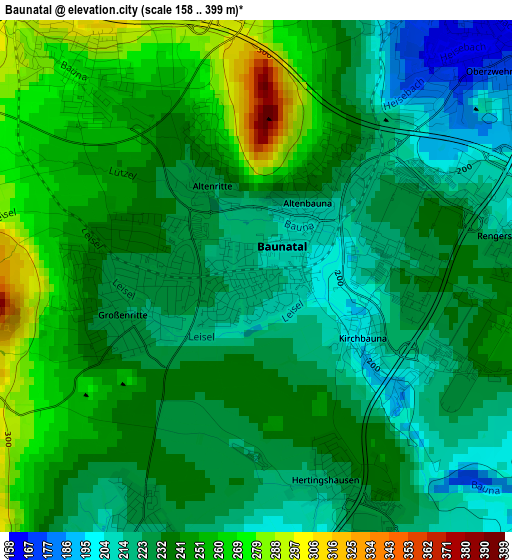
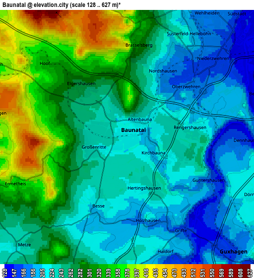
Below is the Elevation map of Baunatal, which displays elevation range with different colors. Scale of the first map is from 158 to 399 m (518 to 1309 ft) with average elevation of 236.6 meters (=776 ft) [note 1]
These maps also provides idea of topography and contour of this city, they are displayed at different zoom levels. More info about maps, scale and edge coordinates you can find below images.
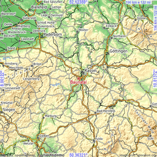
| \ | Map #1 | Map #2 | Topo.Map |
| Scale [m] | 158..399 m | 128..627 m | × |
| Scale [ft] | 518..1309 ft | 420..2057 ft | × |
| Average | 236.6 m = 776 ft | 265.3 m = 870 ft | × |
| Width | 6.12 km = 3.8 mi | 12.23 km = 7.6 mi | 195.7 km = 121.6 mi |
| Height | 6.12 km = 3.8 mi | 12.23 km = 7.6 mi | 195.7 km = 121.6 mi |
| ↑Max Latitude | 51.279317° | 51.306798° | 52.12359° |
| Latitude at center | 51.25182° | 51.25182° | 51.25182° |
| ↓Min Latitude | 51.224306° | 51.196776° | 50.36321° |
| ← Min Longitude | 9.363525° | 9.319579° | 8.00122° |
| Longitude center | 9.40747° | 9.40747° | 9.40747° |
| →Max Longitude | 9.451415° | 9.495361° | 10.81372° |
Nearby cities:
Cities around Baunatal sort by population:
• Kassel elevation 164 m
9.7 km,  41°
41°
• Vellmar 178 m
12.8 km,  23°
23°
• Fritzlar 220 m
16.2 km,  214°
214°
• Lohfelden 196 m
8.9 km,  79°
79°
• Kaufungen 212 m
15 km, 77°
• Felsberg 165 m
12.7 km,  175°
175°
• Gudensberg 246 m
8.8 km,  198°
198°
• Zierenberg 276 m
15 km,  330°
330°
• Niedenstein 314 m
7.1 km,  253°
253°
• Guxhagen 172 m
7.8 km,  137°
137°
• Körle 158 m
12.1 km, 141°
• Martinhagen 385 m
9.3 km,  294°
294°
Multilingual:
 En español:
Baunatal elevación 216 m.
 En France:
Baunatal élévation 216 m.
 Auf Deutsch:
Baunatal höhe über dem Meeresspiegel ist 216 m.

Sources and notes:
- [note 1] Map square and city borders are not equal. Map elevation data is calculated only from area inside that square.
- [src 1] Elevation data from geonames database provided with same terms of usage.
- [src 2] The elevation map of Baunatal is generated using elevation data from NASA's 3 arcsec (90m) resolution SRTM data.
- [src 3] Base (background) map © OpenStreetMap contributors tiles are generated by Geofabrik and OpenTopoMap.
Copyright & License:
This Baunatal Elevation Map is licensed under CC BY-SA. You may reuse any part from this page, if you give a proper credit by linking to this URL:
 More info on terms of use page.