Breuna elevation
Breuna (Hesse, Regierungsbezirk Kassel), Germany elevation is 290 meters and Breuna elevation in feet is 951 ft above sea level [src 1]. Breuna is a seat of a fourth-order administrative division (feature code) with elevation that is 32 meters (105 ft) bigger than average city elevation in Germany.
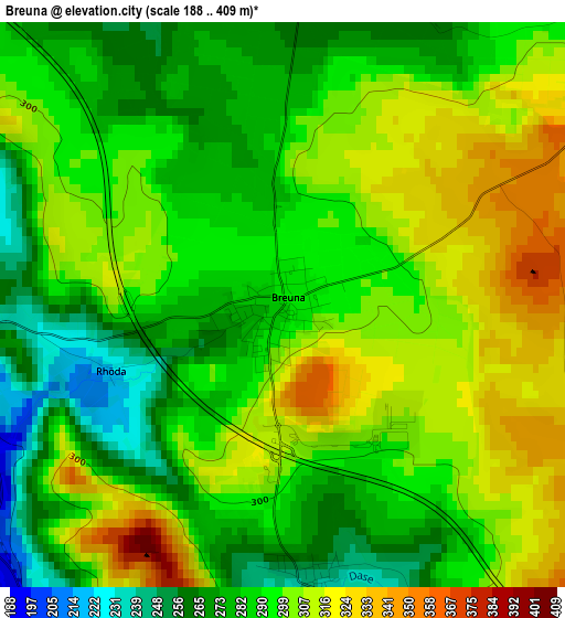
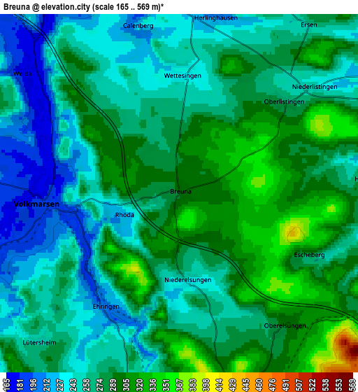
Below is the Elevation map of Breuna, which displays elevation range with different colors. Scale of the first map is from 188 to 409 m (617 to 1342 ft) with average elevation of 294.1 meters (=965 ft) [note 1]
These maps also provides idea of topography and contour of this city, they are displayed at different zoom levels. More info about maps, scale and edge coordinates you can find below images.
| \ | Map #1 | Map #2 | Topo.Map |
| Scale [m] | 188..409 m | 165..569 m | × |
| Scale [ft] | 617..1342 ft | 541..1867 ft | × |
| Average | 294.1 m = 965 ft | 271.2 m = 890 ft | × |
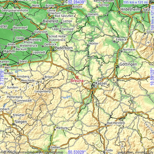
| Width | 6.09 km = 3.8 mi | 12.19 km = 7.6 mi | 195 km = 121.2 mi |
| Height | 6.09 km = 3.8 mi | 12.19 km = 7.6 mi | 195 km = 121.2 mi |
| ↑Max Latitude | 51.443149° | 51.470531° | 52.28439° |
| Latitude at center | 51.41575° | 51.41575° | 51.41575° |
| ↓Min Latitude | 51.388335° | 51.360903° | 50.53029° |
| ← Min Longitude | 9.141055° | 9.097109° | 7.77875° |
| Longitude center | 9.185° | 9.185° | 9.185° |
| →Max Longitude | 9.228945° | 9.272891° | 10.59125° |
Nearby cities:
Cities around Breuna sort by population:
• Warburg elevation 200 m
8.7 km,  342°
342°
• Bad Arolsen 292 m
12.5 km,  251°
251°
• Hofgeismar 157 m
16.5 km,  57°
57°
• Wolfhagen 283 m
10 km,  185°
185°
• Borgentreich 205 m
17.5 km,  12°
12°
• Calden 238 m
15.1 km,  92°
92°
• Volkmarsen 189 m
4.7 km,  260°
260°
• Zierenberg 276 m
9.6 km,  122°
122°
• Grebenstein 199 m
16.1 km,  77°
77°
• Naumburg 286 m
18.7 km,  184°
184°
• Liebenau 147 m
11.3 km,  36°
36°
• Martinhagen 385 m
16 km,  153°
153°
Multilingual:
 En español:
Breuna elevación 290 m.
 En France:
Breuna élévation 290 m.


Sources and notes:
- [note 1] Map square and city borders are not equal. Map elevation data is calculated only from area inside that square.
- [src 1] Elevation data from geonames database provided with same terms of usage.
- [src 2] The elevation map of Breuna is generated using elevation data from NASA's 3 arcsec (90m) resolution SRTM data.
- [src 3] Base (background) map © OpenStreetMap contributors tiles are generated by Geofabrik and OpenTopoMap.
Copyright & License:
This Breuna Elevation Map is licensed under CC BY-SA. You may reuse any part from this page, if you give a proper credit by linking to this URL:
 More info on terms of use page.