Grebenstein elevation
Grebenstein (Hesse, Regierungsbezirk Kassel), Germany elevation is 199 meters and Grebenstein elevation in feet is 653 ft above sea level [src 1]. Grebenstein is a populated place (feature code) with elevation that is 59 meters (194 ft) smaller than average city elevation in Germany.
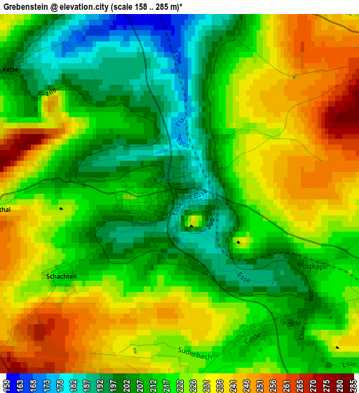
Below is the Elevation map of Grebenstein, which displays elevation range with different colors. Scale of the first map is from 158 to 285 m (518 to 935 ft) with average elevation of 219 meters (=719 ft) [note 1]
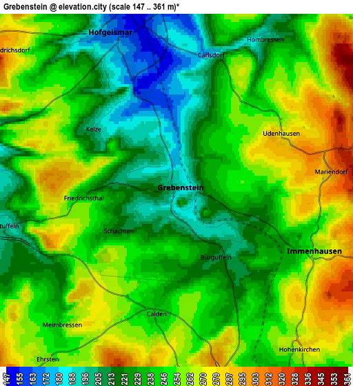
These maps also provides idea of topography and contour of this city, they are displayed at different zoom levels. More info about maps, scale and edge coordinates you can find below images.
| \ | Map #1 | Map #2 | Topo.Map |
| Scale [m] | 158..285 m | 147..361 m | × |
| Scale [ft] | 518..935 ft | 482..1184 ft | × |
| Average | 219 m = 719 ft | 242.6 m = 796 ft | × |
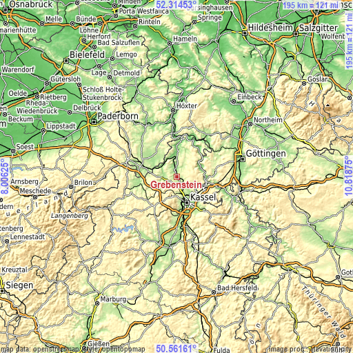
| Width | 6.09 km = 3.8 mi | 12.18 km = 7.6 mi | 194.9 km = 121.1 mi |
| Height | 6.09 km = 3.8 mi | 12.18 km = 7.6 mi | 194.9 km = 121.1 mi |
| ↑Max Latitude | 51.473861° | 51.501225° | 52.31453° |
| Latitude at center | 51.44648° | 51.44648° | 51.44648° |
| ↓Min Latitude | 51.419083° | 51.39167° | 50.56161° |
| ← Min Longitude | 9.368555° | 9.324609° | 8.00625° |
| Longitude center | 9.4125° | 9.4125° | 9.4125° |
| →Max Longitude | 9.456445° | 9.500391° | 10.81875° |
Nearby cities:
Cities around Grebenstein sort by population:
• Kassel elevation 164 m
15.7 km,  157°
157°
• Vellmar 178 m
10.9 km,  154°
154°
• Hofgeismar 157 m
5.8 km,  340°
340°
• Fuldatal 172 m
12.8 km,  123°
123°
• Calden 238 m
4.2 km,  190°
190°
• Immenhausen 252 m
5.1 km,  114°
114°
• Zierenberg 276 m
11.5 km,  221°
221°
• Trendelburg 160 m
14.2 km,  2°
2°
• Espenau 256 m
6.8 km,  144°
144°
• Breuna 290 m
16.1 km,  257°
257°
• Liebenau 147 m
10.6 km,  301°
301°
• Udenhausen 280 m
4 km,  61°
61°
Multilingual:
 En español:
Grebenstein elevación 199 m.
 En France:
Grebenstein élévation 199 m.
 Auf Deutsch:
Grebenstein höhe über dem Meeresspiegel ist 199 m.

Sources and notes:
- [note 1] Map square and city borders are not equal. Map elevation data is calculated only from area inside that square.
- [src 1] Elevation data from geonames database provided with same terms of usage.
- [src 2] The elevation map of Grebenstein is generated using elevation data from NASA's 3 arcsec (90m) resolution SRTM data.
- [src 3] Base (background) map © OpenStreetMap contributors tiles are generated by Geofabrik and OpenTopoMap.
Copyright & License:
This Grebenstein Elevation Map is licensed under CC BY-SA. You may reuse any part from this page, if you give a proper credit by linking to this URL:
 More info on terms of use page.