Maxdorf elevation
Maxdorf (Rheinland-Pfalz), Germany elevation is 95 meters and Maxdorf elevation in feet is 312 ft above sea level [src 1]. Maxdorf is a seat of a fourth-order administrative division (feature code) with elevation that is 163 meters (535 ft) smaller than average city elevation in Germany.
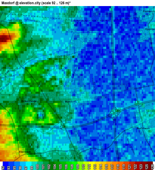
Below is the Elevation map of Maxdorf, which displays elevation range with different colors. Scale of the first map is from 92 to 126 m (302 to 413 ft) with average elevation of 98.5 meters (=323 ft) [note 1]
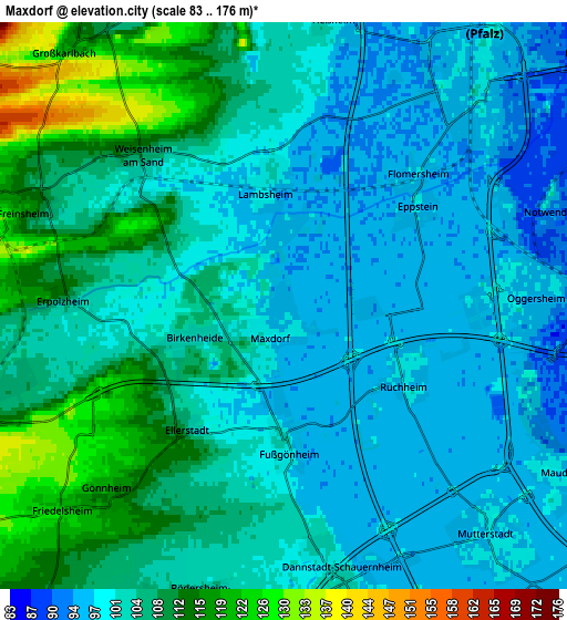
These maps also provides idea of topography and contour of this city, they are displayed at different zoom levels. More info about maps, scale and edge coordinates you can find below images.
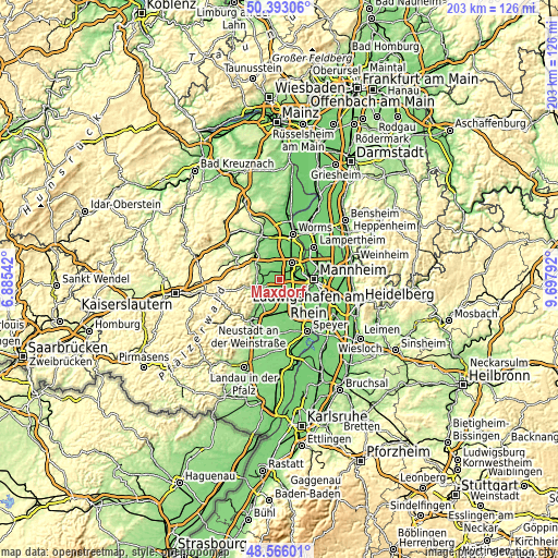
| \ | Map #1 | Map #2 | Topo.Map |
| Scale [m] | 92..126 m | 83..176 m | × |
| Scale [ft] | 302..413 ft | 272..577 ft | × |
| Average | 98.5 m = 323 ft | 103.6 m = 340 ft | × |
| Width | 6.35 km = 3.9 mi | 12.7 km = 7.9 mi | 203.1 km = 126.2 mi |
| Height | 6.35 km = 3.9 mi | 12.7 km = 7.9 mi | 203.1 km = 126.2 mi |
| ↑Max Latitude | 49.516599° | 49.545121° | 50.39306° |
| Latitude at center | 49.48806° | 49.48806° | 49.48806° |
| ↓Min Latitude | 49.459505° | 49.430932° | 48.56601° |
| ← Min Longitude | 8.247725° | 8.203779° | 6.88542° |
| Longitude center | 8.29167° | 8.29167° | 8.29167° |
| →Max Longitude | 8.335615° | 8.379561° | 9.69792° |
Nearby cities:
Cities around Maxdorf sort by population:
• Frankenthal elevation 99 m
6.8 km,  41°
41°
• Dannstadt-Schauernheim 97 m
5.5 km,  167°
167°
• Lambsheim 102 m
2.9 km,  354°
354°
• Freinsheim 118 m
6.1 km,  289°
289°
• Birkenheide 101 m
2.3 km,  250°
250°
• Heßheim 101 m
6.5 km,  10°
10°
• Rödersheim-Gronau 107 m
6.8 km,  198°
198°
• Fußgönheim 102 m
3 km,  179°
179°
• Ellerstadt 114 m
3.7 km,  218°
218°
• Friedelsheim 123 m
6.7 km,  227°
227°
• Gönnheim 119 m
5.9 km, 220°
• Erpolzheim 109 m
4.8 km,  271°
271°
Multilingual:
 En español:
Maxdorf elevación 95 m.
 En France:
Maxdorf élévation 95 m.


Sources and notes:
- [note 1] Map square and city borders are not equal. Map elevation data is calculated only from area inside that square.
- [src 1] Elevation data from geonames database provided with same terms of usage.
- [src 2] The elevation map of Maxdorf is generated using elevation data from NASA's 3 arcsec (90m) resolution SRTM data.
- [src 3] Base (background) map © OpenStreetMap contributors tiles are generated by Geofabrik and OpenTopoMap.
Copyright & License:
This Maxdorf Elevation Map is licensed under CC BY-SA. You may reuse any part from this page, if you give a proper credit by linking to this URL:
 More info on terms of use page.