Frankenthal elevation
Frankenthal (Rheinland-Pfalz), Germany elevation is 99 meters and Frankenthal elevation in feet is 325 ft above sea level [src 1]. Frankenthal is a seat of a third-order administrative division (feature code) with elevation that is 159 meters (522 ft) smaller than average city elevation in Germany.
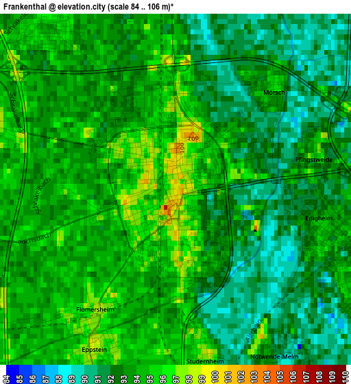
Below is the Elevation map of Frankenthal, which displays elevation range with different colors. Scale of the first map is from 84 to 106 m (276 to 348 ft) with average elevation of 93.2 meters (=306 ft) [note 1]
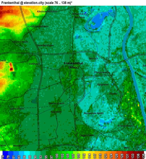
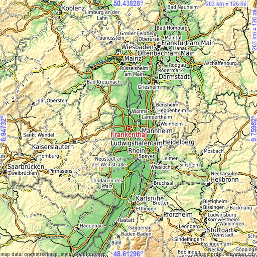
These maps also provides idea of topography and contour of this city, they are displayed at different zoom levels. More info about maps, scale and edge coordinates you can find below images.
| \ | Map #1 | Map #2 | Topo.Map |
| Scale [m] | 84..106 m | 76..138 m | × |
| Scale [ft] | 276..348 ft | 249..453 ft | × |
| Average | 93.2 m = 306 ft | 95.4 m = 313 ft | × |
| Width | 6.34 km = 3.9 mi | 12.68 km = 7.9 mi | 203 km = 126.1 mi |
| Height | 6.34 km = 3.9 mi | 12.68 km = 7.9 mi | 202.9 km = 126.1 mi |
| ↑Max Latitude | 49.562652° | 49.591147° | 50.43828° |
| Latitude at center | 49.53414° | 49.53414° | 49.53414° |
| ↓Min Latitude | 49.505611° | 49.477066° | 48.61296° |
| ← Min Longitude | 8.309625° | 8.265679° | 6.94732° |
| Longitude center | 8.35357° | 8.35357° | 8.35357° |
| →Max Longitude | 8.397515° | 8.441461° | 9.75982° |
Nearby cities:
Cities around Frankenthal sort by population:
• Ludwigshafen am Rhein elevation 97 m
8.9 km,  131°
131°
• Gartenstadt 96 m
9.1 km,  156°
156°
• Bobenheim-Roxheim 95 m
5.9 km,  2°
2°
• Maxdorf 95 m
6.8 km,  221°
221°
• Lambsheim 102 m
5.3 km,  244°
244°
• Birkenheide 101 m
8.8 km,  228°
228°
• Dirmstein 106 m
8.5 km,  292°
292°
• Heßheim 101 m
3.6 km, 291°
• Beindersheim 95 m
3.8 km,  320°
320°
• Gerolsheim 106 m
6.6 km,  283°
283°
• Großniedesheim 99 m
5.5 km,  326°
326°
• Heuchelheim bei Frankenthal 101 m
5.6 km,  305°
305°
Multilingual:
 En español:
Frankenthal elevación 99 m.
 En France:
Frankenthal élévation 99 m.
 Auf Deutsch:
Frankenthal höhe über dem Meeresspiegel ist 99 m.

Sources and notes:
- [note 1] Map square and city borders are not equal. Map elevation data is calculated only from area inside that square.
- [src 1] Elevation data from geonames database provided with same terms of usage.
- [src 2] The elevation map of Frankenthal is generated using elevation data from NASA's 3 arcsec (90m) resolution SRTM data.
- [src 3] Base (background) map © OpenStreetMap contributors tiles are generated by Geofabrik and OpenTopoMap.
Copyright & License:
This Frankenthal Elevation Map is licensed under CC BY-SA. You may reuse any part from this page, if you give a proper credit by linking to this URL:
 More info on terms of use page.