Freinsheim elevation
Freinsheim (Rheinland-Pfalz), Germany elevation is 118 meters and Freinsheim elevation in feet is 387 ft above sea level [src 1]. Freinsheim is a populated place (feature code) with elevation that is 140 meters (459 ft) smaller than average city elevation in Germany.
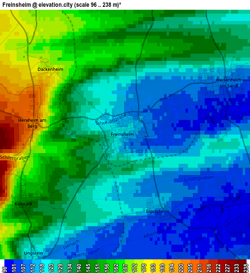
Below is the Elevation map of Freinsheim, which displays elevation range with different colors. Scale of the first map is from 96 to 238 m (315 to 781 ft) with average elevation of 133.7 meters (=439 ft) [note 1]
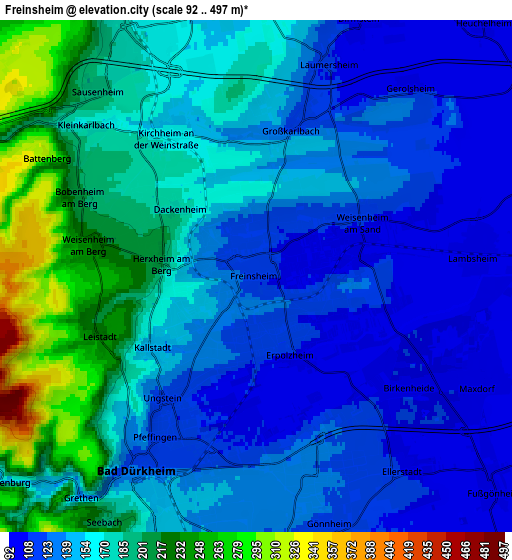
These maps also provides idea of topography and contour of this city, they are displayed at different zoom levels. More info about maps, scale and edge coordinates you can find below images.
| \ | Map #1 | Map #2 | Topo.Map |
| Scale [m] | 96..238 m | 92..497 m | × |
| Scale [ft] | 315..781 ft | 302..1631 ft | × |
| Average | 133.7 m = 439 ft | 157.9 m = 518 ft | × |
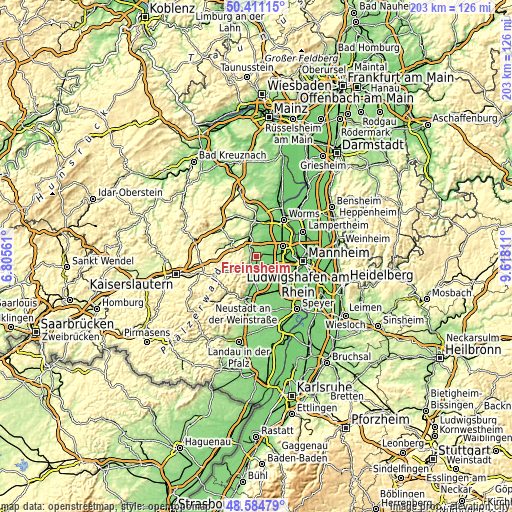
| Width | 6.35 km = 3.9 mi | 12.69 km = 7.9 mi | 203.1 km = 126.2 mi |
| Height | 6.35 km = 3.9 mi | 12.69 km = 7.9 mi | 203.1 km = 126.2 mi |
| ↑Max Latitude | 49.535018° | 49.56353° | 50.41115° |
| Latitude at center | 49.50649° | 49.50649° | 49.50649° |
| ↓Min Latitude | 49.477945° | 49.449384° | 48.58479° |
| ← Min Longitude | 8.167915° | 8.123969° | 6.80561° |
| Longitude center | 8.21186° | 8.21186° | 8.21186° |
| →Max Longitude | 8.255805° | 8.299751° | 9.61811° |
Nearby cities:
Cities around Freinsheim sort by population:
• Bad Dürkheim elevation 133 m
5.7 km,  209°
209°
• Herxheim am Berg 203 m
2.4 km,  277°
277°
• Maxdorf 95 m
6.1 km,  109°
109°
• Lambsheim 102 m
5.5 km,  81°
81°
• Birkenheide 101 m
4.6 km,  127°
127°
• Ellerstadt 114 m
6.1 km,  145°
145°
• Kirchheim an der Weinstraße 164 m
4.1 km,  326°
326°
• Gerolsheim 106 m
5.9 km,  39°
39°
• Friedelsheim 123 m
6.7 km,  173°
173°
• Erpolzheim 109 m
2.1 km, 154°
• Großkarlbach 122 m
3.7 km,  14°
14°
• Kallstadt 146 m
3.1 km,  236°
236°
Multilingual:
 En español:
Freinsheim elevación 118 m.
 En France:
Freinsheim élévation 118 m.
 Auf Deutsch:
Freinsheim höhe über dem Meeresspiegel ist 118 m.

Sources and notes:
- [note 1] Map square and city borders are not equal. Map elevation data is calculated only from area inside that square.
- [src 1] Elevation data from geonames database provided with same terms of usage.
- [src 2] The elevation map of Freinsheim is generated using elevation data from NASA's 3 arcsec (90m) resolution SRTM data.
- [src 3] Base (background) map © OpenStreetMap contributors tiles are generated by Geofabrik and OpenTopoMap.
Copyright & License:
This Freinsheim Elevation Map is licensed under CC BY-SA. You may reuse any part from this page, if you give a proper credit by linking to this URL:
 More info on terms of use page.