Maxhütte-Haidhof elevation
Maxhütte-Haidhof (Bavaria, Upper Palatinate), Germany elevation is 421 meters and Maxhütte-Haidhof elevation in feet is 1381 ft above sea level [src 1]. Maxhütte-Haidhof is a populated place (feature code) with elevation that is 163 meters (535 ft) bigger than average city elevation in Germany.
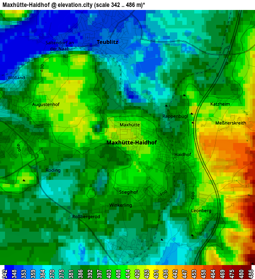
Below is the Elevation map of Maxhütte-Haidhof, which displays elevation range with different colors. Scale of the first map is from 342 to 486 m (1122 to 1594 ft) with average elevation of 392.5 meters (=1288 ft) [note 1]
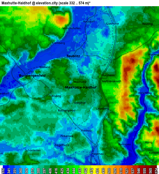
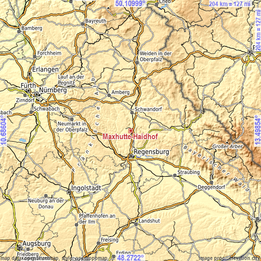
These maps also provides idea of topography and contour of this city, they are displayed at different zoom levels. More info about maps, scale and edge coordinates you can find below images.
| \ | Map #1 | Map #2 | Topo.Map |
| Scale [m] | 342..486 m | 332..574 m | × |
| Scale [ft] | 1122..1594 ft | 1089..1883 ft | × |
| Average | 392.5 m = 1288 ft | 399.4 m = 1310 ft | × |
| Width | 6.39 km = 4 mi | 12.77 km = 7.9 mi | 204.3 km = 126.9 mi |
| Height | 6.39 km = 4 mi | 12.77 km = 7.9 mi | 204.3 km = 126.9 mi |
| ↑Max Latitude | 49.228337° | 49.257027° | 50.10999° |
| Latitude at center | 49.19963° | 49.19963° | 49.19963° |
| ↓Min Latitude | 49.170907° | 49.142167° | 48.2722° |
| ← Min Longitude | 12.048345° | 12.004399° | 10.68604° |
| Longitude center | 12.09229° | 12.09229° | 12.09229° |
| →Max Longitude | 12.136235° | 12.180181° | 13.49854° |
Nearby cities:
Cities around Maxhütte-Haidhof sort by population:
• Schwandorf in Bayern elevation 363 m
14 km,  5°
5°
• Regenstauf 353 m
9.3 km,  162°
162°
• Burglengenfeld 368 m
3.5 km,  277°
277°
• Nittenau 353 m
12.7 km,  92°
92°
• Wenzenbach 358 m
15.8 km,  150°
150°
• Teublitz 355 m
2.6 km,  351°
351°
• Zeitlarn 334 m
13.5 km,  174°
174°
• Wackersdorf 452 m
14.6 km,  26°
26°
• Kallmünz 347 m
10.5 km,  245°
245°
• Schmidmühlen 362 m
14.4 km,  302°
302°
• Wolfsegg 407 m
13.2 km,  218°
218°
• Brunn 463 m
8.3 km,  60°
60°
Multilingual:
 En español:
Maxhütte-Haidhof elevación 421 m.
 En France:
Maxhütte-Haidhof élévation 421 m.
 Auf Deutsch:
Maxhütte-Haidhof höhe über dem Meeresspiegel ist 421 m.

Sources and notes:
- [note 1] Map square and city borders are not equal. Map elevation data is calculated only from area inside that square.
- [src 1] Elevation data from geonames database provided with same terms of usage.
- [src 2] The elevation map of Maxhütte-Haidhof is generated using elevation data from NASA's 3 arcsec (90m) resolution SRTM data.
- [src 3] Base (background) map © OpenStreetMap contributors tiles are generated by Geofabrik and OpenTopoMap.
Copyright & License:
This Maxhütte-Haidhof Elevation Map is licensed under CC BY-SA. You may reuse any part from this page, if you give a proper credit by linking to this URL:
 More info on terms of use page.