Meißenheim elevation
Meißenheim (Baden-Württemberg, Freiburg Region), Germany elevation is 147 meters and Meißenheim elevation in feet is 482 ft above sea level [src 1]. Meißenheim is a seat of a fourth-order administrative division (feature code) with elevation that is 111 meters (364 ft) smaller than average city elevation in Germany.
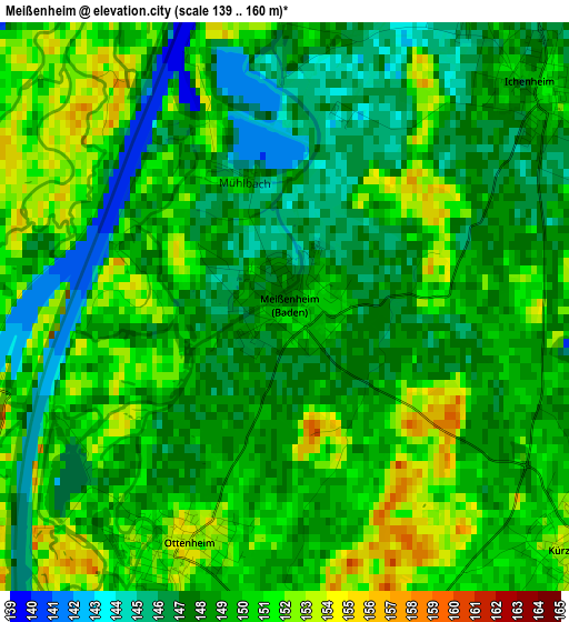
Below is the Elevation map of Meißenheim, which displays elevation range with different colors. Scale of the first map is from 139 to 160 m (456 to 525 ft) with average elevation of 148.8 meters (=488 ft) [note 1]
These maps also provides idea of topography and contour of this city, they are displayed at different zoom levels. More info about maps, scale and edge coordinates you can find below images.
| \ | Map #1 | Map #2 | Topo.Map |
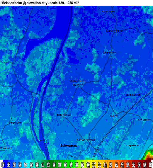
| Scale [m] | 139..160 m | 139..258 m | × |
| Scale [ft] | 456..525 ft | 456..846 ft | × |
| Average | 148.8 m = 488 ft | 149.1 m = 489 ft | × |
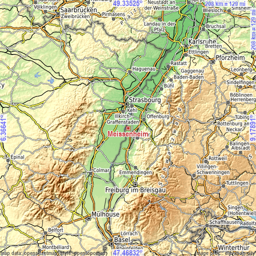
| Width | 6.49 km = 4 mi | 12.97 km = 8.1 mi | 207.6 km = 129 mi |
| Height | 6.49 km = 4 mi | 12.97 km = 8.1 mi | 207.6 km = 129 mi |
| ↑Max Latitude | 48.439512° | 48.468658° | 49.33525° |
| Latitude at center | 48.41035° | 48.41035° | 48.41035° |
| ↓Min Latitude | 48.381171° | 48.351976° | 47.46832° |
| ← Min Longitude | 7.728715° | 7.684769° | 6.36641° |
| Longitude center | 7.77266° | 7.77266° | 7.77266° |
| →Max Longitude | 7.816605° | 7.860551° | 9.17891° |
Nearby cities:
Cities around Meißenheim sort by population:
• Offenburg elevation 163 m
14.5 km,  60°
60°
• Lahr 176 m
10.5 km,  137°
137°
• Hohberg 343 m
13.5 km, 136°
• Schutterwald 150 m
9.3 km, 61°
• Schwanau 151 m
4.9 km,  188°
188°
• Kippenheim 169 m
13.3 km,  163°
163°
• Kappel-Grafenhausen 164 m
14.1 km,  181°
181°
• Mahlberg 191 m
14.1 km,  167°
167°
• Rust 162 m
16.2 km, 190°
• Ortenberg 166 m
15.4 km,  72°
72°
• Berghaupten 176 m
15.8 km,  91°
91°
• Grafenhausen 166 m
14 km, 181°
Multilingual:
 En español:
Meißenheim elevación 147 m.
 En France:
Meißenheim élévation 147 m.
 Auf Deutsch:
Meißenheim höhe über dem Meeresspiegel ist 147 m.

Sources and notes:
- [note 1] Map square and city borders are not equal. Map elevation data is calculated only from area inside that square.
- [src 1] Elevation data from geonames database provided with same terms of usage.
- [src 2] The elevation map of Meißenheim is generated using elevation data from NASA's 3 arcsec (90m) resolution SRTM data.
- [src 3] Base (background) map © OpenStreetMap contributors tiles are generated by Geofabrik and OpenTopoMap.
Copyright & License:
This Meißenheim Elevation Map is licensed under CC BY-SA. You may reuse any part from this page, if you give a proper credit by linking to this URL:
 More info on terms of use page.