Rust elevation
Rust (Baden-Württemberg, Freiburg Region), Germany elevation is 162 meters and Rust elevation in feet is 531 ft above sea level [src 1]. Rust is a seat of a fourth-order administrative division (feature code) with elevation that is 96 meters (315 ft) smaller than average city elevation in Germany.
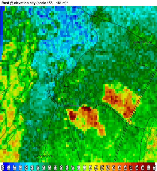
Below is the Elevation map of Rust, which displays elevation range with different colors. Scale of the first map is from 155 to 181 m (509 to 594 ft) with average elevation of 164.1 meters (=538 ft) [note 1]
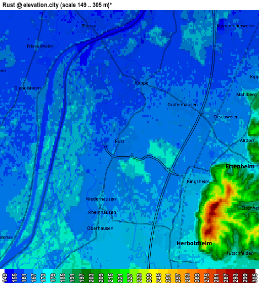
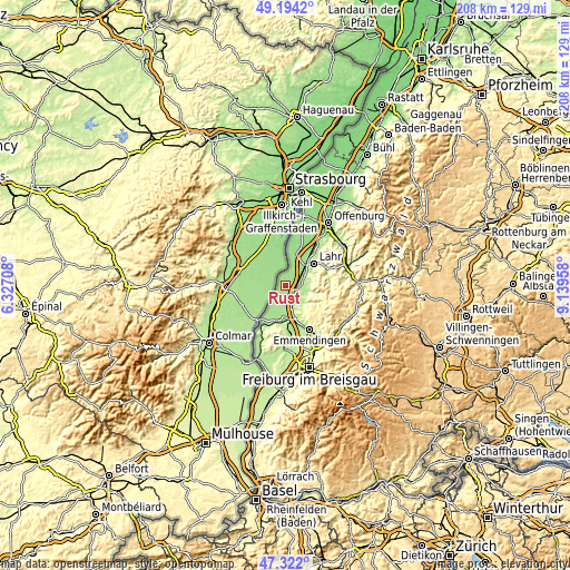
These maps also provides idea of topography and contour of this city, they are displayed at different zoom levels. More info about maps, scale and edge coordinates you can find below images.
| \ | Map #1 | Map #2 | Topo.Map |
| Scale [m] | 155..181 m | 149..305 m | × |
| Scale [ft] | 509..594 ft | 489..1001 ft | × |
| Average | 164.1 m = 538 ft | 168.5 m = 553 ft | × |
| Width | 6.51 km = 4 mi | 13.01 km = 8.1 mi | 208.2 km = 129.4 mi |
| Height | 6.51 km = 4 mi | 13.01 km = 8.1 mi | 208.2 km = 129.4 mi |
| ↑Max Latitude | 48.295914° | 48.325142° | 49.1942° |
| Latitude at center | 48.26667° | 48.26667° | 48.26667° |
| ↓Min Latitude | 48.237409° | 48.208131° | 47.322° |
| ← Min Longitude | 7.689385° | 7.645439° | 6.32708° |
| Longitude center | 7.73333° | 7.73333° | 7.73333° |
| →Max Longitude | 7.777275° | 7.821221° | 9.13958° |
Nearby cities:
Cities around Rust sort by population:
• Ettenheim elevation 173 m
6 km,  100°
100°
• Herbolzheim 178 m
6.2 km,  148°
148°
• Kenzingen 172 m
8.3 km,  160°
160°
• Schwanau 151 m
11.3 km,  10°
10°
• Kippenheim 169 m
7.5 km,  64°
64°
• Kappel-Grafenhausen 164 m
3.1 km,  51°
51°
• Mahlberg 191 m
6.4 km,  69°
69°
• Malterdingen 186 m
12.8 km, 162°
• Grafenhausen 166 m
3.2 km, 51°
• Weisweil 170 m
8.6 km,  209°
209°
• Ringsheim 171 m
3.9 km,  122°
122°
• Forchheim 173 m
11.4 km,  192°
192°
Multilingual:
 En español:
Rust elevación 162 m.
 En France:
Rust élévation 162 m.


Sources and notes:
- [note 1] Map square and city borders are not equal. Map elevation data is calculated only from area inside that square.
- [src 1] Elevation data from geonames database provided with same terms of usage.
- [src 2] The elevation map of Rust is generated using elevation data from NASA's 3 arcsec (90m) resolution SRTM data.
- [src 3] Base (background) map © OpenStreetMap contributors tiles are generated by Geofabrik and OpenTopoMap.
Copyright & License:
This Rust Elevation Map is licensed under CC BY-SA. You may reuse any part from this page, if you give a proper credit by linking to this URL:
 More info on terms of use page.