Hohberg elevation
Hohberg (Baden-Württemberg, Freiburg Region), Germany elevation is 343 meters and Hohberg elevation in feet is 1125 ft above sea level [src 1]. Hohberg is a populated locality (feature code) with elevation that is 85 meters (279 ft) bigger than average city elevation in Germany.
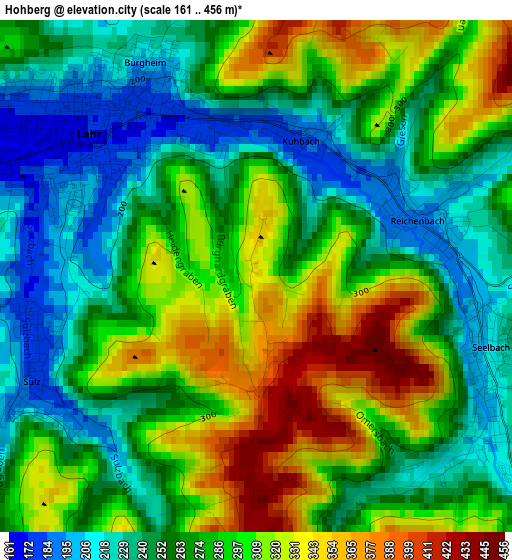
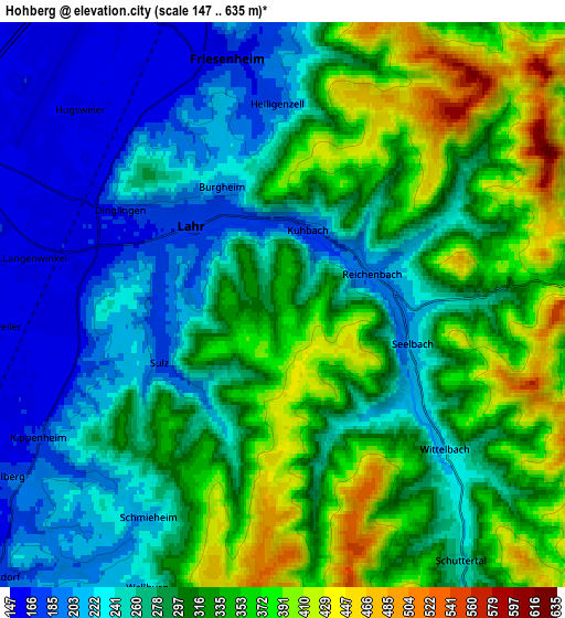
Below is the Elevation map of Hohberg, which displays elevation range with different colors. Scale of the first map is from 161 to 456 m (528 to 1496 ft) with average elevation of 278.8 meters (=915 ft) [note 1]
These maps also provides idea of topography and contour of this city, they are displayed at different zoom levels. More info about maps, scale and edge coordinates you can find below images.
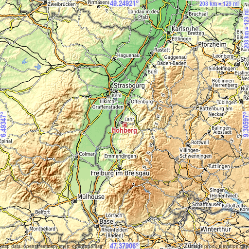
| \ | Map #1 | Map #2 | Topo.Map |
| Scale [m] | 161..456 m | 147..635 m | × |
| Scale [ft] | 528..1496 ft | 482..2083 ft | × |
| Average | 278.8 m = 915 ft | 293.4 m = 963 ft | × |
| Width | 6.5 km = 4 mi | 13 km = 8.1 mi | 207.9 km = 129.2 mi |
| Height | 6.5 km = 4 mi | 13 km = 8.1 mi | 207.9 km = 129.2 mi |
| ↑Max Latitude | 48.351912° | 48.381108° | 49.24921° |
| Latitude at center | 48.3227° | 48.3227° | 48.3227° |
| ↓Min Latitude | 48.293471° | 48.264225° | 47.37906° |
| ← Min Longitude | 7.855775° | 7.811829° | 6.49347° |
| Longitude center | 7.89972° | 7.89972° | 7.89972° |
| →Max Longitude | 7.943665° | 7.987611° | 9.30597° |
Nearby cities:
Cities around Hohberg sort by population:
• Lahr elevation 176 m
3 km,  310°
310°
• Ettenheim 173 m
9.8 km,  221°
221°
• Schwanau 151 m
11.3 km,  295°
295°
• Seelbach 217 m
3.3 km,  114°
114°
• Kippenheim 169 m
6.3 km,  241°
241°
• Kappel-Grafenhausen 164 m
10.8 km,  246°
246°
• Mahlberg 191 m
7.5 km, 237°
• Steinach 278 m
11.4 km,  102°
102°
• Schuttertal 284 m
7.3 km,  149°
149°
• Berghaupten 176 m
11.3 km,  34°
34°
• Grafenhausen 166 m
10.7 km, 246°
• Ringsheim 171 m
12.3 km,  227°
227°
Multilingual:
 En español:
Hohberg elevación 343 m.
 En France:
Hohberg élévation 343 m.


Sources and notes:
- [note 1] Map square and city borders are not equal. Map elevation data is calculated only from area inside that square.
- [src 1] Elevation data from geonames database provided with same terms of usage.
- [src 2] The elevation map of Hohberg is generated using elevation data from NASA's 3 arcsec (90m) resolution SRTM data.
- [src 3] Base (background) map © OpenStreetMap contributors tiles are generated by Geofabrik and OpenTopoMap.
Copyright & License:
This Hohberg Elevation Map is licensed under CC BY-SA. You may reuse any part from this page, if you give a proper credit by linking to this URL:
 More info on terms of use page.