Nordstemmen elevation
Nordstemmen (Lower Saxony), Germany elevation is 76 meters and Nordstemmen elevation in feet is 249 ft above sea level [src 1]. Nordstemmen is a seat of a fourth-order administrative division (feature code) with elevation that is 182 meters (597 ft) smaller than average city elevation in Germany.
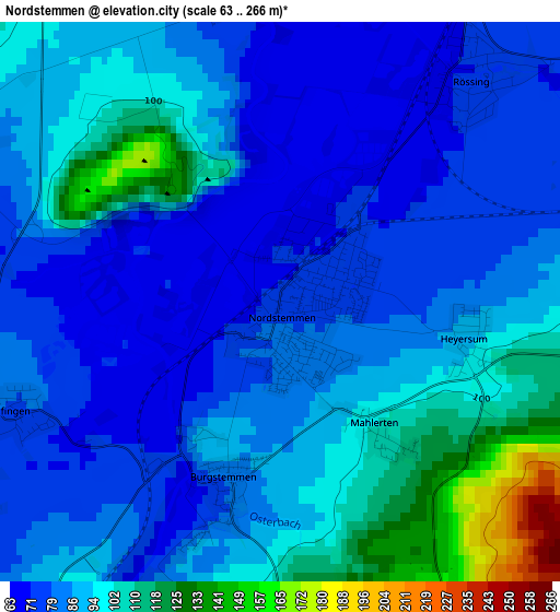
Below is the Elevation map of Nordstemmen, which displays elevation range with different colors. Scale of the first map is from 63 to 266 m (207 to 873 ft) with average elevation of 89.6 meters (=294 ft) [note 1]
These maps also provides idea of topography and contour of this city, they are displayed at different zoom levels. More info about maps, scale and edge coordinates you can find below images.
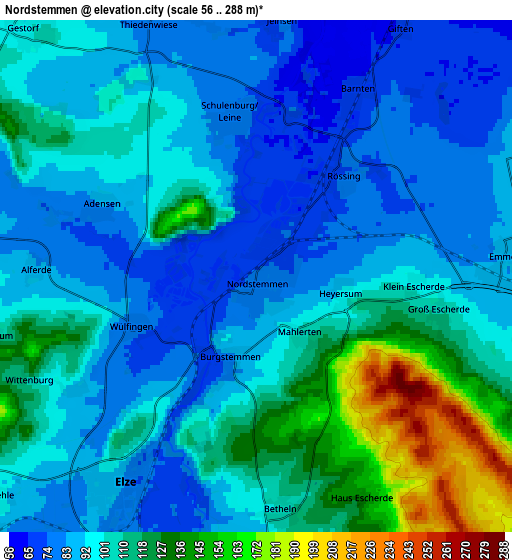
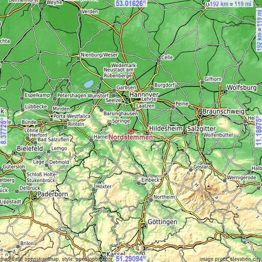
| \ | Map #1 | Map #2 | Topo.Map |
| Scale [m] | 63..266 m | 56..288 m | × |
| Scale [ft] | 207..873 ft | 184..945 ft | × |
| Average | 89.6 m = 294 ft | 101.2 m = 332 ft | × |
| Width | 5.99 km = 3.7 mi | 11.99 km = 7.5 mi | 191.8 km = 119.2 mi |
| Height | 5.99 km = 3.7 mi | 11.99 km = 7.5 mi | 191.8 km = 119.2 mi |
| ↑Max Latitude | 52.188909° | 52.215842° | 53.01626° |
| Latitude at center | 52.16196° | 52.16196° | 52.16196° |
| ↓Min Latitude | 52.134994° | 52.108012° | 51.29094° |
| ← Min Longitude | 9.739555° | 9.695609° | 8.37725° |
| Longitude center | 9.7835° | 9.7835° | 9.7835° |
| →Max Longitude | 9.827445° | 9.871391° | 11.18975° |
Nearby cities:
Cities around Nordstemmen sort by population:
• Hildesheim elevation 92 m
11.5 km,  96°
96°
• Sarstedt 65 m
9.4 km,  30°
30°
• Pattensen 67 m
11.5 km,  353°
353°
• Giesen 81 m
8.8 km,  63°
63°
• Elze 93 m
5.4 km,  216°
216°
• Diekholzen 122 m
11.8 km,  128°
128°
• Gronau 81 m
8.6 km,  183°
183°
• Eime 93 m
10.6 km,  203°
203°
• Banteln 92 m
10.8 km,  192°
192°
• Rheden 90 m
11.6 km, 178°
• Betheln 105 m
5.3 km,  172°
172°
• Heyersum 96 m
2.1 km,  106°
106°
Multilingual:
 En español:
Nordstemmen elevación 76 m.
 En France:
Nordstemmen élévation 76 m.
 Auf Deutsch:
Nordstemmen höhe über dem Meeresspiegel ist 76 m.

Sources and notes:
- [note 1] Map square and city borders are not equal. Map elevation data is calculated only from area inside that square.
- [src 1] Elevation data from geonames database provided with same terms of usage.
- [src 2] The elevation map of Nordstemmen is generated using elevation data from NASA's 3 arcsec (90m) resolution SRTM data.
- [src 3] Base (background) map © OpenStreetMap contributors tiles are generated by Geofabrik and OpenTopoMap.
Copyright & License:
This Nordstemmen Elevation Map is licensed under CC BY-SA. You may reuse any part from this page, if you give a proper credit by linking to this URL:
 More info on terms of use page.