Reichenbach elevation
Reichenbach (Saxony), Germany elevation is 245 meters and Reichenbach elevation in feet is 804 ft above sea level [src 1]. Reichenbach is a populated place (feature code) with elevation that is 13 meters (43 ft) smaller than average city elevation in Germany.
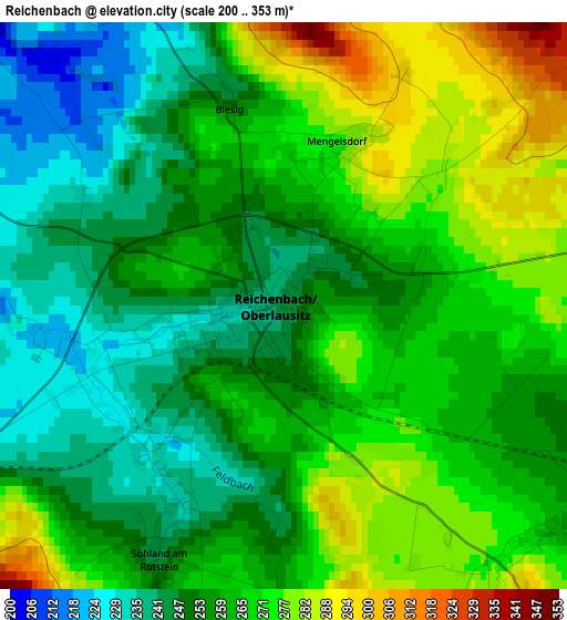
Below is the Elevation map of Reichenbach, which displays elevation range with different colors. Scale of the first map is from 200 to 353 m (656 to 1158 ft) with average elevation of 260.2 meters (=854 ft) [note 1]
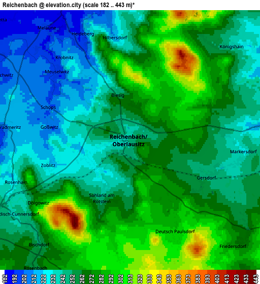
These maps also provides idea of topography and contour of this city, they are displayed at different zoom levels. More info about maps, scale and edge coordinates you can find below images.
| \ | Map #1 | Map #2 | Topo.Map |
| Scale [m] | 200..353 m | 182..443 m | × |
| Scale [ft] | 656..1158 ft | 597..1453 ft | × |
| Average | 260.2 m = 854 ft | 261.4 m = 858 ft | × |
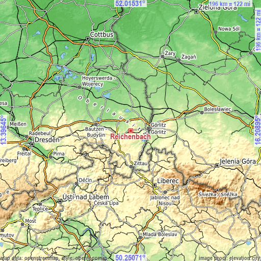
| Width | 6.13 km = 3.8 mi | 12.26 km = 7.6 mi | 196.2 km = 121.9 mi |
| Height | 6.13 km = 3.8 mi | 12.26 km = 7.6 mi | 196.2 km = 121.9 mi |
| ↑Max Latitude | 51.169003° | 51.19655° | 52.01531° |
| Latitude at center | 51.14144° | 51.14144° | 51.14144° |
| ↓Min Latitude | 51.11386° | 51.086264° | 50.25071° |
| ← Min Longitude | 14.758755° | 14.714809° | 13.39645° |
| Longitude center | 14.8027° | 14.8027° | 14.8027° |
| →Max Longitude | 14.846645° | 14.890591° | 16.20895° |
Nearby cities:
Cities around Reichenbach sort by population:
• Görlitz elevation 210 m
13.1 km,  83°
83°
• Löbau 272 m
10.5 km,  243°
243°
• Markersdorf 247 m
5.7 km,  99°
99°
• Bernstadt 233 m
10.6 km,  170°
170°
• Weißenberg 197 m
11.8 km,  301°
301°
• Herrnhut 342 m
14.5 km,  196°
196°
• Kodersdorf 180 m
12.9 km,  29°
29°
• Schönau-Berzdorf 217 m
10.3 km,  146°
146°
• Niedercunnersdorf 287 m
14 km,  226°
226°
• Sohland am Rotstein 244 m
3.1 km,  205°
205°
• Großschweidnitz 279 m
13.7 km, 234°
• Königshain 246 m
6.4 km,  43°
43°
Multilingual:
 En español:
Reichenbach elevación 245 m.
 En France:
Reichenbach élévation 245 m.
 Auf Deutsch:
Reichenbach höhe über dem Meeresspiegel ist 245 m.

Sources and notes:
- [note 1] Map square and city borders are not equal. Map elevation data is calculated only from area inside that square.
- [src 1] Elevation data from geonames database provided with same terms of usage.
- [src 2] The elevation map of Reichenbach is generated using elevation data from NASA's 3 arcsec (90m) resolution SRTM data.
- [src 3] Base (background) map © OpenStreetMap contributors tiles are generated by Geofabrik and OpenTopoMap.
Copyright & License:
This Reichenbach Elevation Map is licensed under CC BY-SA. You may reuse any part from this page, if you give a proper credit by linking to this URL:
 More info on terms of use page.