Rot elevation
Rot (Baden-Württemberg, Tübingen Region), Germany elevation is 657 meters and Rot elevation in feet is 2156 ft above sea level [src 1]. Rot is a populated place (feature code) with elevation that is 399 meters (1309 ft) bigger than average city elevation in Germany.
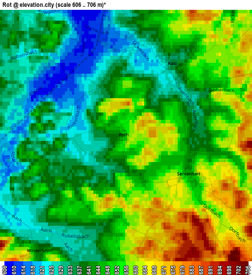
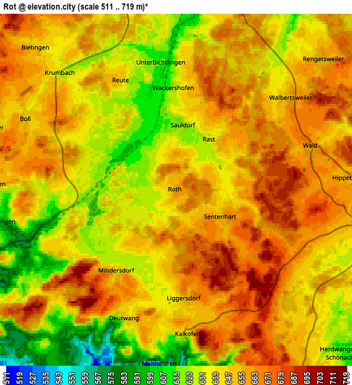
Below is the Elevation map of Rot, which displays elevation range with different colors. Scale of the first map is from 606 to 706 m (1988 to 2316 ft) with average elevation of 645.3 meters (=2117 ft) [note 1]
These maps also provides idea of topography and contour of this city, they are displayed at different zoom levels. More info about maps, scale and edge coordinates you can find below images.
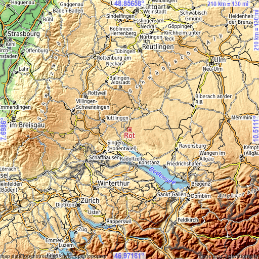
| \ | Map #1 | Map #2 | Topo.Map |
| Scale [m] | 606..706 m | 511..719 m | × |
| Scale [ft] | 1988..2316 ft | 1677..2359 ft | × |
| Average | 645.3 m = 2117 ft | 645.1 m = 2116 ft | × |
| Width | 6.55 km = 4.1 mi | 13.1 km = 8.1 mi | 209.6 km = 130.2 mi |
| Height | 6.55 km = 4.1 mi | 13.1 km = 8.1 mi | 209.6 km = 130.2 mi |
| ↑Max Latitude | 47.952221° | 47.981645° | 48.85658° |
| Latitude at center | 47.92278° | 47.92278° | 47.92278° |
| ↓Min Latitude | 47.893322° | 47.863848° | 46.97181° |
| ← Min Longitude | 9.060905° | 9.016959° | 7.6986° |
| Longitude center | 9.10485° | 9.10485° | 9.10485° |
| →Max Longitude | 9.148795° | 9.192741° | 10.5111° |
Nearby cities:
Cities around Rot sort by population:
• Stockach elevation 474 m
10.7 km,  221°
221°
• Pfullendorf 669 m
11.4 km,  88°
88°
• Meßkirch 603 m
8 km,  5°
5°
• Krauchenwies 585 m
14.9 km,  45°
45°
• Bodman-Ludwigshafen 405 m
12.2 km,  197°
197°
• Owingen 533 m
13.5 km,  158°
158°
• Herdwangen-Schönach 606 m
10.8 km,  138°
138°
• Orsingen-Nenzingen 460 m
14 km,  230°
230°
• Wald 657 m
4.8 km,  75°
75°
• Sauldorf 621 m
2.3 km, 6°
• Mühlingen 614 m
6.6 km,  264°
264°
• Sipplingen 420 m
14 km,  182°
182°
Multilingual:
 En español:
Rot elevación 657 m.
 En France:
Rot élévation 657 m.


Sources and notes:
- [note 1] Map square and city borders are not equal. Map elevation data is calculated only from area inside that square.
- [src 1] Elevation data from geonames database provided with same terms of usage.
- [src 2] The elevation map of Rot is generated using elevation data from NASA's 3 arcsec (90m) resolution SRTM data.
- [src 3] Base (background) map © OpenStreetMap contributors tiles are generated by Geofabrik and OpenTopoMap.
Copyright & License:
This Rot Elevation Map is licensed under CC BY-SA. You may reuse any part from this page, if you give a proper credit by linking to this URL:
 More info on terms of use page.