Schlierbach elevation
Schlierbach (Baden-Württemberg, Regierungsbezirk Stuttgart), Germany elevation is 351 meters and Schlierbach elevation in feet is 1152 ft above sea level [src 1]. Schlierbach is a seat of a fourth-order administrative division (feature code) with elevation that is 93 meters (305 ft) bigger than average city elevation in Germany.
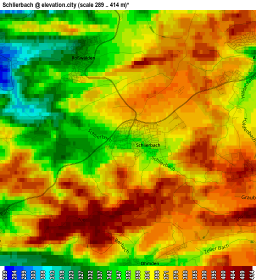
Below is the Elevation map of Schlierbach, which displays elevation range with different colors. Scale of the first map is from 289 to 414 m (948 to 1358 ft) with average elevation of 366.2 meters (=1201 ft) [note 1]
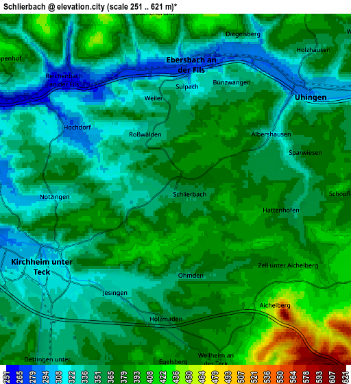
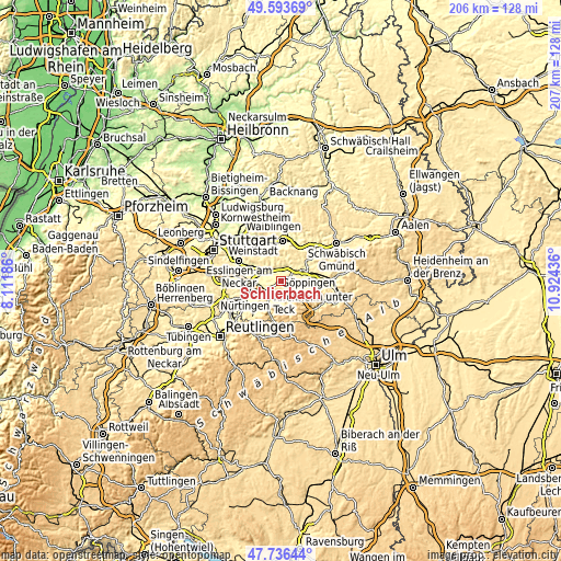
These maps also provides idea of topography and contour of this city, they are displayed at different zoom levels. More info about maps, scale and edge coordinates you can find below images.
| \ | Map #1 | Map #2 | Topo.Map |
| Scale [m] | 289..414 m | 251..621 m | × |
| Scale [ft] | 948..1358 ft | 823..2037 ft | × |
| Average | 366.2 m = 1201 ft | 361.7 m = 1187 ft | × |
| Width | 6.45 km = 4 mi | 12.91 km = 8 mi | 206.5 km = 128.3 mi |
| Height | 6.45 km = 4 mi | 12.91 km = 8 mi | 206.5 km = 128.3 mi |
| ↑Max Latitude | 48.702631° | 48.731625° | 49.59369° |
| Latitude at center | 48.67362° | 48.67362° | 48.67362° |
| ↓Min Latitude | 48.644592° | 48.615548° | 47.73644° |
| ← Min Longitude | 9.474165° | 9.430219° | 8.11186° |
| Longitude center | 9.51811° | 9.51811° | 9.51811° |
| →Max Longitude | 9.562055° | 9.606001° | 10.92436° |
Nearby cities:
Cities around Schlierbach sort by population:
• Kirchheim unter Teck elevation 316 m
5.6 km,  237°
237°
• Ebersbach an der Fils 280 m
4.7 km,  4°
4°
• Uhingen 292 m
6 km,  55°
55°
• Reichenbach an der Fils 261 m
5.7 km,  315°
315°
• Hochdorf 281 m
4.4 km,  298°
298°
• Albershausen 318 m
4 km, 60°
• Notzingen 314 m
4.5 km,  265°
265°
• Zell unter Aichelberg 383 m
4.8 km,  125°
125°
• Hattenhofen 355 m
4.2 km,  100°
100°
• Holzmaden 356 m
4.5 km,  181°
181°
• Ohmden 360 m
3.1 km,  168°
168°
• Aichelberg 434 m
5.4 km,  141°
141°
Multilingual:
 En español:
Schlierbach elevación 351 m.
 En France:
Schlierbach élévation 351 m.
 Auf Deutsch:
Schlierbach höhe über dem Meeresspiegel ist 351 m.

Sources and notes:
- [note 1] Map square and city borders are not equal. Map elevation data is calculated only from area inside that square.
- [src 1] Elevation data from geonames database provided with same terms of usage.
- [src 2] The elevation map of Schlierbach is generated using elevation data from NASA's 3 arcsec (90m) resolution SRTM data.
- [src 3] Base (background) map © OpenStreetMap contributors tiles are generated by Geofabrik and OpenTopoMap.
Copyright & License:
This Schlierbach Elevation Map is licensed under CC BY-SA. You may reuse any part from this page, if you give a proper credit by linking to this URL:
 More info on terms of use page.