Uhingen elevation
Uhingen (Baden-Württemberg, Regierungsbezirk Stuttgart), Germany elevation is 292 meters and Uhingen elevation in feet is 958 ft above sea level [src 1]. Uhingen is a populated place (feature code) with elevation that is 34 meters (112 ft) bigger than average city elevation in Germany.
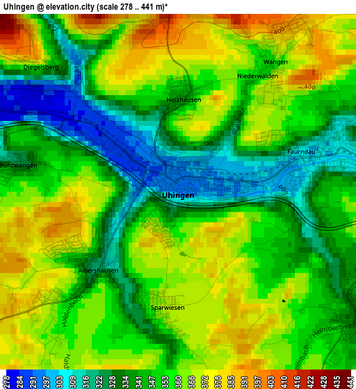
Below is the Elevation map of Uhingen, which displays elevation range with different colors. Scale of the first map is from 278 to 441 m (912 to 1447 ft) with average elevation of 351.3 meters (=1153 ft) [note 1]
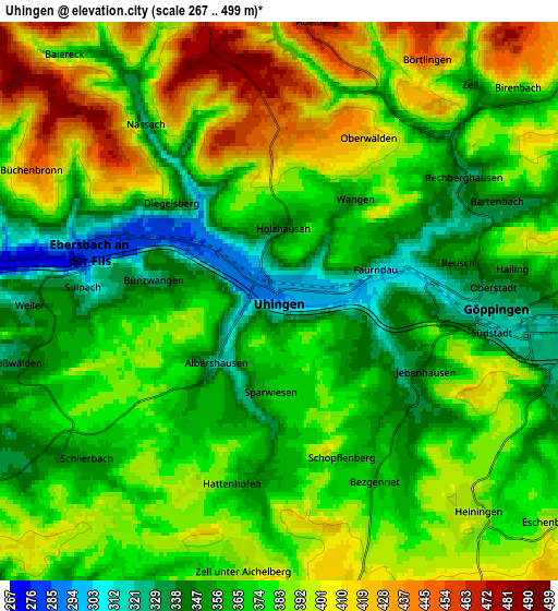
These maps also provides idea of topography and contour of this city, they are displayed at different zoom levels. More info about maps, scale and edge coordinates you can find below images.
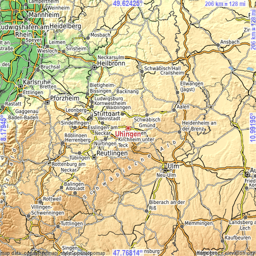
| \ | Map #1 | Map #2 | Topo.Map |
| Scale [m] | 278..441 m | 267..499 m | × |
| Scale [ft] | 912..1447 ft | 876..1637 ft | × |
| Average | 351.3 m = 1153 ft | 376.9 m = 1237 ft | × |
| Width | 6.45 km = 4 mi | 12.9 km = 8 mi | 206.4 km = 128.3 mi |
| Height | 6.45 km = 4 mi | 12.9 km = 8 mi | 206.4 km = 128.3 mi |
| ↑Max Latitude | 48.733743° | 48.762719° | 49.62425° |
| Latitude at center | 48.70475° | 48.70475° | 48.70475° |
| ↓Min Latitude | 48.67574° | 48.646714° | 47.76814° |
| ← Min Longitude | 9.541755° | 9.497809° | 8.17945° |
| Longitude center | 9.5857° | 9.5857° | 9.5857° |
| →Max Longitude | 9.629645° | 9.673591° | 10.99195° |
Nearby cities:
Cities around Uhingen sort by population:
• Göppingen elevation 323 m
4.9 km,  91°
91°
• Ebersbach an der Fils 280 m
4.7 km,  285°
285°
• Rechberghausen 330 m
5.2 km,  55°
55°
• Heiningen 387 m
6.7 km,  135°
135°
• Boll 416 m
7.1 km,  163°
163°
• Albershausen 318 m
2.1 km,  225°
225°
• Schlierbach 351 m
6 km,  235°
235°
• Wangen 382 m
3.3 km,  34°
34°
• Zell unter Aichelberg 383 m
6.3 km,  189°
189°
• Hattenhofen 355 m
4.3 km, 190°
• Adelberg 477 m
6.5 km,  9°
9°
• Börtlingen 450 m
6.4 km, 31°
Multilingual:
 En español:
Uhingen elevación 292 m.
 En France:
Uhingen élévation 292 m.


Sources and notes:
- [note 1] Map square and city borders are not equal. Map elevation data is calculated only from area inside that square.
- [src 1] Elevation data from geonames database provided with same terms of usage.
- [src 2] The elevation map of Uhingen is generated using elevation data from NASA's 3 arcsec (90m) resolution SRTM data.
- [src 3] Base (background) map © OpenStreetMap contributors tiles are generated by Geofabrik and OpenTopoMap.
Copyright & License:
This Uhingen Elevation Map is licensed under CC BY-SA. You may reuse any part from this page, if you give a proper credit by linking to this URL:
 More info on terms of use page.