Boll elevation
Boll (Baden-Württemberg, Regierungsbezirk Stuttgart), Germany elevation is 416 meters and Boll elevation in feet is 1365 ft above sea level [src 1]. Boll is a seat of a fourth-order administrative division (feature code) with elevation that is 158 meters (518 ft) bigger than average city elevation in Germany.
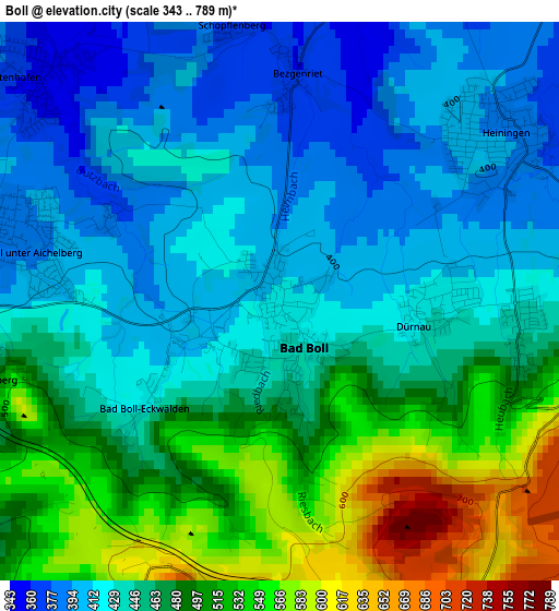
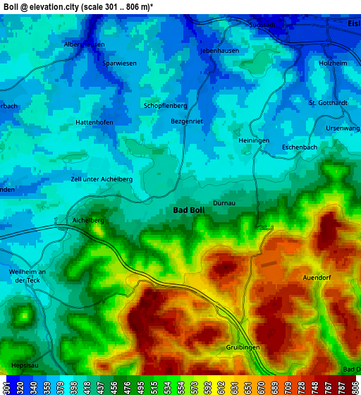
Below is the Elevation map of Boll, which displays elevation range with different colors. Scale of the first map is from 343 to 789 m (1125 to 2589 ft) with average elevation of 460.8 meters (=1512 ft) [note 1]
These maps also provides idea of topography and contour of this city, they are displayed at different zoom levels. More info about maps, scale and edge coordinates you can find below images.
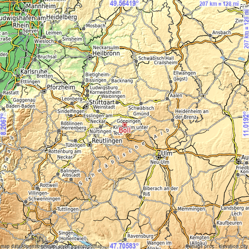
| \ | Map #1 | Map #2 | Topo.Map |
| Scale [m] | 343..789 m | 301..806 m | × |
| Scale [ft] | 1125..2589 ft | 988..2644 ft | × |
| Average | 460.8 m = 1512 ft | 471 m = 1545 ft | × |
| Width | 6.46 km = 4 mi | 12.91 km = 8 mi | 206.6 km = 128.4 mi |
| Height | 6.46 km = 4 mi | 12.91 km = 8 mi | 206.6 km = 128.4 mi |
| ↑Max Latitude | 48.672598° | 48.70161° | 49.56419° |
| Latitude at center | 48.64357° | 48.64357° | 48.64357° |
| ↓Min Latitude | 48.614525° | 48.585464° | 47.70583° |
| ← Min Longitude | 9.569005° | 9.525059° | 8.2067° |
| Longitude center | 9.61295° | 9.61295° | 9.61295° |
| →Max Longitude | 9.656895° | 9.700841° | 11.0192° |
Nearby cities:
Cities around Boll sort by population:
• Weilheim an der Teck elevation 383 m
6.4 km,  240°
240°
• Heiningen 387 m
3.4 km,  53°
53°
• Albershausen 318 m
6.4 km,  326°
326°
• Zell unter Aichelberg 383 m
3.1 km,  280°
280°
• Hattenhofen 355 m
3.8 km,  312°
312°
• Eschenbach 410 m
4.3 km,  76°
76°
• Gruibingen 566 m
5.9 km,  157°
157°
• Dürnau 429 m
1.7 km,  100°
100°
• Ohmden 360 m
6.3 km,  272°
272°
• Schlat 418 m
6.9 km, 81°
• Gammelshausen 441 m
2.8 km, 97°
• Aichelberg 434 m
3.7 km,  256°
256°
Multilingual:
 En español:
Boll elevación 416 m.
 En France:
Boll élévation 416 m.


Sources and notes:
- [note 1] Map square and city borders are not equal. Map elevation data is calculated only from area inside that square.
- [src 1] Elevation data from geonames database provided with same terms of usage.
- [src 2] The elevation map of Boll is generated using elevation data from NASA's 3 arcsec (90m) resolution SRTM data.
- [src 3] Base (background) map © OpenStreetMap contributors tiles are generated by Geofabrik and OpenTopoMap.
Copyright & License:
This Boll Elevation Map is licensed under CC BY-SA. You may reuse any part from this page, if you give a proper credit by linking to this URL:
 More info on terms of use page.