Hochdorf elevation
Hochdorf (Baden-Württemberg, Regierungsbezirk Stuttgart), Germany elevation is 281 meters and Hochdorf elevation in feet is 922 ft above sea level [src 1]. Hochdorf is a seat of a fourth-order administrative division (feature code) with elevation that is 23 meters (75 ft) bigger than average city elevation in Germany.
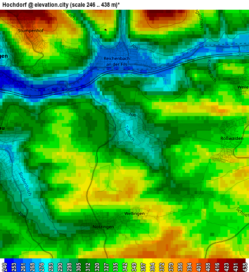
Below is the Elevation map of Hochdorf, which displays elevation range with different colors. Scale of the first map is from 246 to 438 m (807 to 1437 ft) with average elevation of 325.7 meters (=1069 ft) [note 1]
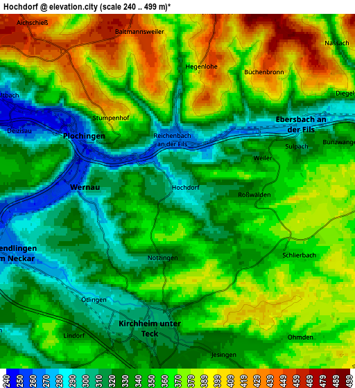
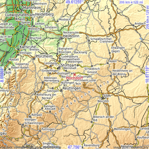
These maps also provides idea of topography and contour of this city, they are displayed at different zoom levels. More info about maps, scale and edge coordinates you can find below images.
| \ | Map #1 | Map #2 | Topo.Map |
| Scale [m] | 246..438 m | 240..499 m | × |
| Scale [ft] | 807..1437 ft | 787..1637 ft | × |
| Average | 325.7 m = 1069 ft | 350.1 m = 1149 ft | × |
| Width | 6.45 km = 4 mi | 12.9 km = 8 mi | 206.4 km = 128.3 mi |
| Height | 6.45 km = 4 mi | 12.9 km = 8 mi | 206.4 km = 128.3 mi |
| ↑Max Latitude | 48.72183° | 48.750813° | 49.61255° |
| Latitude at center | 48.69283° | 48.69283° | 48.69283° |
| ↓Min Latitude | 48.663814° | 48.63478° | 47.756° |
| ← Min Longitude | 9.420995° | 9.377049° | 8.05869° |
| Longitude center | 9.46494° | 9.46494° | 9.46494° |
| →Max Longitude | 9.508885° | 9.552831° | 10.87119° |
Nearby cities:
Cities around Hochdorf sort by population:
• Kirchheim unter Teck elevation 316 m
5.2 km,  189°
189°
• Ebersbach an der Fils 280 m
5 km,  59°
59°
• Wendlingen am Neckar 268 m
6.9 km,  249°
249°
• Plochingen 268 m
3.9 km,  300°
300°
• Wernau 260 m
3.6 km,  270°
270°
• Reichenbach an der Fils 261 m
1.9 km,  358°
358°
• Deizisau 251 m
6.2 km,  290°
290°
• Altbach 248 m
7 km, 298°
• Baltmannsweiler 456 m
5.6 km,  348°
348°
• Schlierbach 351 m
4.4 km,  118°
118°
• Notzingen 314 m
2.5 km, 193°
• Ohmden 360 m
6.9 km,  138°
138°
Multilingual:
 En español:
Hochdorf elevación 281 m.
 En France:
Hochdorf élévation 281 m.
 Auf Deutsch:
Hochdorf höhe über dem Meeresspiegel ist 281 m.

Sources and notes:
- [note 1] Map square and city borders are not equal. Map elevation data is calculated only from area inside that square.
- [src 1] Elevation data from geonames database provided with same terms of usage.
- [src 2] The elevation map of Hochdorf is generated using elevation data from NASA's 3 arcsec (90m) resolution SRTM data.
- [src 3] Base (background) map © OpenStreetMap contributors tiles are generated by Geofabrik and OpenTopoMap.
Copyright & License:
This Hochdorf Elevation Map is licensed under CC BY-SA. You may reuse any part from this page, if you give a proper credit by linking to this URL:
 More info on terms of use page.