Schwarzenfeld elevation
Schwarzenfeld (Bavaria, Upper Palatinate), Germany elevation is 364 meters and Schwarzenfeld elevation in feet is 1194 ft above sea level [src 1]. Schwarzenfeld is a populated place (feature code) with elevation that is 106 meters (348 ft) bigger than average city elevation in Germany.
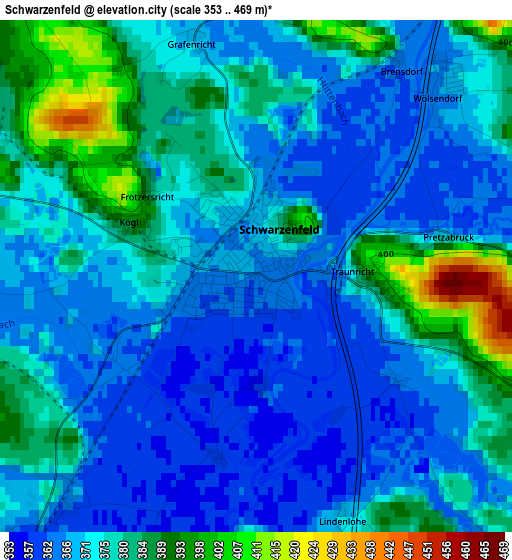
Below is the Elevation map of Schwarzenfeld, which displays elevation range with different colors. Scale of the first map is from 353 to 469 m (1158 to 1539 ft) with average elevation of 373.8 meters (=1226 ft) [note 1]
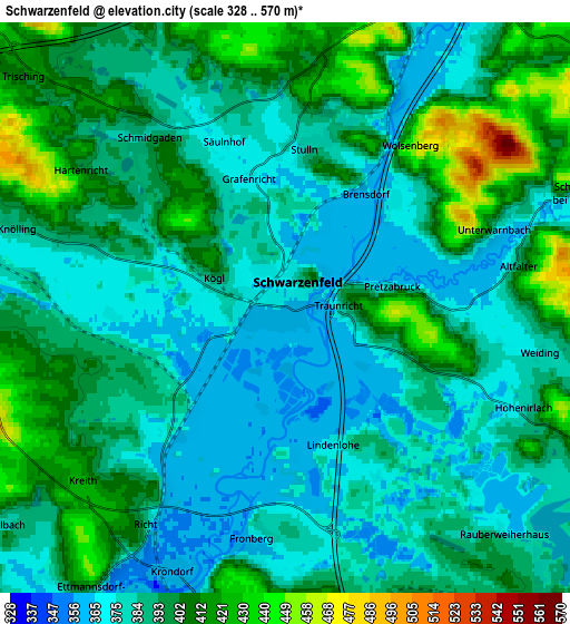
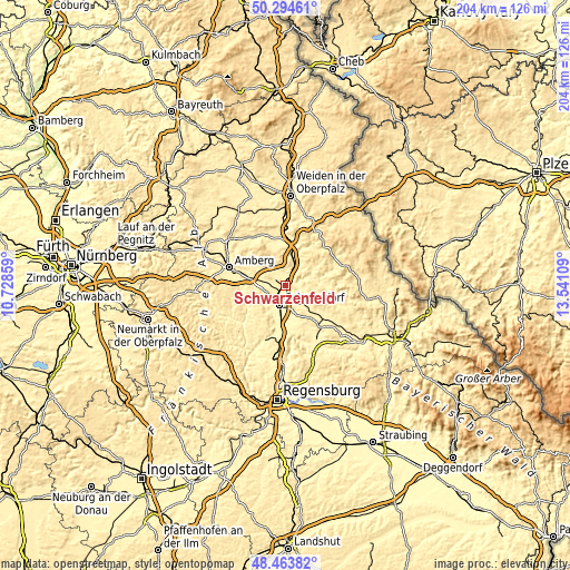
These maps also provides idea of topography and contour of this city, they are displayed at different zoom levels. More info about maps, scale and edge coordinates you can find below images.
| \ | Map #1 | Map #2 | Topo.Map |
| Scale [m] | 353..469 m | 328..570 m | × |
| Scale [ft] | 1158..1539 ft | 1076..1870 ft | × |
| Average | 373.8 m = 1226 ft | 391.8 m = 1285 ft | × |
| Width | 6.36 km = 4 mi | 12.72 km = 7.9 mi | 203.6 km = 126.5 mi |
| Height | 6.36 km = 4 mi | 12.72 km = 7.9 mi | 203.5 km = 126.4 mi |
| ↑Max Latitude | 49.416337° | 49.444918° | 50.29461° |
| Latitude at center | 49.38774° | 49.38774° | 49.38774° |
| ↓Min Latitude | 49.359126° | 49.330495° | 48.46382° |
| ← Min Longitude | 12.090895° | 12.046949° | 10.72859° |
| Longitude center | 12.13484° | 12.13484° | 12.13484° |
| →Max Longitude | 12.178785° | 12.222731° | 13.54109° |
Nearby cities:
Cities around Schwarzenfeld sort by population:
• Schwandorf in Bayern elevation 363 m
7.2 km,  194°
194°
• Nabburg 391 m
8 km,  24°
24°
• Pfreimd 372 m
12 km, 16°
• Wackersdorf 452 m
8.6 km,  156°
156°
• Freudenberg 479 m
15.3 km,  314°
314°
• Breitenbrunn 410 m
8.7 km,  252°
252°
• Rieden 365 m
15.7 km,  242°
242°
• Schmidgaden 382 m
5 km,  322°
322°
• Ebermannsdorf 409 m
14.4 km,  272°
272°
• Ensdorf 373 m
15.3 km, 250°
• Stulln 369 m
3.2 km,  358°
358°
• Schwarzhofen 389 m
15.2 km,  94°
94°
Multilingual:
 En español:
Schwarzenfeld elevación 364 m.
 En France:
Schwarzenfeld élévation 364 m.
 Auf Deutsch:
Schwarzenfeld höhe über dem Meeresspiegel ist 364 m.

Sources and notes:
- [note 1] Map square and city borders are not equal. Map elevation data is calculated only from area inside that square.
- [src 1] Elevation data from geonames database provided with same terms of usage.
- [src 2] The elevation map of Schwarzenfeld is generated using elevation data from NASA's 3 arcsec (90m) resolution SRTM data.
- [src 3] Base (background) map © OpenStreetMap contributors tiles are generated by Geofabrik and OpenTopoMap.
Copyright & License:
This Schwarzenfeld Elevation Map is licensed under CC BY-SA. You may reuse any part from this page, if you give a proper credit by linking to this URL:
 More info on terms of use page.