Pfreimd elevation
Pfreimd (Bavaria, Upper Palatinate), Germany elevation is 372 meters and Pfreimd elevation in feet is 1220 ft above sea level [src 1]. Pfreimd is a populated place (feature code) with elevation that is 114 meters (374 ft) bigger than average city elevation in Germany.
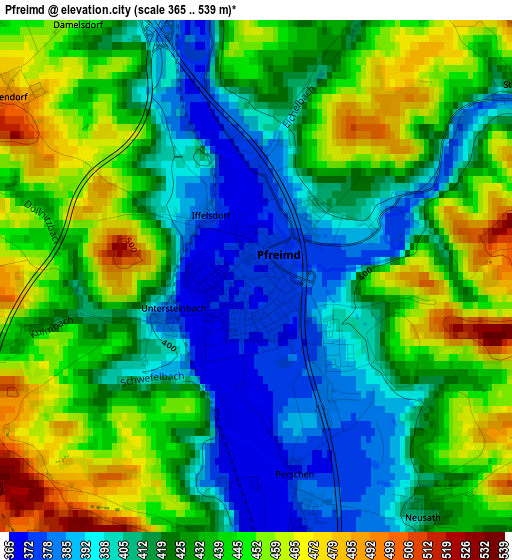
Below is the Elevation map of Pfreimd, which displays elevation range with different colors. Scale of the first map is from 365 to 539 m (1198 to 1768 ft) with average elevation of 428 meters (=1404 ft) [note 1]
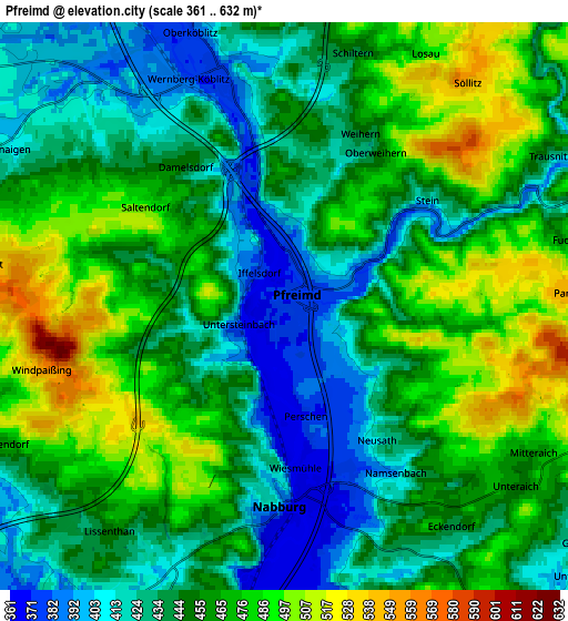
These maps also provides idea of topography and contour of this city, they are displayed at different zoom levels. More info about maps, scale and edge coordinates you can find below images.
| \ | Map #1 | Map #2 | Topo.Map |
| Scale [m] | 365..539 m | 361..632 m | × |
| Scale [ft] | 1198..1768 ft | 1184..2073 ft | × |
| Average | 428 m = 1404 ft | 452.5 m = 1485 ft | × |
| Width | 6.35 km = 3.9 mi | 12.7 km = 7.9 mi | 203.1 km = 126.2 mi |
| Height | 6.35 km = 3.9 mi | 12.7 km = 7.9 mi | 203.1 km = 126.2 mi |
| ↑Max Latitude | 49.519677° | 49.548197° | 50.39608° |
| Latitude at center | 49.49114° | 49.49114° | 49.49114° |
| ↓Min Latitude | 49.462586° | 49.434016° | 48.56915° |
| ← Min Longitude | 12.136745° | 12.092799° | 10.77444° |
| Longitude center | 12.18069° | 12.18069° | 12.18069° |
| →Max Longitude | 12.224635° | 12.268581° | 13.58694° |
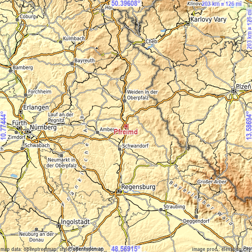
Nearby cities:
Cities around Pfreimd sort by population:
• Schwarzenfeld elevation 364 m
12 km,  196°
196°
• Nabburg 391 m
4.2 km,  180°
180°
• Wernberg-Köblitz 380 m
5.5 km,  345°
345°
• Schnaittenbach 408 m
14.3 km,  295°
295°
• Freudenberg 479 m
14.3 km,  266°
266°
• Luhe-Wildenau 394 m
10.5 km, 347°
• Schmidgaden 382 m
9.9 km,  220°
220°
• Teunz 470 m
14.7 km,  93°
93°
• Stulln 369 m
9 km, 202°
• Tännesberg 602 m
11.5 km,  66°
66°
• Leuchtenberg 563 m
13.1 km,  25°
25°
• Trausnitz 428 m
6.8 km,  60°
60°
Multilingual:
 En español:
Pfreimd elevación 372 m.
 En France:
Pfreimd élévation 372 m.


Sources and notes:
- [note 1] Map square and city borders are not equal. Map elevation data is calculated only from area inside that square.
- [src 1] Elevation data from geonames database provided with same terms of usage.
- [src 2] The elevation map of Pfreimd is generated using elevation data from NASA's 3 arcsec (90m) resolution SRTM data.
- [src 3] Base (background) map © OpenStreetMap contributors tiles are generated by Geofabrik and OpenTopoMap.
Copyright & License:
This Pfreimd Elevation Map is licensed under CC BY-SA. You may reuse any part from this page, if you give a proper credit by linking to this URL:
 More info on terms of use page.