Trausnitz elevation
Trausnitz (Bavaria, Upper Palatinate), Germany elevation is 428 meters and Trausnitz elevation in feet is 1404 ft above sea level [src 1]. Trausnitz is a seat of a fourth-order administrative division (feature code) with elevation that is 170 meters (558 ft) bigger than average city elevation in Germany.
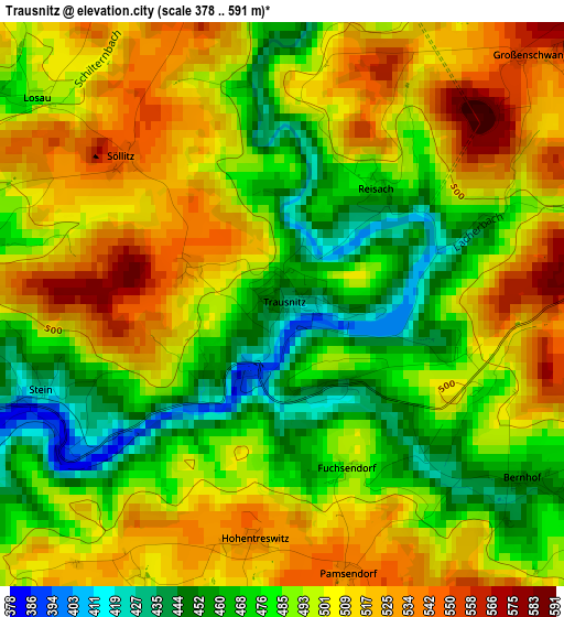
Below is the Elevation map of Trausnitz, which displays elevation range with different colors. Scale of the first map is from 378 to 591 m (1240 to 1939 ft) with average elevation of 495 meters (=1624 ft) [note 1]
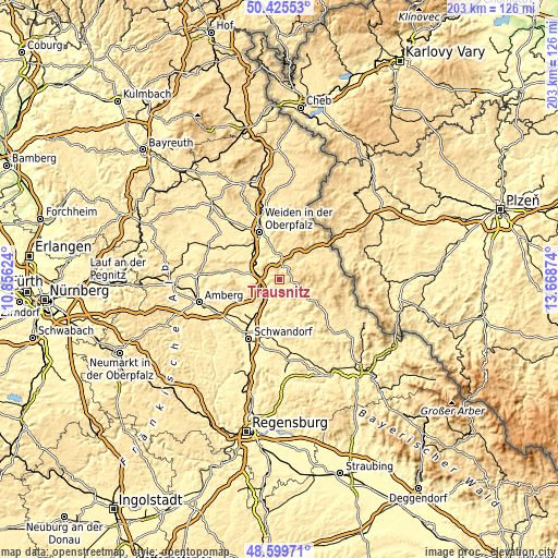
These maps also provides idea of topography and contour of this city, they are displayed at different zoom levels. More info about maps, scale and edge coordinates you can find below images.
| \ | Map #1 | Topo.Map |
| Scale [m] | 378..591 m | × |
| Scale [ft] | 1240..1939 ft | × |
| Average | 495 m = 1624 ft | × |
| Width | 6.34 km = 3.9 mi | 203 km = 126.1 mi |
| Height | 6.34 km = 3.9 mi | 203 km = 126.1 mi |
| ↑Max Latitude | 49.54966° | 50.42553° |
| Latitude at center | 49.52114° | 49.52114° |
| ↓Min Latitude | 49.492604° | 48.59971° |
| ← Min Longitude | 12.218545° | 10.85624° |
| Longitude center | 12.26249° | 12.26249° |
| →Max Longitude | 12.306435° | 13.66874° |
Nearby cities:
Cities around Trausnitz sort by population:
• Vohenstrauß elevation 553 m
12.7 km,  25°
25°
• Nabburg 391 m
9.6 km,  218°
218°
• Wernberg-Köblitz 380 m
7.6 km,  285°
285°
• Pfreimd 372 m
6.8 km,  240°
240°
• Oberviechtach 506 m
13.2 km,  122°
122°
• Luhe-Wildenau 394 m
10.7 km,  310°
310°
• Moosbach 499 m
13.1 km,  54°
54°
• Teunz 470 m
9.7 km, 115°
• Tännesberg 602 m
4.9 km,  75°
75°
• Niedermurach 420 m
11.4 km,  133°
133°
• Leuchtenberg 563 m
8.5 km,  358°
358°
• Irchenrieth 431 m
11.6 km,  346°
346°
Multilingual:
 En español:
Trausnitz elevación 428 m.
 En France:
Trausnitz élévation 428 m.
 Auf Deutsch:
Trausnitz höhe über dem Meeresspiegel ist 428 m.

Sources and notes:
- [note 1] Map square and city borders are not equal. Map elevation data is calculated only from area inside that square.
- [src 1] Elevation data from geonames database provided with same terms of usage.
- [src 2] The elevation map of Trausnitz is generated using elevation data from NASA's 3 arcsec (90m) resolution SRTM data.
- [src 3] Base (background) map © OpenStreetMap contributors tiles are generated by Geofabrik and OpenTopoMap.
Copyright & License:
This Trausnitz Elevation Map is licensed under CC BY-SA. You may reuse any part from this page, if you give a proper credit by linking to this URL:
 More info on terms of use page.