Welzow elevation
Welzow (Brandenburg), Germany elevation is 125 meters and Welzow elevation in feet is 410 ft above sea level [src 1]. Welzow is a populated place (feature code) with elevation that is 133 meters (436 ft) smaller than average city elevation in Germany.
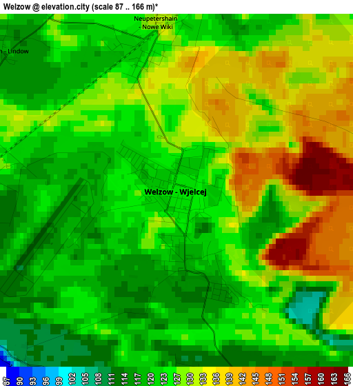
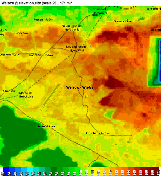
Below is the Elevation map of Welzow, which displays elevation range with different colors. Scale of the first map is from 87 to 166 m (285 to 545 ft) with average elevation of 126 meters (=413 ft) [note 1]
These maps also provides idea of topography and contour of this city, they are displayed at different zoom levels. More info about maps, scale and edge coordinates you can find below images.
| \ | Map #1 | Map #2 | Topo.Map |
| Scale [m] | 87..166 m | 29..171 m | × |
| Scale [ft] | 285..545 ft | 95..561 ft | × |
| Average | 126 m = 413 ft | 118.3 m = 388 ft | × |
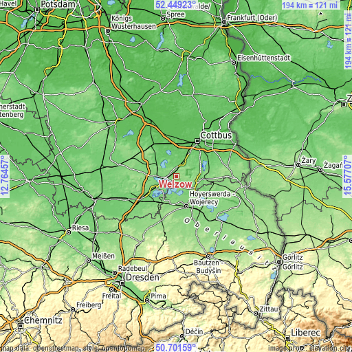
| Width | 6.07 km = 3.8 mi | 12.14 km = 7.5 mi | 194.3 km = 120.7 mi |
| Height | 6.07 km = 3.8 mi | 12.14 km = 7.5 mi | 194.3 km = 120.7 mi |
| ↑Max Latitude | 51.611108° | 51.63839° | 52.44923° |
| Latitude at center | 51.58381° | 51.58381° | 51.58381° |
| ↓Min Latitude | 51.556496° | 51.529165° | 50.70159° |
| ← Min Longitude | 14.126875° | 14.082929° | 12.76457° |
| Longitude center | 14.17082° | 14.17082° | 14.17082° |
| →Max Longitude | 14.214765° | 14.258711° | 15.57707° |
Nearby cities:
Cities around Welzow sort by population:
• Cottbus elevation 80 m
22.2 km,  29°
29°
• Hoyerswerda 118 m
16.8 km,  164°
164°
• Senftenberg 104 m
13.4 km,  240°
240°
• Großräschen 117 m
11.1 km,  272°
272°
• Kolkwitz 69 m
19.3 km,  16°
16°
• Calau 93 m
23.3 km,  319°
319°
• Schipkau 113 m
20.3 km,  248°
248°
• Drebkau 90 m
8.6 km, 24°
• Wittichenau 126 m
22.7 km,  167°
167°
• Altdöbern 88 m
12 km,  307°
307°
• Sallgast 139 m
22.3 km, 271°
• Hohenbocka 131 m
20.3 km,  213°
213°
Multilingual:
 En español:
Welzow elevación 125 m.
 En France:
Welzow élévation 125 m.


Sources and notes:
- [note 1] Map square and city borders are not equal. Map elevation data is calculated only from area inside that square.
- [src 1] Elevation data from geonames database provided with same terms of usage.
- [src 2] The elevation map of Welzow is generated using elevation data from NASA's 3 arcsec (90m) resolution SRTM data.
- [src 3] Base (background) map © OpenStreetMap contributors tiles are generated by Geofabrik and OpenTopoMap.
Copyright & License:
This Welzow Elevation Map is licensed under CC BY-SA. You may reuse any part from this page, if you give a proper credit by linking to this URL:
 More info on terms of use page.