Senftenberg elevation
Senftenberg (Brandenburg), Germany elevation is 104 meters and Senftenberg elevation in feet is 341 ft above sea level [src 1]. Senftenberg is a seat of a third-order administrative division (feature code) with elevation that is 154 meters (505 ft) smaller than average city elevation in Germany.
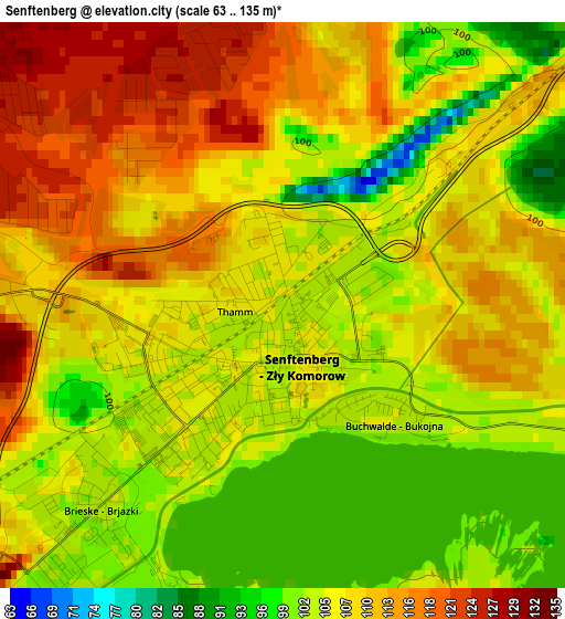
Below is the Elevation map of Senftenberg, which displays elevation range with different colors. Scale of the first map is from 63 to 135 m (207 to 443 ft) with average elevation of 107.3 meters (=352 ft) [note 1]
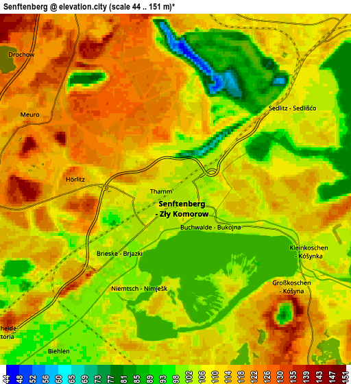
These maps also provides idea of topography and contour of this city, they are displayed at different zoom levels. More info about maps, scale and edge coordinates you can find below images.
| \ | Map #1 | Map #2 | Topo.Map |
| Scale [m] | 63..135 m | 44..151 m | × |
| Scale [ft] | 207..443 ft | 144..495 ft | × |
| Average | 107.3 m = 352 ft | 109.8 m = 360 ft | × |
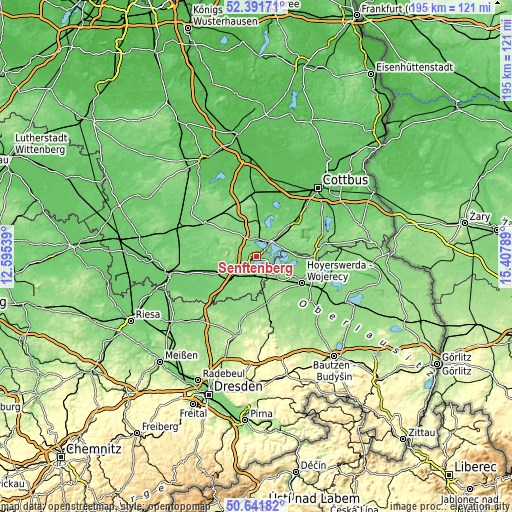
| Width | 6.08 km = 3.8 mi | 12.16 km = 7.6 mi | 194.6 km = 120.9 mi |
| Height | 6.08 km = 3.8 mi | 12.16 km = 7.6 mi | 194.6 km = 120.9 mi |
| ↑Max Latitude | 51.552503° | 51.57982° | 52.39171° |
| Latitude at center | 51.52517° | 51.52517° | 51.52517° |
| ↓Min Latitude | 51.49782° | 51.470454° | 50.64182° |
| ← Min Longitude | 13.957695° | 13.913749° | 12.59539° |
| Longitude center | 14.00164° | 14.00164° | 14.00164° |
| →Max Longitude | 14.045585° | 14.089531° | 15.40789° |
Nearby cities:
Cities around Senftenberg sort by population:
• Hoyerswerda elevation 118 m
18.9 km,  120°
120°
• Lauchhammer 99 m
16.8 km,  255°
255°
• Großräschen 117 m
7 km,  5°
5°
• Schipkau 113 m
7.3 km, 263°
• Schwarzheide 100 m
11.5 km,  241°
241°
• Bernsdorf 148 m
17.5 km,  164°
164°
• Welzow 125 m
13.4 km,  60°
60°
• Ruhland 101 m
12 km,  231°
231°
• Altdöbern 88 m
14.1 km, 8°
• Sallgast 139 m
12.7 km,  303°
303°
• Hohenbocka 131 m
10.5 km,  176°
176°
• Wiednitz 137 m
15.6 km,  173°
173°
Multilingual:
 En español:
Senftenberg elevación 104 m.
 En France:
Senftenberg élévation 104 m.
 Auf Deutsch:
Senftenberg höhe über dem Meeresspiegel ist 104 m.

Sources and notes:
- [note 1] Map square and city borders are not equal. Map elevation data is calculated only from area inside that square.
- [src 1] Elevation data from geonames database provided with same terms of usage.
- [src 2] The elevation map of Senftenberg is generated using elevation data from NASA's 3 arcsec (90m) resolution SRTM data.
- [src 3] Base (background) map © OpenStreetMap contributors tiles are generated by Geofabrik and OpenTopoMap.
Copyright & License:
This Senftenberg Elevation Map is licensed under CC BY-SA. You may reuse any part from this page, if you give a proper credit by linking to this URL:
 More info on terms of use page.