Kolkwitz elevation
Kolkwitz (Brandenburg), Germany elevation is 69 meters and Kolkwitz elevation in feet is 226 ft above sea level [src 1]. Kolkwitz is a seat of a fourth-order administrative division (feature code) with elevation that is 189 meters (620 ft) smaller than average city elevation in Germany.
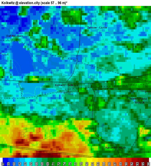
Below is the Elevation map of Kolkwitz, which displays elevation range with different colors. Scale of the first map is from 57 to 96 m (187 to 315 ft) with average elevation of 67.9 meters (=223 ft) [note 1]
These maps also provides idea of topography and contour of this city, they are displayed at different zoom levels. More info about maps, scale and edge coordinates you can find below images.
| \ | Map #1 | Map #2 | Topo.Map |
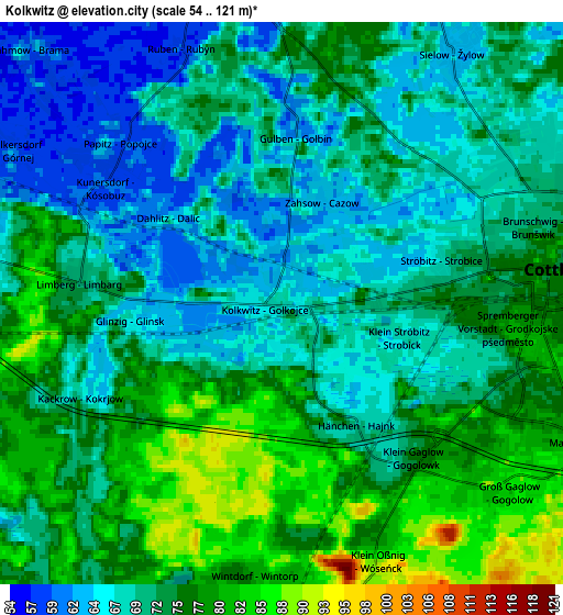
| Scale [m] | 57..96 m | 54..121 m | × |
| Scale [ft] | 187..315 ft | 177..397 ft | × |
| Average | 67.9 m = 223 ft | 72.3 m = 237 ft | × |
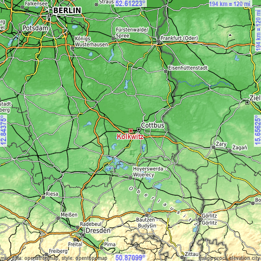
| Width | 6.05 km = 3.8 mi | 12.1 km = 7.5 mi | 193.6 km = 120.3 mi |
| Height | 6.05 km = 3.8 mi | 12.1 km = 7.5 mi | 193.6 km = 120.3 mi |
| ↑Max Latitude | 51.777198° | 51.80438° | 52.61223° |
| Latitude at center | 51.75° | 51.75° | 51.75° |
| ↓Min Latitude | 51.722786° | 51.695555° | 50.87099° |
| ← Min Longitude | 14.206055° | 14.162109° | 12.84375° |
| Longitude center | 14.25° | 14.25° | 14.25° |
| →Max Longitude | 14.293945° | 14.337891° | 15.65625° |
Nearby cities:
Cities around Kolkwitz sort by population:
• Cottbus elevation 80 m
5.5 km,  81°
81°
• Vetschau 64 m
12.4 km,  289°
289°
• Calau 93 m
20.4 km,  268°
268°
• Drebkau 90 m
10.8 km,  189°
189°
• Peitz 64 m
16.4 km,  42°
42°
• Burg 58 m
11.7 km,  323°
323°
• Welzow 125 m
19.3 km,  196°
196°
• Altdöbern 88 m
18.6 km,  233°
233°
• Jänschwalde 64 m
21 km,  54°
54°
• Werben 59 m
8.7 km,  328°
328°
• Neu Zauche 54 m
22.7 km, 330°
• Straupitz 59 m
20.2 km, 334°
Multilingual:
 En español:
Kolkwitz elevación 69 m.
 En France:
Kolkwitz élévation 69 m.


Sources and notes:
- [note 1] Map square and city borders are not equal. Map elevation data is calculated only from area inside that square.
- [src 1] Elevation data from geonames database provided with same terms of usage.
- [src 2] The elevation map of Kolkwitz is generated using elevation data from NASA's 3 arcsec (90m) resolution SRTM data.
- [src 3] Base (background) map © OpenStreetMap contributors tiles are generated by Geofabrik and OpenTopoMap.
Copyright & License:
This Kolkwitz Elevation Map is licensed under CC BY-SA. You may reuse any part from this page, if you give a proper credit by linking to this URL:
 More info on terms of use page.