Wesseling elevation
Wesseling (North Rhine-Westphalia, Regierungsbezirk Köln), Germany elevation is 50 meters and Wesseling elevation in feet is 164 ft above sea level [src 1]. Wesseling is a populated place (feature code) with elevation that is 208 meters (682 ft) smaller than average city elevation in Germany.
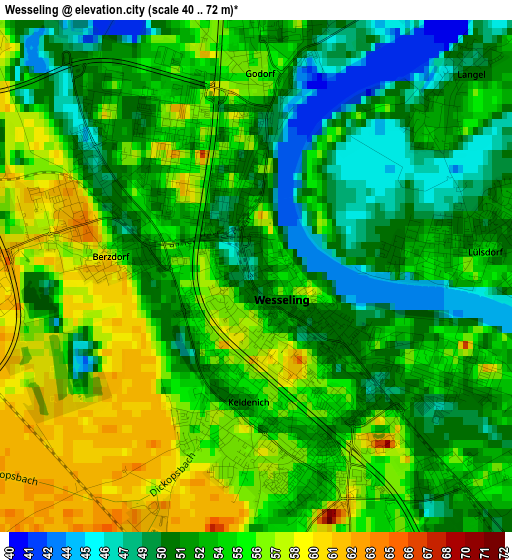
Below is the Elevation map of Wesseling, which displays elevation range with different colors. Scale of the first map is from 40 to 72 m (131 to 236 ft) with average elevation of 53.4 meters (=175 ft) [note 1]
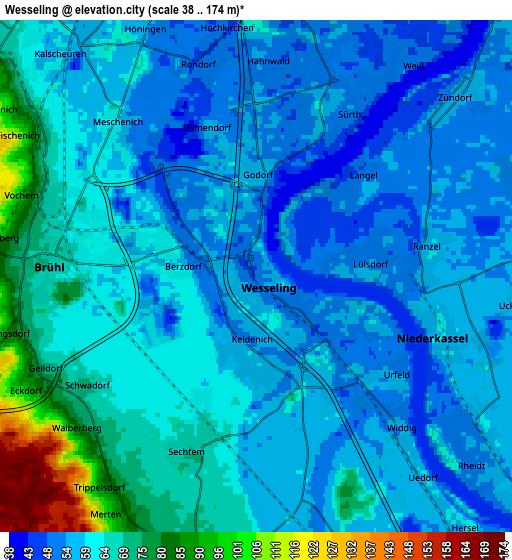
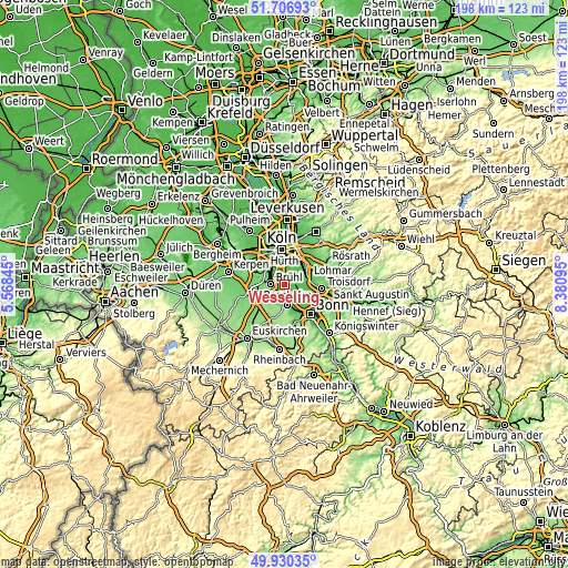
These maps also provides idea of topography and contour of this city, they are displayed at different zoom levels. More info about maps, scale and edge coordinates you can find below images.
| \ | Map #1 | Map #2 | Topo.Map |
| Scale [m] | 40..72 m | 38..174 m | × |
| Scale [ft] | 131..236 ft | 125..571 ft | × |
| Average | 53.4 m = 175 ft | 61.2 m = 201 ft | × |
| Width | 6.17 km = 3.8 mi | 12.35 km = 7.7 mi | 197.5 km = 122.7 mi |
| Height | 6.17 km = 3.8 mi | 12.35 km = 7.7 mi | 197.5 km = 122.7 mi |
| ↑Max Latitude | 50.85484° | 50.882574° | 51.70693° |
| Latitude at center | 50.82709° | 50.82709° | 50.82709° |
| ↓Min Latitude | 50.799323° | 50.77154° | 49.93035° |
| ← Min Longitude | 6.930755° | 6.886809° | 5.56845° |
| Longitude center | 6.9747° | 6.9747° | 6.9747° |
| →Max Longitude | 7.018645° | 7.062591° | 8.38095° |
Nearby cities:
Cities around Wesseling sort by population:
• Hürth elevation 91 m
9 km,  302°
302°
• Bornheim 62 m
7.2 km,  170°
170°
• Brühl 68 m
4.9 km,  272°
272°
• Neustadt/Süd 55 m
11.1 km,  350°
350°
• Niederkassel 59 m
4.6 km,  106°
106°
• Alfter 85 m
10.8 km,  164°
164°
• Porz am Rhein 54 m
8.8 km,  41°
41°
• Poll 52 m
9.6 km,  6°
6°
• Eil 52 m
10.4 km, 44°
• Bayenthal 51 m
9.5 km,  357°
357°
• Wahn-Heide 59 m
9.9 km,  69°
69°
• Gremberghoven 51 m
10.3 km, 36°
Multilingual:
 En español:
Wesseling elevación 50 m.
 En France:
Wesseling élévation 50 m.
 Auf Deutsch:
Wesseling höhe über dem Meeresspiegel ist 50 m.

Sources and notes:
- [note 1] Map square and city borders are not equal. Map elevation data is calculated only from area inside that square.
- [src 1] Elevation data from geonames database provided with same terms of usage.
- [src 2] The elevation map of Wesseling is generated using elevation data from NASA's 3 arcsec (90m) resolution SRTM data.
- [src 3] Base (background) map © OpenStreetMap contributors tiles are generated by Geofabrik and OpenTopoMap.
Copyright & License:
This Wesseling Elevation Map is licensed under CC BY-SA. You may reuse any part from this page, if you give a proper credit by linking to this URL:
 More info on terms of use page.