Bayenthal elevation
Bayenthal (North Rhine-Westphalia, Regierungsbezirk Köln), Germany elevation is 51 meters and Bayenthal elevation in feet is 167 ft above sea level [src 1]. Bayenthal is a section of populated place (feature code) with elevation that is 207 meters (679 ft) smaller than average city elevation in Germany.
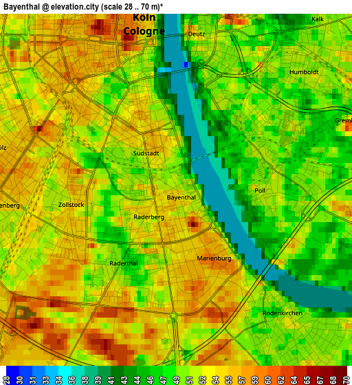
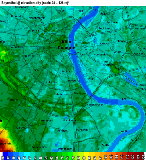
Below is the Elevation map of Bayenthal, which displays elevation range with different colors. Scale of the first map is from 28 to 70 m (92 to 230 ft) with average elevation of 51.2 meters (=168 ft) [note 1]
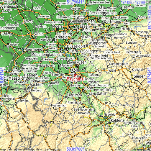
These maps also provides idea of topography and contour of this city, they are displayed at different zoom levels. More info about maps, scale and edge coordinates you can find below images.
| \ | Map #1 | Map #2 | Topo.Map |
| Scale [m] | 28..70 m | 28..128 m | × |
| Scale [ft] | 92..230 ft | 92..420 ft | × |
| Average | 51.2 m = 168 ft | 52.8 m = 173 ft | × |
| Width | 6.16 km = 3.8 mi | 12.32 km = 7.7 mi | 197.2 km = 122.5 mi |
| Height | 6.16 km = 3.8 mi | 12.32 km = 7.7 mi | 197.2 km = 122.5 mi |
| ↑Max Latitude | 50.93988° | 50.967563° | 51.79041° |
| Latitude at center | 50.91218° | 50.91218° | 50.91218° |
| ↓Min Latitude | 50.884464° | 50.856731° | 50.01706° |
| ← Min Longitude | 6.924045° | 6.880099° | 5.56174° |
| Longitude center | 6.96799° | 6.96799° | 6.96799° |
| →Max Longitude | 7.011935° | 7.055881° | 8.37424° |
Nearby cities:
Cities around Bayenthal sort by population:
• Köln elevation 58 m
2.7 km,  331°
331°
• Neustadt/Süd 55 m
2 km,  315°
315°
• Neustadt/Nord 51 m
4.3 km,  341°
341°
• Altstadt Sud 52 m
2.4 km,  345°
345°
• Neuehrenfeld 49 m
5.5 km, 336°
• Kalk 50 m
4.1 km,  40°
40°
• Altstadt Nord 59 m
3.1 km, 346°
• Deutz 49 m
2.5 km,  11°
11°
• Humboldtkolonie 49 m
2.9 km, 40°
• Buchheim 47 m
5.7 km, 40°
• Poll 52 m
1.6 km,  88°
88°
• Buchforst 50 m
5.1 km,  31°
31°
Multilingual:
 En español:
Bayenthal elevación 51 m.
 En France:
Bayenthal élévation 51 m.
 Auf Deutsch:
Bayenthal höhe über dem Meeresspiegel ist 51 m.

Sources and notes:
- [note 1] Map square and city borders are not equal. Map elevation data is calculated only from area inside that square.
- [src 1] Elevation data from geonames database provided with same terms of usage.
- [src 2] The elevation map of Bayenthal is generated using elevation data from NASA's 3 arcsec (90m) resolution SRTM data.
- [src 3] Base (background) map © OpenStreetMap contributors tiles are generated by Geofabrik and OpenTopoMap.
Copyright & License:
This Bayenthal Elevation Map is licensed under CC BY-SA. You may reuse any part from this page, if you give a proper credit by linking to this URL:
 More info on terms of use page.