Fortul elevation
Fortul (Arauca), Colombia elevation is 241 meters and Fortul elevation in feet is 791 ft above sea level [src 1]. Fortul is a seat of a second-order administrative division (feature code) with elevation that is 908 meters (2979 ft) smaller than average city elevation in Colombia.
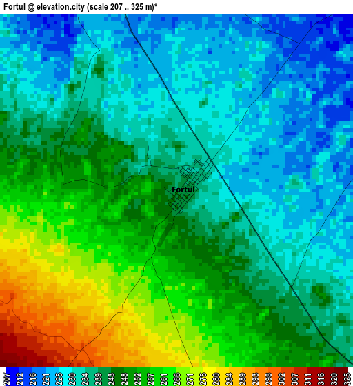
Below is the Elevation map of Fortul, which displays elevation range with different colors. Scale of the first map is from 207 to 325 m (679 to 1066 ft) with average elevation of 243.3 meters (=798 ft) [note 1]
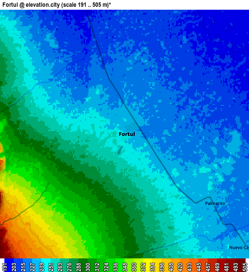
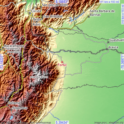
These maps also provides idea of topography and contour of this city, they are displayed at different zoom levels. More info about maps, scale and edge coordinates you can find below images.
| \ | Map #1 | Map #2 | Topo.Map |
| Scale [m] | 207..325 m | 191..505 m | × |
| Scale [ft] | 679..1066 ft | 627..1657 ft | × |
| Average | 243.3 m = 798 ft | 254.9 m = 836 ft | × |
| Width | 9.7 km = 6 mi | 19.41 km = 12.1 mi | 310.5 km = 192.9 mi |
| Height | 9.7 km = 6 mi | 19.41 km = 12.1 mi | 310.5 km = 192.9 mi |
| ↑Max Latitude | 6.836245° | 6.879876° | 8.18683° |
| Latitude at center | 6.79261° | 6.79261° | 6.79261° |
| ↓Min Latitude | 6.748971° | 6.705328° | 5.39434° |
| ← Min Longitude | -71.819905° | -71.863851° | -73.18221° |
| Longitude center | -71.77596° | -71.77596° | -71.77596° |
| →Max Longitude | -71.732015° | -71.688069° | -70.36971° |
Nearby cities:
Cities around Fortul sort by population:
• Tame elevation 320 m
37.2 km,  173°
173°
• Arauquita 156 m
46.5 km,  55°
55°
• El Cocuy 2646 m
85.5 km,  240°
240°
• Municipio Hato Corozal 256 m
70.7 km,  178°
178°
• Güicán 2820 m
79.4 km, 242°
• Cubará 351 m
43.4 km,  303°
303°
• Chiscas 2404 m
84.6 km,  251°
251°
• El Espino 2127 m
86.8 km, 246°
• Guacamayas 2151 m
88.5 km, 245°
• Sácama 1248 m
93.1 km,  214°
214°
• Panqueba 2196 m
85.1 km, 243°
• Saravena 225 m
22.3 km,  328°
328°
Multilingual:
 En español:
Fortul elevación 241 m.
 En France:
Fortul élévation 241 m.


Sources and notes:
- [note 1] Map square and city borders are not equal. Map elevation data is calculated only from area inside that square.
- [src 1] Elevation data from geonames database provided with same terms of usage.
- [src 2] The elevation map of Fortul is generated using elevation data from NASA's 3 arcsec (90m) resolution SRTM data.
- [src 3] Base (background) map © OpenStreetMap contributors tiles are generated by Geofabrik and OpenTopoMap.
Copyright & License:
This Fortul Elevation Map is licensed under CC BY-SA. You may reuse any part from this page, if you give a proper credit by linking to this URL:
 More info on terms of use page.