Ordos elevation
Ordos (Inner Mongolia), China elevation is 1310 meters and Ordos elevation in feet is 4298 ft above sea level [src 1]. Ordos is a populated place (feature code) with elevation that is 752 meters (2467 ft) bigger than average city elevation in China.
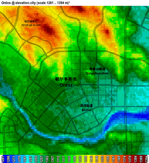
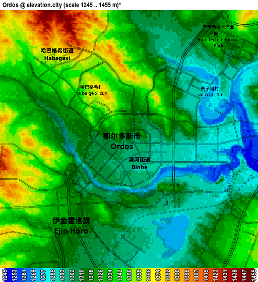
Below is the Elevation map of Ordos, which displays elevation range with different colors. Scale of the first map is from 1261 to 1394 m (4137 to 4573 ft) with average elevation of 1315 meters (=4314 ft) [note 1]
These maps also provides idea of topography and contour of this city, they are displayed at different zoom levels. More info about maps, scale and edge coordinates you can find below images.
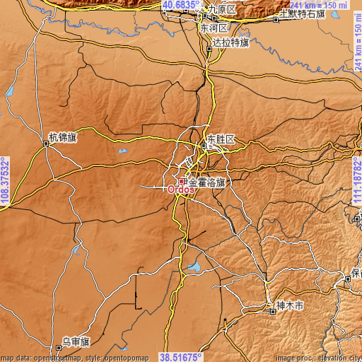
| \ | Map #1 | Map #2 | Topo.Map |
| Scale [m] | 1261..1394 m | 1245..1455 m | × |
| Scale [ft] | 4137..4573 ft | 4085..4774 ft | × |
| Average | 1315 m = 4314 ft | 1322.2 m = 4338 ft | × |
| Width | 7.53 km = 4.7 mi | 15.06 km = 9.4 mi | 240.9 km = 149.7 mi |
| Height | 7.53 km = 4.7 mi | 15.06 km = 9.4 mi | 240.9 km = 149.7 mi |
| ↑Max Latitude | 39.642448° | 39.676279° | 40.6835° |
| Latitude at center | 39.6086° | 39.6086° | 39.6086° |
| ↓Min Latitude | 39.574735° | 39.540854° | 38.51675° |
| ← Min Longitude | 109.737625° | 109.693679° | 108.37532° |
| Longitude center | 109.78157° | 109.78157° | 109.78157° |
| →Max Longitude | 109.825515° | 109.869461° | 111.18782° |
Nearby cities:
Cities around Ordos sort by population:
• Baotou elevation 1066 m
116.1 km,  1°
1°
• Dongsheng 1439 m
28.5 km,  36°
36°
• Shiguai 1337 m
129.3 km,  19°
19°
• Salaqi 1000 m
120.9 km,  30°
30°
• Galutu 1303 m
138 km,  215°
215°
• Dongguan 983 m
133.1 km,  119°
119°
• Xuejiawan 1138 m
126.4 km,  76°
76°
• Wenbi 957 m
123.4 km,  101°
101°
• Xinli 1362 m
93.3 km,  286°
286°
• Shulinzhao 1011 m
89.7 km,  13°
13°
• Tianjiao 1440 m
30.5 km, 37°
• Aletengxire 1304 m
3.8 km,  212°
212°
Multilingual:
 En español:
Ordos elevación 1310 m.
 En France:
Ordos élévation 1310 m.


Sources and notes:
- [note 1] Map square and city borders are not equal. Map elevation data is calculated only from area inside that square.
- [src 1] Elevation data from geonames database provided with same terms of usage.
- [src 2] The elevation map of Ordos is generated using elevation data from NASA's 3 arcsec (90m) resolution SRTM data.
- [src 3] Base (background) map © OpenStreetMap contributors tiles are generated by Geofabrik and OpenTopoMap.
Copyright & License:
This Ordos Elevation Map is licensed under CC BY-SA. You may reuse any part from this page, if you give a proper credit by linking to this URL:
 More info on terms of use page.