Changtu elevation
Changtu (Liaoning), China elevation is 135 meters and Changtu elevation in feet is 443 ft above sea level [src 1]. Changtu is a seat of a third-order administrative division (feature code) with elevation that is 423 meters (1388 ft) smaller than average city elevation in China.
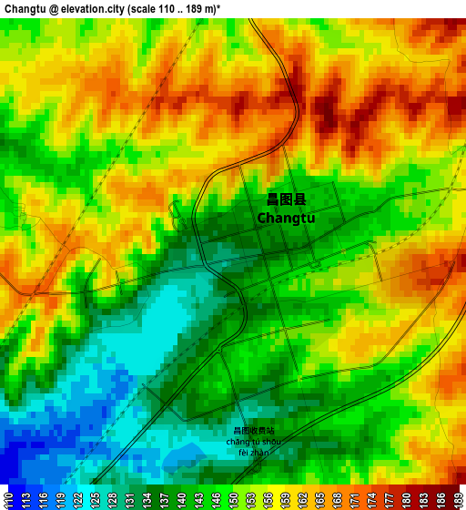
Below is the Elevation map of Changtu, which displays elevation range with different colors. Scale of the first map is from 110 to 189 m (361 to 620 ft) with average elevation of 150.2 meters (=493 ft) [note 1]
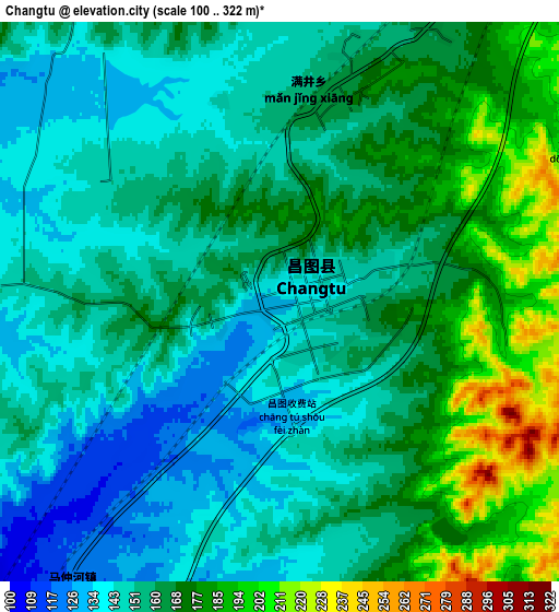
These maps also provides idea of topography and contour of this city, they are displayed at different zoom levels. More info about maps, scale and edge coordinates you can find below images.
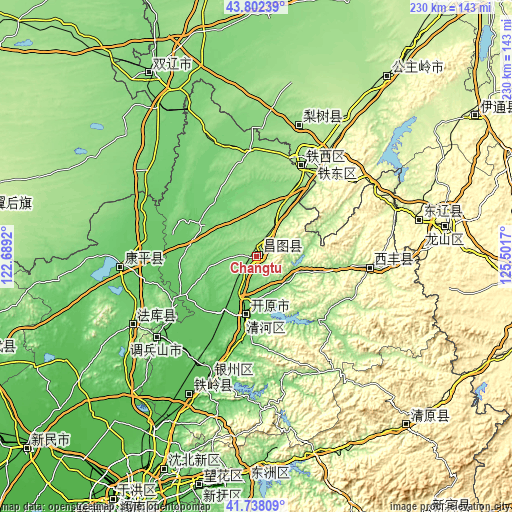
| \ | Map #1 | Map #2 | Topo.Map |
| Scale [m] | 110..189 m | 100..322 m | × |
| Scale [ft] | 361..620 ft | 328..1056 ft | × |
| Average | 150.2 m = 493 ft | 160.1 m = 525 ft | × |
| Width | 7.17 km = 4.5 mi | 14.35 km = 8.9 mi | 229.5 km = 142.6 mi |
| Height | 7.17 km = 4.5 mi | 14.35 km = 8.9 mi | 229.5 km = 142.6 mi |
| ↑Max Latitude | 42.811087° | 42.843316° | 43.80239° |
| Latitude at center | 42.77884° | 42.77884° | 42.77884° |
| ↓Min Latitude | 42.746577° | 42.714296° | 41.73809° |
| ← Min Longitude | 124.051505° | 124.007559° | 122.6892° |
| Longitude center | 124.09545° | 124.09545° | 124.09545° |
| →Max Longitude | 124.139395° | 124.183341° | 125.5017° |
Nearby cities:
Cities around Changtu sort by population:
• Fushun elevation 83 m
100 km,  187°
187°
• Siping 176 m
48.3 km,  28°
28°
• Liaoyuan 263 m
85.9 km,  80°
80°
• Tieling 64 m
57.9 km,  201°
201°
• Gongzhuling 211 m
99.5 km,  36°
36°
• Kaiyuan 91 m
27.7 km, 189°
• Zhengjiatun 117 m
94 km,  329°
329°
• Hushitai 66 m
105 km,  207°
207°
• Lishu 168 m
61.4 km,  17°
17°
• Xifeng 197 m
51.4 km,  95°
95°
• Baiquan 336 m
71.3 km, 80°
• Kangping 101 m
61.1 km,  265°
265°
Multilingual:
 En español:
Changtu elevación 135 m.
 En France:
Changtu élévation 135 m.


Sources and notes:
- [note 1] Map square and city borders are not equal. Map elevation data is calculated only from area inside that square.
- [src 1] Elevation data from geonames database provided with same terms of usage.
- [src 2] The elevation map of Changtu is generated using elevation data from NASA's 3 arcsec (90m) resolution SRTM data.
- [src 3] Base (background) map © OpenStreetMap contributors tiles are generated by Geofabrik and OpenTopoMap.
Copyright & License:
This Changtu Elevation Map is licensed under CC BY-SA. You may reuse any part from this page, if you give a proper credit by linking to this URL:
 More info on terms of use page.