Zhengjiatun elevation
Zhengjiatun (Jilin), China elevation is 117 meters and Zhengjiatun elevation in feet is 384 ft above sea level [src 1]. Zhengjiatun is a populated place (feature code) with elevation that is 441 meters (1447 ft) smaller than average city elevation in China.
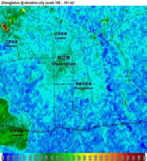
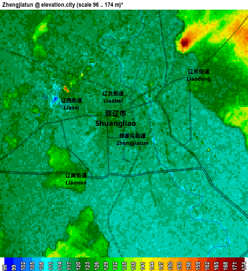
Below is the Elevation map of Zhengjiatun, which displays elevation range with different colors. Scale of the first map is from 108 to 161 m (354 to 528 ft) with average elevation of 116.9 meters (=384 ft) [note 1]
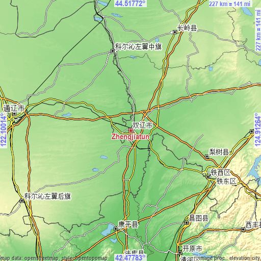
These maps also provides idea of topography and contour of this city, they are displayed at different zoom levels. More info about maps, scale and edge coordinates you can find below images.
| \ | Map #1 | Map #2 | Topo.Map |
| Scale [m] | 108..161 m | 96..174 m | × |
| Scale [ft] | 354..528 ft | 315..571 ft | × |
| Average | 116.9 m = 384 ft | 118.5 m = 389 ft | × |
| Width | 7.09 km = 4.4 mi | 14.18 km = 8.8 mi | 226.8 km = 140.9 mi |
| Height | 7.09 km = 4.4 mi | 14.18 km = 8.8 mi | 226.8 km = 140.9 mi |
| ↑Max Latitude | 43.538255° | 43.570103° | 44.51772° |
| Latitude at center | 43.50639° | 43.50639° | 43.50639° |
| ↓Min Latitude | 43.474508° | 43.442609° | 42.47783° |
| ← Min Longitude | 123.462445° | 123.418499° | 122.10014° |
| Longitude center | 123.50639° | 123.50639° | 123.50639° |
| →Max Longitude | 123.550335° | 123.594281° | 124.91264° |
Nearby cities:
Cities around Zhengjiatun sort by population:
• Siping elevation 176 m
80.2 km,  118°
118°
• Tieling 64 m
137.6 km,  168°
168°
• Tongliao 182 m
100.7 km,  276°
276°
• Gongzhuling 211 m
105.9 km,  90°
90°
• Kaiyuan 91 m
116.6 km,  158°
158°
• Changtu 135 m
94 km,  149°
149°
• Lishu 168 m
70 km,  108°
108°
• Xifeng 197 m
130.6 km,  130°
130°
• Changling 190 m
93.2 km,  25°
25°
• Baiquan 336 m
136.4 km, 120°
• Kangping 101 m
86.3 km,  188°
188°
• Baokang 146 m
70.1 km,  346°
346°
Multilingual:
 En español:
Zhengjiatun elevación 117 m.
 En France:
Zhengjiatun élévation 117 m.
 Auf Deutsch:
Zhengjiatun höhe über dem Meeresspiegel ist 117 m.

Sources and notes:
- [note 1] Map square and city borders are not equal. Map elevation data is calculated only from area inside that square.
- [src 1] Elevation data from geonames database provided with same terms of usage.
- [src 2] The elevation map of Zhengjiatun is generated using elevation data from NASA's 3 arcsec (90m) resolution SRTM data.
- [src 3] Base (background) map © OpenStreetMap contributors tiles are generated by Geofabrik and OpenTopoMap.
Copyright & License:
This Zhengjiatun Elevation Map is licensed under CC BY-SA. You may reuse any part from this page, if you give a proper credit by linking to this URL:
 More info on terms of use page.