Tongliao elevation
Tongliao (Inner Mongolia), China elevation is 182 meters and Tongliao elevation in feet is 597 ft above sea level [src 1]. Tongliao is a seat of a second-order administrative division (feature code) with elevation that is 376 meters (1234 ft) smaller than average city elevation in China.
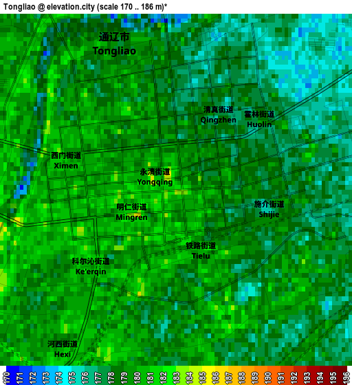
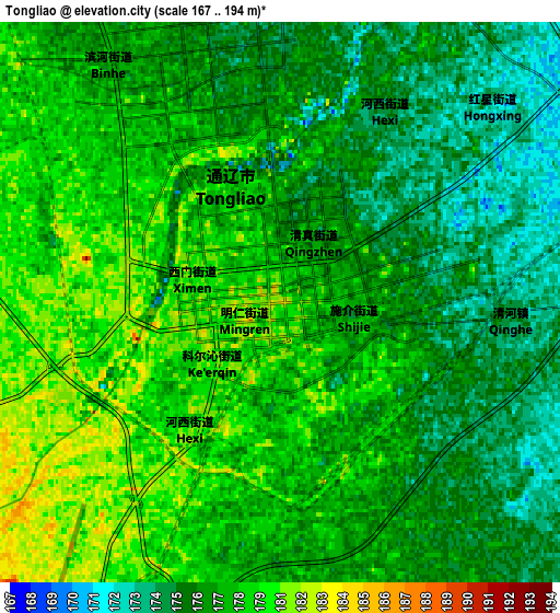
Below is the Elevation map of Tongliao, which displays elevation range with different colors. Scale of the first map is from 170 to 186 m (558 to 610 ft) with average elevation of 178.4 meters (=585 ft) [note 1]
These maps also provides idea of topography and contour of this city, they are displayed at different zoom levels. More info about maps, scale and edge coordinates you can find below images.
| \ | Map #1 | Map #2 | Topo.Map |
| Scale [m] | 170..186 m | 167..194 m | × |
| Scale [ft] | 558..610 ft | 548..636 ft | × |
| Average | 178.4 m = 585 ft | 177.6 m = 583 ft | × |
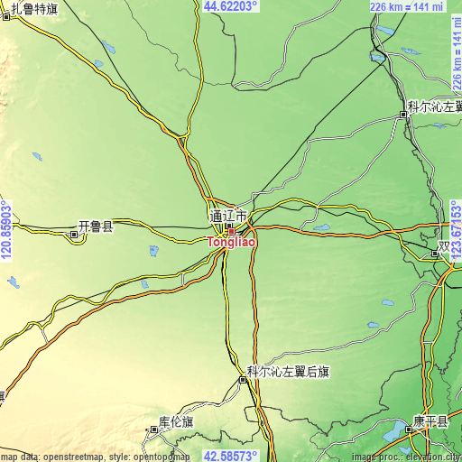
| Width | 7.08 km = 4.4 mi | 14.15 km = 8.8 mi | 226.4 km = 140.7 mi |
| Height | 7.08 km = 4.4 mi | 14.15 km = 8.8 mi | 226.4 km = 140.7 mi |
| ↑Max Latitude | 43.644309° | 43.676101° | 44.62203° |
| Latitude at center | 43.6125° | 43.6125° | 43.6125° |
| ↓Min Latitude | 43.580674° | 43.548832° | 42.58573° |
| ← Min Longitude | 122.221335° | 122.177389° | 120.85903° |
| Longitude center | 122.26528° | 122.26528° | 122.26528° |
| →Max Longitude | 122.309225° | 122.353171° | 123.67153° |
Nearby cities:
Cities around Tongliao sort by population:
• Zhengjiatun elevation 117 m
100.7 km,  96°
96°
• Changtu 135 m
174.9 km,  121°
121°
• Kaitong 145 m
151 km,  27°
27°
• Lishu 168 m
169.9 km, 101°
• Changling 190 m
156.7 km,  62°
62°
• Tianshan 365 m
177.1 km,  279°
279°
• Lubei 331 m
152.3 km,  316°
316°
• Daqin Tal 365 m
152 km,  237°
237°
• Kangping 101 m
131 km,  137°
137°
• Kulun 266 m
105.8 km,  202°
202°
• Baokang 146 m
100.6 km, 55°
• Kailu 251 m
85.8 km,  267°
267°
Multilingual:
 En español:
Tongliao elevación 182 m.
 En France:
Tongliao élévation 182 m.
 Auf Deutsch:
Tongliao höhe über dem Meeresspiegel ist 182 m.

Sources and notes:
- [note 1] Map square and city borders are not equal. Map elevation data is calculated only from area inside that square.
- [src 1] Elevation data from geonames database provided with same terms of usage.
- [src 2] The elevation map of Tongliao is generated using elevation data from NASA's 3 arcsec (90m) resolution SRTM data.
- [src 3] Base (background) map © OpenStreetMap contributors tiles are generated by Geofabrik and OpenTopoMap.
Copyright & License:
This Tongliao Elevation Map is licensed under CC BY-SA. You may reuse any part from this page, if you give a proper credit by linking to this URL:
 More info on terms of use page.