Xianning elevation
Xianning (Hubei, Xianning Prefecture), China elevation is 30 meters and Xianning elevation in feet is 98 ft above sea level [src 1]. Xianning is a seat of a second-order administrative division (feature code) with elevation that is 528 meters (1732 ft) smaller than average city elevation in China.
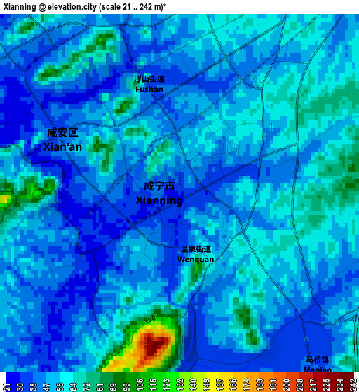
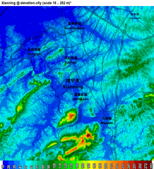
Below is the Elevation map of Xianning, which displays elevation range with different colors. Scale of the first map is from 21 to 242 m (69 to 794 ft) with average elevation of 50.9 meters (=167 ft) [note 1]
These maps also provides idea of topography and contour of this city, they are displayed at different zoom levels. More info about maps, scale and edge coordinates you can find below images.
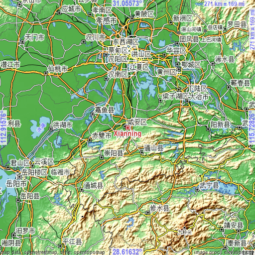
| \ | Map #1 | Map #2 | Topo.Map |
| Scale [m] | 21..242 m | 16..282 m | × |
| Scale [ft] | 69..794 ft | 52..925 ft | × |
| Average | 50.9 m = 167 ft | 57.8 m = 190 ft | × |
| Width | 8.48 km = 5.3 mi | 16.95 km = 10.5 mi | 271.2 km = 168.5 mi |
| Height | 8.48 km = 5.3 mi | 16.95 km = 10.5 mi | 271.2 km = 168.5 mi |
| ↑Max Latitude | 29.88158° | 29.919676° | 31.05573° |
| Latitude at center | 29.84347° | 29.84347° | 29.84347° |
| ↓Min Latitude | 29.805345° | 29.767206° | 28.61632° |
| ← Min Longitude | 114.278065° | 114.234119° | 112.91576° |
| Longitude center | 114.32201° | 114.32201° | 114.32201° |
| →Max Longitude | 114.365955° | 114.409901° | 115.72826° |
Nearby cities:
Cities around Xianning sort by population:
• Wuhan elevation 20 m
82.4 km,  356°
356°
• Ezhou 25 m
79 km,  38°
38°
• Xindi 27 m
82.6 km,  267°
267°
• Puqi 40 m
44.6 km,  251°
251°
• Huangzhou 19 m
81.6 km,  34°
34°
• Daye 25 m
66.1 km,  66°
66°
• E’zhou 29 m
82 km, 41°
• Juanshui 117 m
73.4 km,  215°
215°
• Zhifang 36 m
56.3 km, 359°
• Tiancheng 64 m
43.3 km, 218°
• Yuyue 24 m
39.7 km,  299°
299°
• Tongyang 314 m
32.8 km,  125°
125°
Multilingual:
 En español:
Xianning elevación 30 m.
 En France:
Xianning élévation 30 m.


Sources and notes:
- [note 1] Map square and city borders are not equal. Map elevation data is calculated only from area inside that square.
- [src 1] Elevation data from geonames database provided with same terms of usage.
- [src 2] The elevation map of Xianning is generated using elevation data from NASA's 3 arcsec (90m) resolution SRTM data.
- [src 3] Base (background) map © OpenStreetMap contributors tiles are generated by Geofabrik and OpenTopoMap.
Copyright & License:
This Xianning Elevation Map is licensed under CC BY-SA. You may reuse any part from this page, if you give a proper credit by linking to this URL:
 More info on terms of use page.