Daye elevation
Daye (Hubei), China elevation is 25 meters and Daye elevation in feet is 82 ft above sea level [src 1]. Daye is a populated place (feature code) with elevation that is 533 meters (1749 ft) smaller than average city elevation in China.
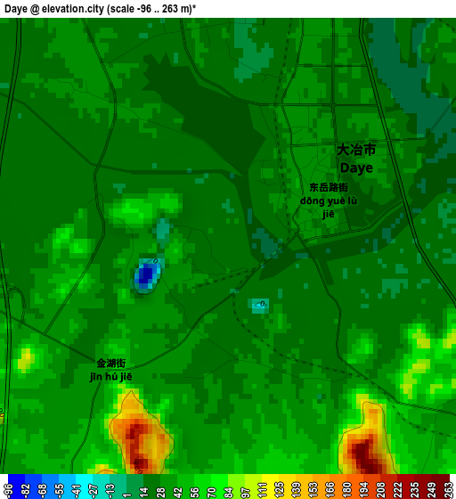
Below is the Elevation map of Daye, which displays elevation range with different colors. Scale of the first map is from -96 to 263 m (-315 to 863 ft) with average elevation of 33.2 meters (=109 ft) [note 1]
These maps also provides idea of topography and contour of this city, they are displayed at different zoom levels. More info about maps, scale and edge coordinates you can find below images.

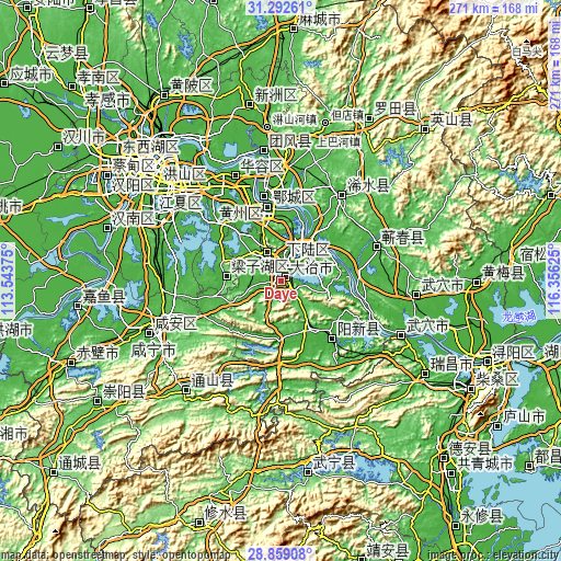
| \ | Map #1 | Map #2 | Topo.Map |
| Scale [m] | -96..263 m | -96..641 m | × |
| Scale [ft] | -315..863 ft | -315..2103 ft | × |
| Average | 33.2 m = 109 ft | 64.1 m = 210 ft | × |
| Width | 8.46 km = 5.3 mi | 16.91 km = 10.5 mi | 270.6 km = 168.1 mi |
| Height | 8.46 km = 5.3 mi | 16.91 km = 10.5 mi | 270.6 km = 168.1 mi |
| ↑Max Latitude | 30.121348° | 30.159352° | 31.29261° |
| Latitude at center | 30.08333° | 30.08333° | 30.08333° |
| ↓Min Latitude | 30.045297° | 30.007249° | 28.85908° |
| ← Min Longitude | 114.906055° | 114.862109° | 113.54375° |
| Longitude center | 114.95° | 114.95° | 114.95° |
| →Max Longitude | 114.993945° | 115.037891° | 116.35625° |
Nearby cities:
Cities around Daye sort by population:
• Huangshi elevation 22 m
20.5 km,  27°
27°
• Wuxue 23 m
63.5 km,  114°
114°
• Ezhou 25 m
37 km,  342°
342°
• Huangzhou 19 m
43.2 km, 340°
• Qingquan 35 m
50.4 km,  35°
35°
• Caohe 27 m
49.2 km,  70°
70°
• Tongyang 314 m
57.1 km,  216°
216°
• Huarong 41 m
54.2 km, 337°
• Wuxue Shi 33 m
48.5 km, 112°
• Huanggang 46 m
41.6 km,  349°
349°
• Xingguo 28 m
38.3 km,  117°
117°
• E’zhou 29 m
35.3 km, 350°
Multilingual:
 En español:
Daye elevación 25 m.
 En France:
Daye élévation 25 m.


Sources and notes:
- [note 1] Map square and city borders are not equal. Map elevation data is calculated only from area inside that square.
- [src 1] Elevation data from geonames database provided with same terms of usage.
- [src 2] The elevation map of Daye is generated using elevation data from NASA's 3 arcsec (90m) resolution SRTM data.
- [src 3] Base (background) map © OpenStreetMap contributors tiles are generated by Geofabrik and OpenTopoMap.
Copyright & License:
This Daye Elevation Map is licensed under CC BY-SA. You may reuse any part from this page, if you give a proper credit by linking to this URL:
 More info on terms of use page.