Tongyang elevation
Tongyang (Hubei), China elevation is 314 meters and Tongyang elevation in feet is 1030 ft above sea level [src 1]. Tongyang is a seat of a third-order administrative division (feature code) with elevation that is 244 meters (801 ft) smaller than average city elevation in China.
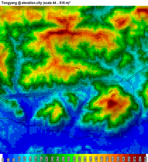
Below is the Elevation map of Tongyang, which displays elevation range with different colors. Scale of the first map is from 44 to 616 m (144 to 2021 ft) with average elevation of 235.3 meters (=772 ft) [note 1]
These maps also provides idea of topography and contour of this city, they are displayed at different zoom levels. More info about maps, scale and edge coordinates you can find below images.
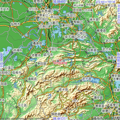
| \ | Map #1 | Topo.Map |
| Scale [m] | 44..616 m | × |
| Scale [ft] | 144..2021 ft | × |
| Average | 235.3 m = 772 ft | × |
| Width | 8.49 km = 5.3 mi | 271.7 km = 168.8 mi |
| Height | 8.49 km = 5.3 mi | 271.7 km = 168.8 mi |
| ↑Max Latitude | 29.708716° | 30.88493° |
| Latitude at center | 29.67054° | 29.67054° |
| ↓Min Latitude | 29.632349° | 28.44131° |
| ← Min Longitude | 114.552995° | 113.19069° |
| Longitude center | 114.59694° | 114.59694° |
| →Max Longitude | 114.640885° | 116.00319° |
Nearby cities:
Cities around Tongyang sort by population:
• Huangshi elevation 22 m
77.4 km,  34°
34°
• Ezhou 25 m
84.2 km,  15°
15°
• Xianning 30 m
32.8 km,  305°
305°
• Puqi 40 m
69.1 km,  274°
274°
• Daye 25 m
57.1 km,  36°
36°
• Wuxue Shi 33 m
83.4 km,  70°
70°
• Zhifang 36 m
80.2 km,  340°
340°
• Juanshui 117 m
80 km,  239°
239°
• Xingguo 28 m
73.6 km, 67°
• Yuyue 24 m
72.3 km,  302°
302°
• Yining 112 m
70.6 km,  182°
182°
• Tiancheng 64 m
55.6 km,  254°
254°
Multilingual:
 En español:
Tongyang elevación 314 m.
 En France:
Tongyang élévation 314 m.
 Auf Deutsch:
Tongyang höhe über dem Meeresspiegel ist 314 m.

Sources and notes:
- [note 1] Map square and city borders are not equal. Map elevation data is calculated only from area inside that square.
- [src 1] Elevation data from geonames database provided with same terms of usage.
- [src 2] The elevation map of Tongyang is generated using elevation data from NASA's 3 arcsec (90m) resolution SRTM data.
- [src 3] Base (background) map © OpenStreetMap contributors tiles are generated by Geofabrik and OpenTopoMap.
Copyright & License:
This Tongyang Elevation Map is licensed under CC BY-SA. You may reuse any part from this page, if you give a proper credit by linking to this URL:
 More info on terms of use page.