Huangzhou elevation
Huangzhou (Hubei), China elevation is 19 meters and Huangzhou elevation in feet is 62 ft above sea level [src 1]. Huangzhou is a populated place (feature code) with elevation that is 539 meters (1768 ft) smaller than average city elevation in China.
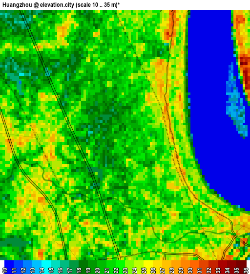
Below is the Elevation map of Huangzhou, which displays elevation range with different colors. Scale of the first map is from 10 to 35 m (33 to 115 ft) with average elevation of 20.2 meters (=66 ft) [note 1]
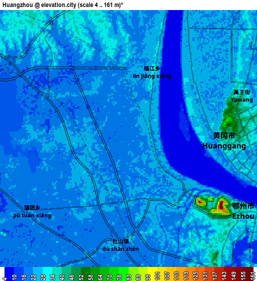
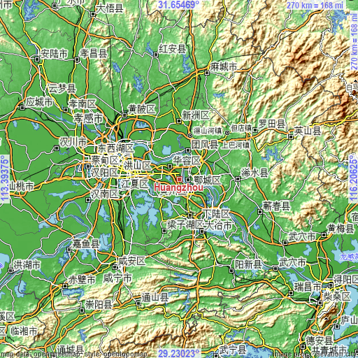
These maps also provides idea of topography and contour of this city, they are displayed at different zoom levels. More info about maps, scale and edge coordinates you can find below images.
| \ | Map #1 | Map #2 | Topo.Map |
| Scale [m] | 10..35 m | 4..161 m | × |
| Scale [ft] | 33..115 ft | 13..528 ft | × |
| Average | 20.2 m = 66 ft | 22.6 m = 74 ft | × |
| Width | 8.42 km = 5.2 mi | 16.85 km = 10.5 mi | 269.6 km = 167.5 mi |
| Height | 8.42 km = 5.2 mi | 16.85 km = 10.5 mi | 269.6 km = 167.5 mi |
| ↑Max Latitude | 30.487877° | 30.525739° | 31.65469° |
| Latitude at center | 30.45° | 30.45° | 30.45° |
| ↓Min Latitude | 30.412109° | 30.374203° | 29.23023° |
| ← Min Longitude | 114.756055° | 114.712109° | 113.39375° |
| Longitude center | 114.8° | 114.8° | 114.8° |
| →Max Longitude | 114.843945° | 114.887891° | 116.20625° |
Nearby cities:
Cities around Huangzhou sort by population:
• Wuhan elevation 20 m
53.2 km,  286°
286°
• Huangshi 22 m
32.8 km,  133°
133°
• Ezhou 25 m
6.4 km,  150°
150°
• Xinzhou 29 m
46.3 km,  0°
0°
• Qingquan 35 m
43.7 km,  89°
89°
• Daye 25 m
43.2 km,  160°
160°
• Jiang’an Qu 35 m
50.4 km, 290°
• Zhifang 36 m
47.7 km,  256°
256°
• Tuanfeng 29 m
31.3 km,  20°
20°
• Huarong 41 m
11.3 km,  325°
325°
• E’zhou 29 m
10.2 km, 125°
• Huanggang 46 m
6.7 km, 88°
Multilingual:
 En español:
Huangzhou elevación 19 m.
 En France:
Huangzhou élévation 19 m.
 Auf Deutsch:
Huangzhou höhe über dem Meeresspiegel ist 19 m.

Sources and notes:
- [note 1] Map square and city borders are not equal. Map elevation data is calculated only from area inside that square.
- [src 1] Elevation data from geonames database provided with same terms of usage.
- [src 2] The elevation map of Huangzhou is generated using elevation data from NASA's 3 arcsec (90m) resolution SRTM data.
- [src 3] Base (background) map © OpenStreetMap contributors tiles are generated by Geofabrik and OpenTopoMap.
Copyright & License:
This Huangzhou Elevation Map is licensed under CC BY-SA. You may reuse any part from this page, if you give a proper credit by linking to this URL:
 More info on terms of use page.