Cassilândia elevation
Cassilândia (Mato Grosso do Sul), Brazil elevation is 475 meters and Cassilândia elevation in feet is 1558 ft above sea level [src 1]. Cassilândia is a populated place (feature code) with elevation that is 93 meters (305 ft) bigger than average city elevation in Brazil.
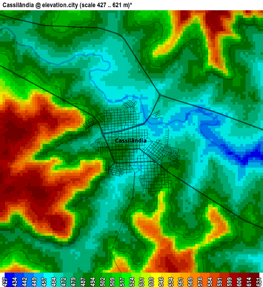
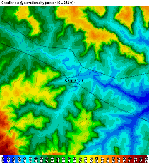
Below is the Elevation map of Cassilândia, which displays elevation range with different colors. Scale of the first map is from 427 to 621 m (1401 to 2037 ft) with average elevation of 504.2 meters (=1654 ft) [note 1]
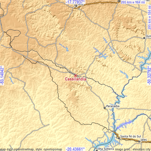
These maps also provides idea of topography and contour of this city, they are displayed at different zoom levels. More info about maps, scale and edge coordinates you can find below images.
| \ | Map #1 | Map #2 | Topo.Map |
| Scale [m] | 427..621 m | 410..753 m | × |
| Scale [ft] | 1401..2037 ft | 1345..2470 ft | × |
| Average | 504.2 m = 1654 ft | 524.2 m = 1720 ft | × |
| Width | 9.23 km = 5.7 mi | 18.47 km = 11.5 mi | 295.5 km = 183.6 mi |
| Height | 9.23 km = 5.7 mi | 18.47 km = 11.5 mi | 295.5 km = 183.6 mi |
| ↑Max Latitude | -19.071802° | -19.030264° | -17.77937° |
| Latitude at center | -19.11333° | -19.11333° | -19.11333° |
| ↓Min Latitude | -19.154848° | -19.196355° | -20.43661° |
| ← Min Longitude | -51.778115° | -51.822061° | -53.14042° |
| Longitude center | -51.73417° | -51.73417° | -51.73417° |
| →Max Longitude | -51.690225° | -51.646279° | -50.32792° |
Nearby cities:
Cities around Cassilândia sort by population:
• Rio Verde elevation 721 m
169.2 km,  30°
30°
• Jataí 741 m
137.2 km,  0°
0°
• Jales 507 m
178.8 km,  135°
135°
• Paranaíba 383 m
84.7 km, 137°
• Quirinópolis 531 m
153.9 km,  61°
61°
• Iturama 469 m
175.2 km,  112°
112°
• Santa Fé do Sul 402 m
148.5 km,  145°
145°
• Ilha Solteira 372 m
152.3 km,  164°
164°
• Aparecida do Taboado 379 m
127.3 km, 148°
• Santa Vitória 474 m
172.3 km,  79°
79°
• Caçu 482 m
88.7 km,  45°
45°
• Paraíso das Águas 594 m
134.7 km,  274°
274°
Multilingual:
 En español:
Cassilândia elevación 475 m.
 En France:
Cassilândia élévation 475 m.
 Auf Deutsch:
Cassilândia höhe über dem Meeresspiegel ist 475 m.

Sources and notes:
- [note 1] Map square and city borders are not equal. Map elevation data is calculated only from area inside that square.
- [src 1] Elevation data from geonames database provided with same terms of usage.
- [src 2] The elevation map of Cassilândia is generated using elevation data from NASA's 3 arcsec (90m) resolution SRTM data.
- [src 3] Base (background) map © OpenStreetMap contributors tiles are generated by Geofabrik and OpenTopoMap.
Copyright & License:
This Cassilândia Elevation Map is licensed under CC BY-SA. You may reuse any part from this page, if you give a proper credit by linking to this URL:
 More info on terms of use page.