Frutal elevation
Frutal (Minas Gerais), Brazil elevation is 511 meters and Frutal elevation in feet is 1677 ft above sea level [src 1]. Frutal is a populated place (feature code) with elevation that is 129 meters (423 ft) bigger than average city elevation in Brazil.
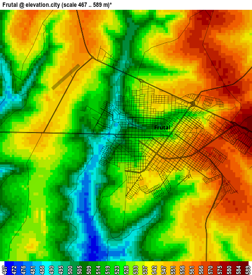
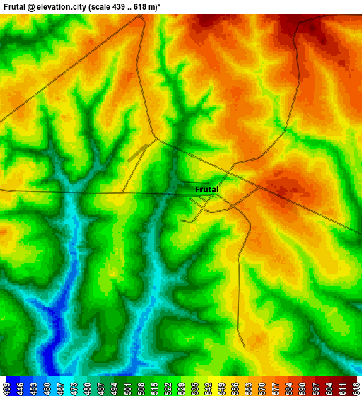
Below is the Elevation map of Frutal, which displays elevation range with different colors. Scale of the first map is from 467 to 589 m (1532 to 1932 ft) with average elevation of 532.5 meters (=1747 ft) [note 1]
These maps also provides idea of topography and contour of this city, they are displayed at different zoom levels. More info about maps, scale and edge coordinates you can find below images.
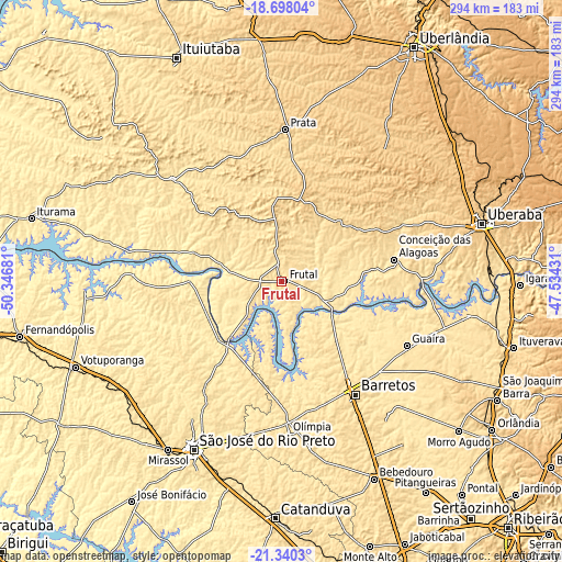
| \ | Map #1 | Map #2 | Topo.Map |
| Scale [m] | 467..589 m | 439..618 m | × |
| Scale [ft] | 1532..1932 ft | 1440..2028 ft | × |
| Average | 532.5 m = 1747 ft | 532.8 m = 1748 ft | × |
| Width | 9.18 km = 5.7 mi | 18.36 km = 11.4 mi | 293.8 km = 182.6 mi |
| Height | 9.18 km = 5.7 mi | 18.36 km = 11.4 mi | 293.8 km = 182.6 mi |
| ↑Max Latitude | -19.983426° | -19.942121° | -18.69804° |
| Latitude at center | -20.02472° | -20.02472° | -20.02472° |
| ↓Min Latitude | -20.066003° | -20.107275° | -21.3403° |
| ← Min Longitude | -48.984505° | -49.028451° | -50.34681° |
| Longitude center | -48.94056° | -48.94056° | -48.94056° |
| →Max Longitude | -48.896615° | -48.852669° | -47.53431° |
Nearby cities:
Cities around Frutal sort by population:
• São José do Rio Preto elevation 505 m
99.5 km,  207°
207°
• Barretos 538 m
70.8 km,  146°
146°
• Olímpia 520 m
79.3 km,  178°
178°
• Guaíra 516 m
73.4 km,  116°
116°
• Prata 642 m
79.8 km,  1°
1°
• Miguelópolis 515 m
96.4 km,  100°
100°
• Conceição das Alagoas 513 m
59 km,  78°
78°
• Nova Granada 520 m
68.7 km, 214°
• Guapiaçu 508 m
90.5 km,  198°
198°
• Severínia 588 m
88.4 km,  170°
170°
• Campina Verde 549 m
78.8 km,  313°
313°
• Riolândia 443 m
77.6 km,  273°
273°
Multilingual:
 En español:
Frutal elevación 511 m.
 En France:
Frutal élévation 511 m.


Sources and notes:
- [note 1] Map square and city borders are not equal. Map elevation data is calculated only from area inside that square.
- [src 1] Elevation data from geonames database provided with same terms of usage.
- [src 2] The elevation map of Frutal is generated using elevation data from NASA's 3 arcsec (90m) resolution SRTM data.
- [src 3] Base (background) map © OpenStreetMap contributors tiles are generated by Geofabrik and OpenTopoMap.
Copyright & License:
This Frutal Elevation Map is licensed under CC BY-SA. You may reuse any part from this page, if you give a proper credit by linking to this URL:
 More info on terms of use page.