Guaíra elevation
Guaíra (São Paulo), Brazil elevation is 516 meters and Guaíra elevation in feet is 1693 ft above sea level [src 1]. Guaíra is a populated place (feature code) with elevation that is 134 meters (440 ft) bigger than average city elevation in Brazil.
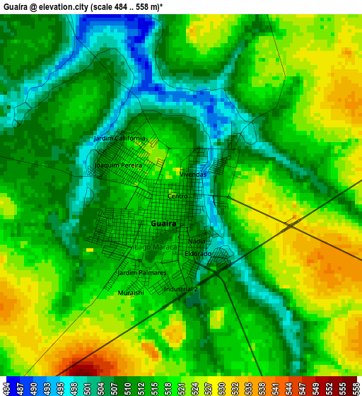
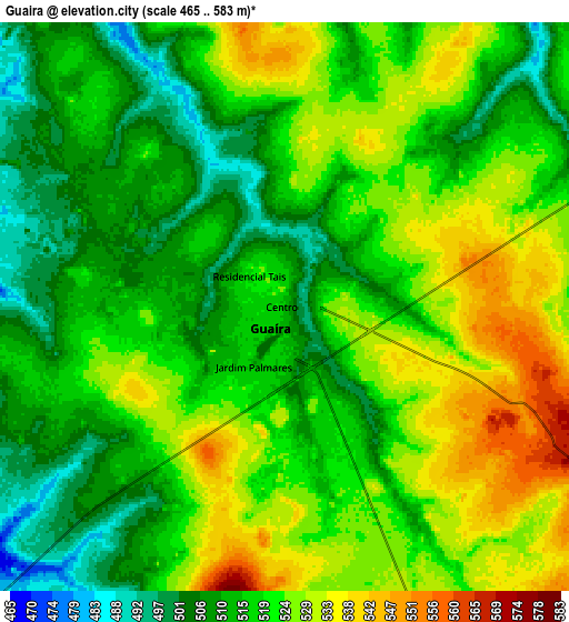
Below is the Elevation map of Guaíra, which displays elevation range with different colors. Scale of the first map is from 484 to 558 m (1588 to 1831 ft) with average elevation of 515.4 meters (=1691 ft) [note 1]
These maps also provides idea of topography and contour of this city, they are displayed at different zoom levels. More info about maps, scale and edge coordinates you can find below images.
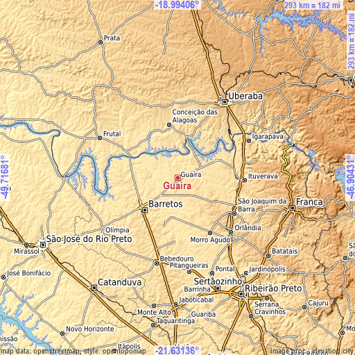
| \ | Map #1 | Map #2 | Topo.Map |
| Scale [m] | 484..558 m | 465..583 m | × |
| Scale [ft] | 1588..1831 ft | 1526..1913 ft | × |
| Average | 515.4 m = 1691 ft | 518.9 m = 1702 ft | × |
| Width | 9.16 km = 5.7 mi | 18.33 km = 11.4 mi | 293.2 km = 182.2 mi |
| Height | 9.16 km = 5.7 mi | 18.33 km = 11.4 mi | 293.3 km = 182.2 mi |
| ↑Max Latitude | -20.277114° | -20.235886° | -18.99406° |
| Latitude at center | -20.31833° | -20.31833° | -20.31833° |
| ↓Min Latitude | -20.359535° | -20.40073° | -21.63136° |
| ← Min Longitude | -48.354505° | -48.398451° | -49.71681° |
| Longitude center | -48.31056° | -48.31056° | -48.31056° |
| →Max Longitude | -48.266615° | -48.222669° | -46.90431° |
Nearby cities:
Cities around Guaíra sort by population:
• Barretos elevation 538 m
37.7 km,  225°
225°
• Bebedouro 574 m
72.3 km,  194°
194°
• Orlândia 700 m
62.8 km,  135°
135°
• São Joaquim da Barra 623 m
55.8 km,  121°
121°
• Ituverava 607 m
55.3 km,  92°
92°
• Igarapava 572 m
66.6 km,  62°
62°
• Morro Agudo 554 m
52.9 km,  150°
150°
• Guará 575 m
52.2 km,  103°
103°
• Miguelópolis 515 m
32.9 km, 62°
• Viradouro 540 m
61.7 km,  178°
178°
• Conceição das Alagoas 513 m
45.6 km,  349°
349°
• Ipuã 551 m
33.8 km,  113°
113°
Multilingual:
 En español:
Guaíra elevación 516 m.
 En France:
Guaíra élévation 516 m.


Sources and notes:
- [note 1] Map square and city borders are not equal. Map elevation data is calculated only from area inside that square.
- [src 1] Elevation data from geonames database provided with same terms of usage.
- [src 2] The elevation map of Guaíra is generated using elevation data from NASA's 3 arcsec (90m) resolution SRTM data.
- [src 3] Base (background) map © OpenStreetMap contributors tiles are generated by Geofabrik and OpenTopoMap.
Copyright & License:
This Guaíra Elevation Map is licensed under CC BY-SA. You may reuse any part from this page, if you give a proper credit by linking to this URL:
 More info on terms of use page.