Iúna elevation
Iúna (Espírito Santo), Brazil elevation is 670 meters and Iúna elevation in feet is 2198 ft above sea level [src 1]. Iúna is a populated place (feature code) with elevation that is 288 meters (945 ft) bigger than average city elevation in Brazil.
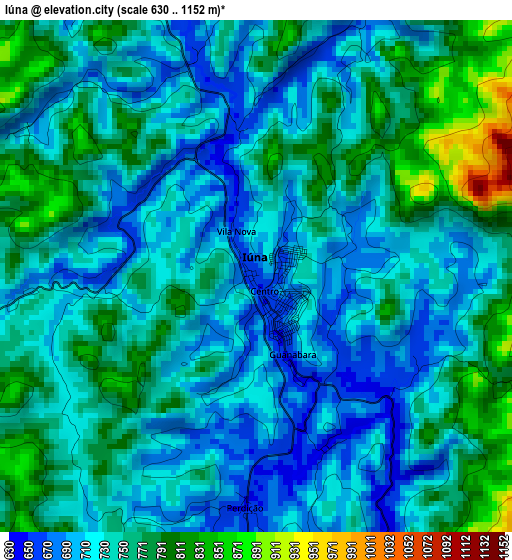
Below is the Elevation map of Iúna, which displays elevation range with different colors. Scale of the first map is from 630 to 1152 m (2067 to 3780 ft) with average elevation of 743.1 meters (=2438 ft) [note 1]
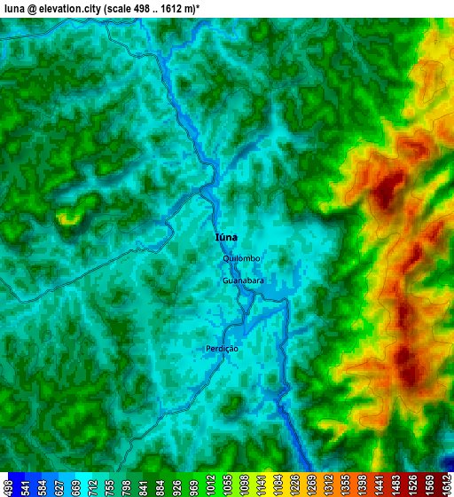
These maps also provides idea of topography and contour of this city, they are displayed at different zoom levels. More info about maps, scale and edge coordinates you can find below images.
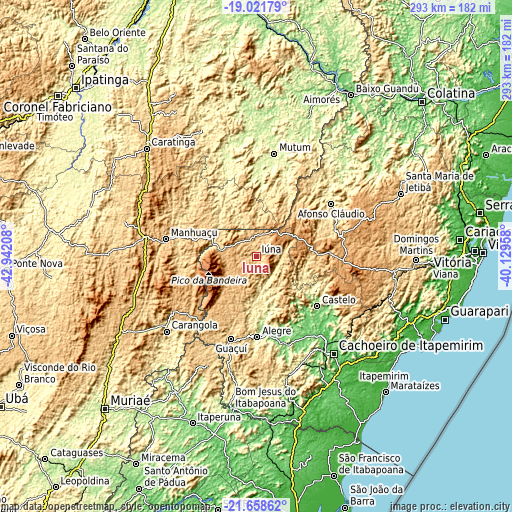
| \ | Map #1 | Map #2 | Topo.Map |
| Scale [m] | 630..1152 m | 498..1612 m | × |
| Scale [ft] | 2067..3780 ft | 1634..5289 ft | × |
| Average | 743.1 m = 2438 ft | 862 m = 2828 ft | × |
| Width | 9.16 km = 5.7 mi | 18.33 km = 11.4 mi | 293.2 km = 182.2 mi |
| Height | 9.16 km = 5.7 mi | 18.33 km = 11.4 mi | 293.2 km = 182.2 mi |
| ↑Max Latitude | -20.304621° | -20.263401° | -19.02179° |
| Latitude at center | -20.34583° | -20.34583° | -20.34583° |
| ↓Min Latitude | -20.387028° | -20.428215° | -21.65862° |
| ← Min Longitude | -41.579775° | -41.623721° | -42.94208° |
| Longitude center | -41.53583° | -41.53583° | -41.53583° |
| →Max Longitude | -41.491885° | -41.447939° | -40.12958° |
Nearby cities:
Cities around Iúna sort by population:
• Castelo elevation 129 m
46.5 km,  128°
128°
• Guaçuí 597 m
50.1 km,  197°
197°
• Alegre 248 m
46.5 km,  179°
179°
• Lajinha 491 m
23.4 km,  337°
337°
• Manhumirim 603 m
44 km,  268°
268°
• Afonso Cláudio 368 m
52.5 km,  54°
54°
• Espera Feliz 767 m
51.4 km,  228°
228°
• Ibatiba 750 m
12.7 km,  11°
11°
• Muniz Freire 555 m
18.4 km,  135°
135°
• Jerônimo Monteiro 118 m
51.5 km,  163°
163°
• Conceição do Castelo 722 m
30.5 km,  94°
94°
• Irupi 747 m
11 km, 270°
Multilingual:
 En español:
Iúna elevación 670 m.
 En France:
Iúna élévation 670 m.


Sources and notes:
- [note 1] Map square and city borders are not equal. Map elevation data is calculated only from area inside that square.
- [src 1] Elevation data from geonames database provided with same terms of usage.
- [src 2] The elevation map of Iúna is generated using elevation data from NASA's 3 arcsec (90m) resolution SRTM data.
- [src 3] Base (background) map © OpenStreetMap contributors tiles are generated by Geofabrik and OpenTopoMap.
Copyright & License:
This Iúna Elevation Map is licensed under CC BY-SA. You may reuse any part from this page, if you give a proper credit by linking to this URL:
 More info on terms of use page.