Matão elevation
Matão (São Paulo), Brazil elevation is 574 meters and Matão elevation in feet is 1883 ft above sea level [src 1]. Matão is a populated place (feature code) with elevation that is 192 meters (630 ft) bigger than average city elevation in Brazil.
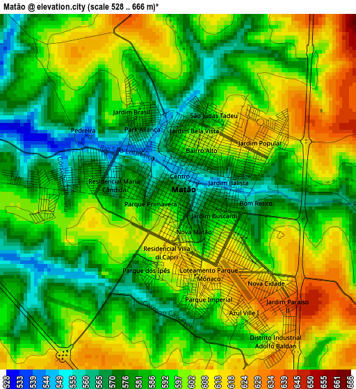
Below is the Elevation map of Matão, which displays elevation range with different colors. Scale of the first map is from 528 to 666 m (1732 to 2185 ft) with average elevation of 592.7 meters (=1945 ft) [note 1]
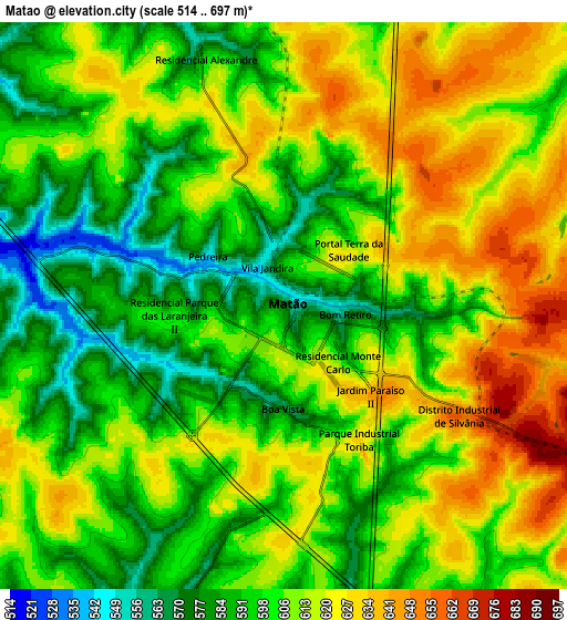
These maps also provides idea of topography and contour of this city, they are displayed at different zoom levels. More info about maps, scale and edge coordinates you can find below images.
| \ | Map #1 | Map #2 | Topo.Map |
| Scale [m] | 528..666 m | 514..697 m | × |
| Scale [ft] | 1732..2185 ft | 1686..2287 ft | × |
| Average | 592.7 m = 1945 ft | 606.1 m = 1989 ft | × |
| Width | 9.09 km = 5.6 mi | 18.17 km = 11.3 mi | 290.7 km = 180.6 mi |
| Height | 9.09 km = 5.6 mi | 18.17 km = 11.3 mi | 290.7 km = 180.6 mi |
| ↑Max Latitude | -21.562466° | -21.52159° | -20.29005° |
| Latitude at center | -21.60333° | -21.60333° | -21.60333° |
| ↓Min Latitude | -21.644183° | -21.685024° | -22.9048° |
| ← Min Longitude | -48.409775° | -48.453721° | -49.77208° |
| Longitude center | -48.36583° | -48.36583° | -48.36583° |
| →Max Longitude | -48.321885° | -48.277939° | -46.95958° |
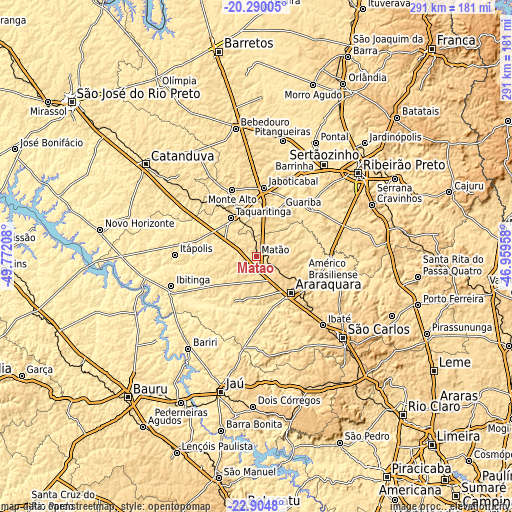
Nearby cities:
Cities around Matão sort by population:
• Araraquara elevation 677 m
28.9 km,  137°
137°
• Jaboticabal 606 m
39 km,  6°
6°
• Taquaritinga 573 m
26.2 km,  326°
326°
• Ibitinga 500 m
50.8 km,  250°
250°
• Monte Alto 723 m
40.4 km,  340°
340°
• Itápolis 495 m
46.2 km,  271°
271°
• Américo Brasiliense 726 m
30.4 km,  116°
116°
• Guariba 619 m
30.6 km,  27°
27°
• Barrinha 514 m
50.1 km,  24°
24°
• Pradópolis 539 m
41.2 km,  48°
48°
• Tabatinga 489 m
35.5 km, 249°
• Boa Esperança do Sul 480 m
43.3 km,  183°
183°
Multilingual:
 En español:
Matão elevación 574 m.
 En France:
Matão élévation 574 m.


Sources and notes:
- [note 1] Map square and city borders are not equal. Map elevation data is calculated only from area inside that square.
- [src 1] Elevation data from geonames database provided with same terms of usage.
- [src 2] The elevation map of Matão is generated using elevation data from NASA's 3 arcsec (90m) resolution SRTM data.
- [src 3] Base (background) map © OpenStreetMap contributors tiles are generated by Geofabrik and OpenTopoMap.
Copyright & License:
This Matão Elevation Map is licensed under CC BY-SA. You may reuse any part from this page, if you give a proper credit by linking to this URL:
 More info on terms of use page.