Naviraí elevation
Naviraí (Mato Grosso do Sul), Brazil elevation is 366 meters and Naviraí elevation in feet is 1201 ft above sea level [src 1]. Naviraí is a populated place (feature code) with elevation that is 16 meters (52 ft) smaller than average city elevation in Brazil.
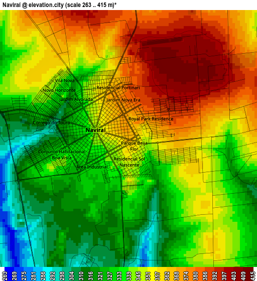
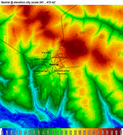
Below is the Elevation map of Naviraí, which displays elevation range with different colors. Scale of the first map is from 263 to 415 m (863 to 1362 ft) with average elevation of 346.2 meters (=1136 ft) [note 1]
These maps also provides idea of topography and contour of this city, they are displayed at different zoom levels. More info about maps, scale and edge coordinates you can find below images.
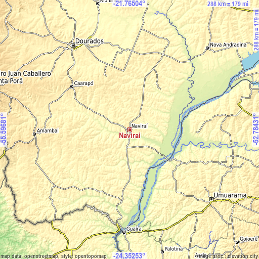
| \ | Map #1 | Map #2 | Topo.Map |
| Scale [m] | 263..415 m | 241..415 m | × |
| Scale [ft] | 863..1362 ft | 791..1362 ft | × |
| Average | 346.2 m = 1136 ft | 332 m = 1089 ft | × |
| Width | 8.99 km = 5.6 mi | 17.98 km = 11.2 mi | 287.7 km = 178.8 mi |
| Height | 8.99 km = 5.6 mi | 17.98 km = 11.2 mi | 287.7 km = 178.8 mi |
| ↑Max Latitude | -23.024562° | -22.984111° | -21.76504° |
| Latitude at center | -23.065° | -23.065° | -23.065° |
| ↓Min Latitude | -23.105426° | -23.14584° | -24.35253° |
| ← Min Longitude | -54.234505° | -54.278451° | -55.59681° |
| Longitude center | -54.19056° | -54.19056° | -54.19056° |
| →Max Longitude | -54.146615° | -54.102669° | -52.78431° |
Nearby cities:
Cities around Naviraí sort by population:
• Dourados elevation 445 m
113.1 km,  326°
326°
• Umuarama 443 m
117.8 km,  131°
131°
• Loanda 464 m
109 km,  81°
81°
• Pôrto Barra do Ivinheima 234 m
54.7 km, 78°
• Caarapó 469 m
80.5 km,  306°
306°
• Costa Rica 394 m
61.1 km,  230°
230°
• Altãnia 353 m
94.7 km,  161°
161°
• Nova Londrina 336 m
127.9 km,  74°
74°
• Iporã 377 m
115.5 km,  154°
154°
• Iguatemi 342 m
78.2 km,  208°
208°
• Eldorado 350 m
80.8 km,  186°
186°
• Bataiporã 326 m
127.4 km,  47°
47°
Multilingual:
 En español:
Naviraí elevación 366 m.
 En France:
Naviraí élévation 366 m.


Sources and notes:
- [note 1] Map square and city borders are not equal. Map elevation data is calculated only from area inside that square.
- [src 1] Elevation data from geonames database provided with same terms of usage.
- [src 2] The elevation map of Naviraí is generated using elevation data from NASA's 3 arcsec (90m) resolution SRTM data.
- [src 3] Base (background) map © OpenStreetMap contributors tiles are generated by Geofabrik and OpenTopoMap.
Copyright & License:
This Naviraí Elevation Map is licensed under CC BY-SA. You may reuse any part from this page, if you give a proper credit by linking to this URL:
 More info on terms of use page.