Pirajuí elevation
Pirajuí (São Paulo), Brazil elevation is 499 meters and Pirajuí elevation in feet is 1637 ft above sea level [src 1]. Pirajuí is a populated place (feature code) with elevation that is 117 meters (384 ft) bigger than average city elevation in Brazil.
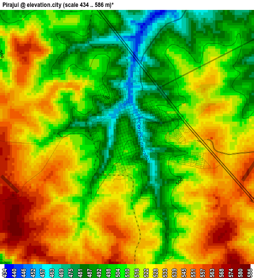
Below is the Elevation map of Pirajuí, which displays elevation range with different colors. Scale of the first map is from 434 to 586 m (1424 to 1923 ft) with average elevation of 516.4 meters (=1694 ft) [note 1]
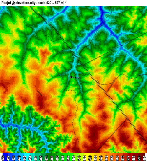
These maps also provides idea of topography and contour of this city, they are displayed at different zoom levels. More info about maps, scale and edge coordinates you can find below images.
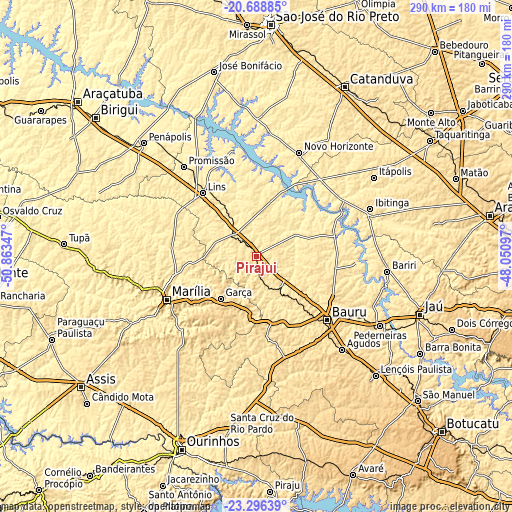
| \ | Map #1 | Map #2 | Topo.Map |
| Scale [m] | 434..586 m | 420..597 m | × |
| Scale [ft] | 1424..1923 ft | 1378..1959 ft | × |
| Average | 516.4 m = 1694 ft | 509 m = 1670 ft | × |
| Width | 9.06 km = 5.6 mi | 18.12 km = 11.3 mi | 289.9 km = 180.1 mi |
| Height | 9.06 km = 5.6 mi | 18.12 km = 11.3 mi | 289.9 km = 180.1 mi |
| ↑Max Latitude | -21.957858° | -21.917095° | -20.68885° |
| Latitude at center | -21.99861° | -21.99861° | -21.99861° |
| ↓Min Latitude | -22.03935° | -22.080078° | -23.29639° |
| ← Min Longitude | -49.501165° | -49.545111° | -50.86347° |
| Longitude center | -49.45722° | -49.45722° | -49.45722° |
| →Max Longitude | -49.413275° | -49.369329° | -48.05097° |
Nearby cities:
Cities around Pirajuí sort by population:
• Bauru elevation 530 m
53.9 km,  130°
130°
• Marília 655 m
55.7 km,  244°
244°
• Lins 411 m
46.2 km,  320°
320°
• Ibitinga 500 m
70.1 km,  67°
67°
• Garça 678 m
31.2 km,  221°
221°
• Agudos 587 m
71.2 km,  137°
137°
• Novo Horizonte 453 m
63.8 km,  22°
22°
• Promissão 428 m
66 km, 321°
• Cafelândia 450 m
26.9 km, 324°
• Duartina 515 m
46.6 km,  173°
173°
• Borborema 424 m
57.8 km,  43°
43°
• Boracéia 485 m
73.2 km,  107°
107°
Multilingual:
 En español:
Pirajuí elevación 499 m.
 En France:
Pirajuí élévation 499 m.


Sources and notes:
- [note 1] Map square and city borders are not equal. Map elevation data is calculated only from area inside that square.
- [src 1] Elevation data from geonames database provided with same terms of usage.
- [src 2] The elevation map of Pirajuí is generated using elevation data from NASA's 3 arcsec (90m) resolution SRTM data.
- [src 3] Base (background) map © OpenStreetMap contributors tiles are generated by Geofabrik and OpenTopoMap.
Copyright & License:
This Pirajuí Elevation Map is licensed under CC BY-SA. You may reuse any part from this page, if you give a proper credit by linking to this URL:
 More info on terms of use page.