Dulovo elevation
Dulovo (Silistra, Obshtina Dulovo), Bulgaria elevation is 226 meters and Dulovo elevation in feet is 741 ft above sea level [src 1]. Dulovo is a populated place (feature code) with elevation that is 93 meters (305 ft) smaller than average city elevation in Bulgaria.
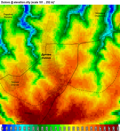
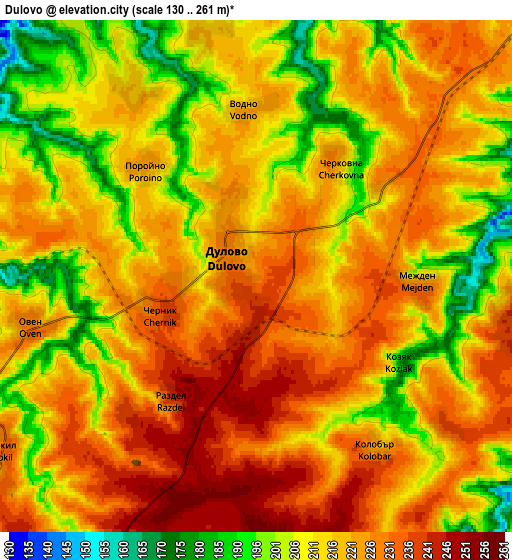
Below is the Elevation map of Dulovo, which displays elevation range with different colors. Scale of the first map is from 181 to 252 m (594 to 827 ft) with average elevation of 224.5 meters (=737 ft) [note 1]
These maps also provides idea of topography and contour of this city, they are displayed at different zoom levels. More info about maps, scale and edge coordinates you can find below images.
| \ | Map #1 | Map #2 | Topo.Map |
| Scale [m] | 181..252 m | 130..261 m | × |
| Scale [ft] | 594..827 ft | 427..856 ft | × |
| Average | 224.5 m = 737 ft | 217 m = 712 ft | × |
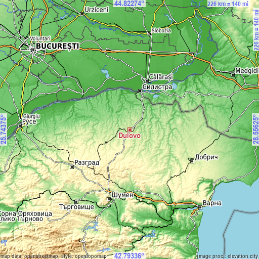
| Width | 7.05 km = 4.4 mi | 14.1 km = 8.8 mi | 225.6 km = 140.2 mi |
| Height | 7.05 km = 4.4 mi | 14.1 km = 8.8 mi | 225.6 km = 140.2 mi |
| ↑Max Latitude | 43.848371° | 43.880055° | 44.82274° |
| Latitude at center | 43.81667° | 43.81667° | 43.81667° |
| ↓Min Latitude | 43.784952° | 43.753218° | 42.79336° |
| ← Min Longitude | 27.106055° | 27.062109° | 25.74375° |
| Longitude center | 27.15° | 27.15° | 27.15° |
| →Max Longitude | 27.193945° | 27.237891° | 28.55625° |
Nearby cities:
Cities around Dulovo sort by population:
• Silistra elevation 4 m
34.6 km,  14°
14°
• Isperih 279 m
27.8 km,  246°
246°
• Tervel 266 m
22.2 km,  110°
110°
• Zavet 240 m
38.2 km,  260°
260°
• Samuil 432 m
46.3 km,  223°
223°
• Glavinitsa 108 m
27.7 km,  293°
293°
• Alfatar 189 m
18.1 km,  37°
37°
• Kaolinovo 266 m
22.4 km,  186°
186°
• Venets 349 m
34.4 km,  210°
210°
• Gara Hitrino 332 m
46.6 km,  203°
203°
• Sitovo 116 m
25.6 km,  336°
336°
• Kaynardzha 102 m
34.7 km,  55°
55°
Multilingual:
 En español:
Dulovo elevación 226 m.
 En France:
Dulovo élévation 226 m.


Sources and notes:
- [note 1] Map square and city borders are not equal. Map elevation data is calculated only from area inside that square.
- [src 1] Elevation data from geonames database provided with same terms of usage.
- [src 2] The elevation map of Dulovo is generated using elevation data from NASA's 3 arcsec (90m) resolution SRTM data.
- [src 3] Base (background) map © OpenStreetMap contributors tiles are generated by Geofabrik and OpenTopoMap.
Copyright & License:
This Dulovo Elevation Map is licensed under CC BY-SA. You may reuse any part from this page, if you give a proper credit by linking to this URL:
 More info on terms of use page.