Zavet elevation
Zavet (Razgrad, Obshtina Zavet), Bulgaria elevation is 240 meters and Zavet elevation in feet is 787 ft above sea level [src 1]. Zavet is a seat of a second-order administrative division (feature code) with elevation that is 79 meters (259 ft) smaller than average city elevation in Bulgaria.
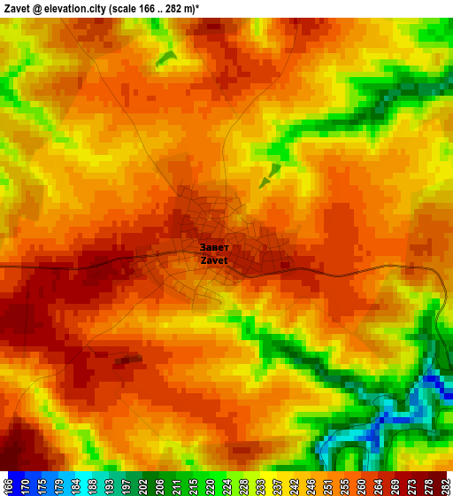
Below is the Elevation map of Zavet, which displays elevation range with different colors. Scale of the first map is from 166 to 282 m (545 to 925 ft) with average elevation of 246.1 meters (=807 ft) [note 1]
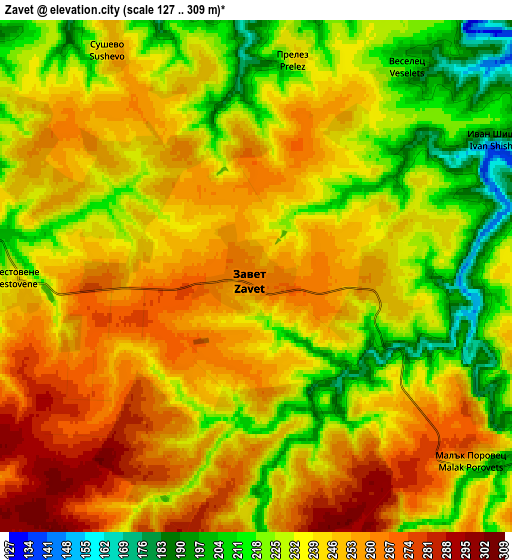
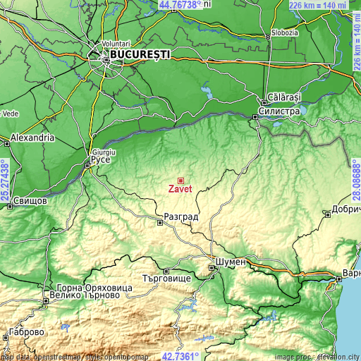
These maps also provides idea of topography and contour of this city, they are displayed at different zoom levels. More info about maps, scale and edge coordinates you can find below images.
| \ | Map #1 | Map #2 | Topo.Map |
| Scale [m] | 166..282 m | 127..309 m | × |
| Scale [ft] | 545..925 ft | 417..1014 ft | × |
| Average | 246.1 m = 807 ft | 239.6 m = 786 ft | × |
| Width | 7.06 km = 4.4 mi | 14.12 km = 8.8 mi | 225.9 km = 140.4 mi |
| Height | 7.06 km = 4.4 mi | 14.12 km = 8.8 mi | 225.8 km = 140.3 mi |
| ↑Max Latitude | 43.792091° | 43.823804° | 44.76738° |
| Latitude at center | 43.76036° | 43.76036° | 43.76036° |
| ↓Min Latitude | 43.728613° | 43.696848° | 42.7361° |
| ← Min Longitude | 26.636685° | 26.592739° | 25.27438° |
| Longitude center | 26.68063° | 26.68063° | 26.68063° |
| →Max Longitude | 26.724575° | 26.768521° | 28.08688° |
Nearby cities:
Cities around Zavet sort by population:
• Razgrad elevation 197 m
28.5 km,  207°
207°
• Tutrakan 109 m
32.6 km,  350°
350°
• Isperih 279 m
13.2 km,  111°
111°
• Kubrat 202 m
15 km,  285°
285°
• Vetovo 194 m
33.9 km,  258°
258°
• Samuil 432 m
27.7 km,  168°
168°
• Glavinitsa 108 m
21.3 km,  35°
35°
• Senovo 210 m
28.1 km,  244°
244°
• Venets 349 m
31 km,  139°
139°
• Gorichevo 136 m
21 km,  298°
298°
• Tochilari 147 m
19.9 km, 300°
• Medovene 210 m
13.2 km,  273°
273°
Multilingual:
 En español:
Zavet elevación 240 m.
 En France:
Zavet élévation 240 m.


Sources and notes:
- [note 1] Map square and city borders are not equal. Map elevation data is calculated only from area inside that square.
- [src 1] Elevation data from geonames database provided with same terms of usage.
- [src 2] The elevation map of Zavet is generated using elevation data from NASA's 3 arcsec (90m) resolution SRTM data.
- [src 3] Base (background) map © OpenStreetMap contributors tiles are generated by Geofabrik and OpenTopoMap.
Copyright & License:
This Zavet Elevation Map is licensed under CC BY-SA. You may reuse any part from this page, if you give a proper credit by linking to this URL:
 More info on terms of use page.