Razgrad elevation
Razgrad, Bulgaria elevation is 197 meters and Razgrad elevation in feet is 646 ft above sea level [src 1]. Razgrad is a seat of a first-order administrative division (feature code) with elevation that is 122 meters (400 ft) smaller than average city elevation in Bulgaria.
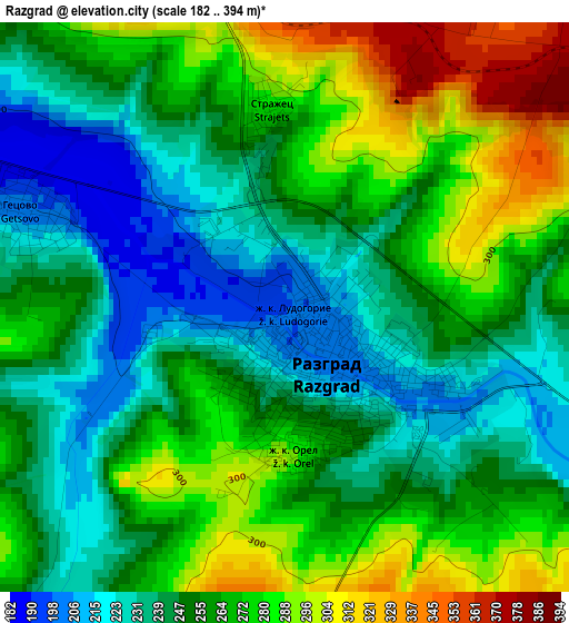
Below is the Elevation map of Razgrad, which displays elevation range with different colors. Scale of the first map is from 182 to 394 m (597 to 1293 ft) with average elevation of 258.3 meters (=847 ft) [note 1]
These maps also provides idea of topography and contour of this city, they are displayed at different zoom levels. More info about maps, scale and edge coordinates you can find below images.
| \ | Map #1 | Map #2 | Topo.Map |
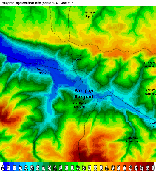
| Scale [m] | 182..394 m | 174..459 m | × |
| Scale [ft] | 597..1293 ft | 571..1506 ft | × |
| Average | 258.3 m = 847 ft | 303.2 m = 995 ft | × |
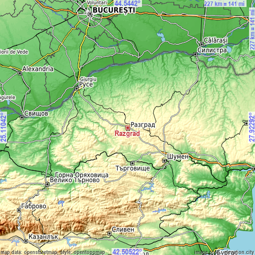
| Width | 7.08 km = 4.4 mi | 14.17 km = 8.8 mi | 226.7 km = 140.9 mi |
| Height | 7.08 km = 4.4 mi | 14.17 km = 8.8 mi | 226.7 km = 140.9 mi |
| ↑Max Latitude | 43.565181° | 43.597015° | 44.5442° |
| Latitude at center | 43.53333° | 43.53333° | 43.53333° |
| ↓Min Latitude | 43.501462° | 43.469578° | 42.50522° |
| ← Min Longitude | 26.472725° | 26.428779° | 25.11042° |
| Longitude center | 26.51667° | 26.51667° | 26.51667° |
| →Max Longitude | 26.560615° | 26.604561° | 27.92292° |
Nearby cities:
Cities around Razgrad sort by population:
• Targovishte elevation 186 m
31.7 km,  171°
171°
• Popovo 190 m
30.6 km,  228°
228°
• Isperih 279 m
32.6 km,  51°
51°
• Kubrat 202 m
29.3 km,  357°
357°
• Vetovo 194 m
27.4 km,  312°
312°
• Tsar Kaloyan 209 m
23.4 km,  293°
293°
• Zavet 240 m
28.5 km,  27°
27°
• Opaka 224 m
29.7 km,  251°
251°
• Loznitsa 265 m
19.7 km,  160°
160°
• Samuil 432 m
18.9 km,  95°
95°
• Senovo 210 m
17.7 km,  317°
317°
• Medovene 210 m
25.9 km,  0°
0°
Multilingual:
 En español:
Razgrad elevación 197 m.
 En France:
Razgrad élévation 197 m.


Sources and notes:
- [note 1] Map square and city borders are not equal. Map elevation data is calculated only from area inside that square.
- [src 1] Elevation data from geonames database provided with same terms of usage.
- [src 2] The elevation map of Razgrad is generated using elevation data from NASA's 3 arcsec (90m) resolution SRTM data.
- [src 3] Base (background) map © OpenStreetMap contributors tiles are generated by Geofabrik and OpenTopoMap.
Copyright & License:
This Razgrad Elevation Map is licensed under CC BY-SA. You may reuse any part from this page, if you give a proper credit by linking to this URL:
 More info on terms of use page.